|
|
 |
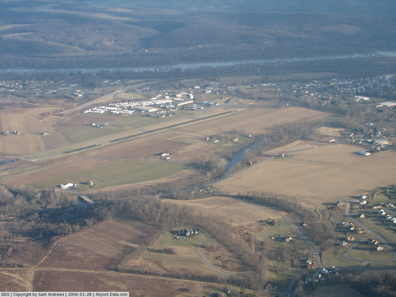
(Click on the photo to enlarge) |
Location & QuickFacts
| FAA Information Effective: | 2008-09-25 |
| Airport Identifier: | SEG |
| Airport Status: | Operational |
| Longitude/Latitude: | 076-51-49.5940W/40-49-13.9050N
-76.863776/40.820529 (Estimated) |
| Elevation: | 450 ft / 137.16 m (Surveyed) |
| Land: | 149 acres |
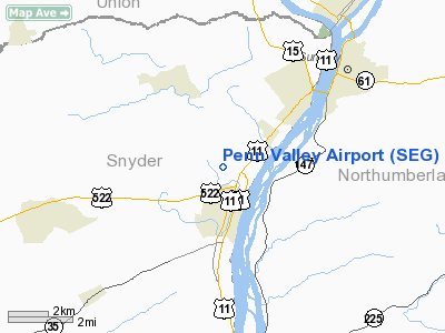
| From nearest city: | 1 nautical miles N of Selinsgrove, PA |
| Location: | Snyder County, PA |
| Magnetic Variation: | 11W (2000) |
Owner & Manager
| Ownership: | Publicly owned |
| Owner: | Penn Valley Airport Auth |
| Address: | 100 Airport Rd
Selinsgrove, PA 17870 |
| Phone number: | 570-374-7671 |
| Manager: | Susan Sprenkel |
| Address: | 100 Airport Rd
Selinsgrove, PA 17870 |
| Phone number: | 570-374-7671 |
Airport Operations and Facilities
| Airport Use: | Open to public |
| Wind indicator: | Yes |
| Segmented Circle: | Yes |
| Control Tower: | No |
| Lighting Schedule: | DUSK-DAWN
ACTVT MIRL RY 17/35, & REIL RYS 17 & 35 - CTAF. |
| Beacon Color: | Clear-Green (lighted land airport) |
| Landing fee charge: | No |
| Sectional chart: | New York |
| Region: | AEA - Eastern |
| Boundary ARTCC: | ZNY - New York |
| Tie-in FSS: | IPT - Williamsport |
| FSS on Airport: | No |
| FSS Toll Free: | 1-800-WX-BRIEF |
| NOTAMs Facility: | SEG (NOTAM-d service avaliable) |
| Federal Agreements: | NGY |
Airport Communications
| CTAF: | 122.700 |
| Unicom: | 122.700 |
Airport Services
| Fuel available: | 100LLA |
| Airframe Repair: | MAJOR |
| Power Plant Repair: | MAJOR |
| Bottled Oxygen: | NONE |
| Bulk Oxygen: | NONE |
Runway Information
Runway 17/35
| Dimension: | 3800 x 75 ft / 1158.2 x 22.9 m |
| Surface: | ASPH, Good Condition |
| Weight Limit: | Single wheel: 27000 lbs.
Dual wheel: 27000 lbs. |
| Edge Lights: | Medium |
| |
Runway 17 |
Runway 35 |
| Longitude: | 076-51-58.5750W | 076-51-40.7100W |
| Latitude: | 40-49-31.3740N | 40-48-56.3650N |
| Elevation: | 450.00 ft | 443.00 ft |
| Alignment: | 127 | 127 |
| Traffic Pattern: | Left | Left |
| Markings: | Basic, Good Condition | Basic, Good Condition |
| Runway End Identifier: | Yes
RY 17 REIL OTS INDEFLY. | Yes
RY 35 REIL SNGL LGT RIGHT SIDE. |
| Obstruction: | 17 ft pole, 466.0 ft from runway, 36 ft right of centerline, 15:1 slope to clear | 65 ft trees, 1129.0 ft from runway, 152 ft left of centerline, 14:1 slope to clear |
|
Radio Navigation Aids
| ID |
Type |
Name |
Ch |
Freq |
Var |
Dist |
| BZJ | NDB | Bellgrove | | 328.00 | 10W | 27.1 nm |
| PIX | NDB | Picture Rocks | | 344.00 | 09W | 28.3 nm |
| HXM | NDB | Humbolt | | 366.00 | 10W | 40.7 nm |
| RV | NDB | Stroh | | 407.00 | 10W | 40.8 nm |
| HZL | VOR | Hazleton | | 109.40 | 09W | 34.8 nm |
| FQM | VOR/DME | Williamsport | 091X | 114.40 | 09W | 31.4 nm |
| SEG | VORTAC | Selinsgrove | 041X | 110.40 | 08W | 2.0 nm |
| MIP | VORTAC | Milton | 029X | 109.20 | 09W | 15.2 nm |
| RAV | VORTAC | Ravine | 093X | 114.60 | 11W | 20.1 nm |
| HAR | VORTAC | Harrisburg | 072X | 112.50 | 10W | 32.5 nm |
| LRP | VORTAC | Lancaster | 120X | 117.30 | 09W | 49.6 nm |
| MDT | VOT | Harrisburg International | | 110.00 | | 37.7 nm |
Remarks
- FOR PICKUP CLNC DIAL TOLL FREE 800-932-0712.
- DEER & BIRDS ON AND INVOF ARPT.
- RISING TRRN BOTH SIDES OF APCH TO RY 17.
- ULTRALIGHTS ON & INVOF ARPT; RIGHT TRAFFIC.
Images and information placed above are from
http://www.airport-data.com/airport/SEG/
We thank them for the data!
| General Info
|
| Country |
United States
|
| State |
PENNSYLVANIA
|
| FAA ID |
SEG
|
| Latitude |
40-49-13.905N
|
| Longitude |
076-51-49.594W
|
| Elevation |
450 feet
|
| Near City |
SELINSGROVE
|
We don't guarantee the information is fresh and accurate. The data may
be wrong or outdated.
For more up-to-date information please refer to other sources.
|
|