 |
|
Location & QuickFacts
| FAA Information Effective: | 2008-09-25 |
| Airport Identifier: | PS18 |
| Airport Status: | Operational |
| Longitude/Latitude: | 078-37-39.0950W/41-54-13.2260N
-78.627526/41.903674 (Estimated) |
| Elevation: | 1500 ft / 457.20 m (Estimated) |
| Land: | 130 acres |
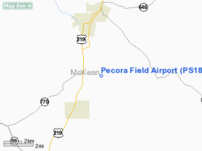
| From nearest city: | 3 nautical miles S of Bradford, PA |
| Location: | Mc Kean County, PA |
| Magnetic Variation: | 10W (1990) |
Owner & Manager
| Ownership: | Privately owned |
| Owner: | Philip A. Pecora |
| Address: | 110 Fuller Rd
Bradford, PA 16701 |
| Phone number: | 814-362-2447 |
| Manager: | Philip A, Pecora |
| Address: | 110 Fuller Rd
Bradford, PA 16701 |
| Phone number: | 814-362-2447 |
Airport Operations and Facilities
| Airport Use: | Private |
| Wind indicator: | Yes |
| Segmented Circle: | No |
| Control Tower: | No |
| Sectional chart: | Detroit |
| Region: | AEA - Eastern |
| Boundary ARTCC: | ZOB - Cleveland |
| Tie-in FSS: | AOO - Altoona |
| FSS Toll Free: | 1-800-WX-BRIEF |
Runway Information
Runway 10/28
| Dimension: | 1800 x 60 ft / 548.6 x 18.3 m |
| Surface: | TURF, |
| |
Runway 10 |
Runway 28 |
| Traffic Pattern: | Left | Left |
| Obstruction: | | 50 ft trees |
|
Radio Navigation Aids
| ID |
Type |
Name |
Ch |
Freq |
Var |
Dist |
| LYS | NDB | Olean | | 360.00 | 09W | 26.3 nm |
| EL | NDB | Halos | | 269.00 | 09W | 34.2 nm |
| ORJ | NDB | Corry | | 258.00 | 09W | 45.7 nm |
| BFD | VOR/DME | Bradford | 113X | 116.60 | 07W | 7.1 nm |
| JHW | VOR/DME | Jamestown | 094X | 114.70 | 07W | 27.9 nm |
| ELZ | VORTAC | Wellsville | 051X | 111.40 | 09W | 30.2 nm |
| TDT | VORTAC | Tidioute | 123X | 117.60 | 09W | 37.2 nm |
| SLT | VORTAC | Slate Run | 086X | 113.90 | 08W | 37.7 nm |
| DKK | VORTAC | Dunkirk | 109X | 116.20 | 07W | 45.5 nm |
| ETG | VORTAC | Keating | 107X | 116.00 | 10W | 46.8 nm |
Remarks
Images and information placed above are from
http://www.airport-data.com/airport/PS18/
We thank them for the data!
| General Info
|
| Country |
United States
|
| State |
PENNSYLVANIA
|
| FAA ID |
PS18
|
| Latitude |
41-54-13.226N
|
| Longitude |
078-37-39.095W
|
| Elevation |
1500 feet
|
| Near City |
BRADFORD
|
We don't guarantee the information is fresh and accurate. The data may
be wrong or outdated.
For more up-to-date information please refer to other sources.
|
|


