 |
|
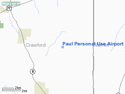
Paul Personal Use Airport |
Location & QuickFacts
| FAA Information Effective: | 2008-09-25 |
| Airport Identifier: | 0PN9 |
| Airport Status: | Operational |
| Longitude/Latitude: | 079-40-40.1860W/41-43-10.2110N
-79.677829/41.719503 (Estimated) |
| Elevation: | 1645 ft / 501.40 m (Estimated) |
| Land: | 0 acres |
| From nearest city: | 6 nautical miles N of Titusville, PA |
| Location: | Crawford County, PA |
| Magnetic Variation: | 08W (1985) |
Owner & Manager
| Ownership: | Privately owned |
| Owner: | James S. Paul |
| Address: | Rd 1, Box 161
Centerville, PA 16404 |
| Phone number: | 814-827-3298 |
| Address: |
|
Airport Operations and Facilities
| Airport Use: | Private |
| Wind indicator: | Yes |
| Segmented Circle: | No |
| Control Tower: | No |
| Landing fee charge: | No |
| Sectional chart: | Detroit |
| Region: | AEA - Eastern |
| Boundary ARTCC: | ZOB - Cleveland |
| Tie-in FSS: | AOO - Altoona |
| FSS on Airport: | No |
| FSS Toll Free: | 1-800-WX-BRIEF |
Airport Services
| Airframe Repair: | NONE |
| Power Plant Repair: | NONE |
Runway Information
Runway NW/SE
| Dimension: | 1800 x 75 ft / 548.6 x 22.9 m |
| Surface: | TURF, |
| |
Runway NW |
Runway SE |
| Traffic Pattern: | Left | Left |
|
Radio Navigation Aids
| ID |
Type |
Name |
Ch |
Freq |
Var |
Dist |
| ORJ | NDB | Corry | | 258.00 | 09W | 11.7 nm |
| CQD | NDB | Cascade | | 372.00 | 08W | 30.7 nm |
| FKL | VOR | Franklin | | 109.60 | 06W | 18.7 nm |
| CIP | VOR/DME | Clarion | 076X | 112.90 | 06W | 35.9 nm |
| JHW | VOR/DME | Jamestown | 094X | 114.70 | 07W | 37.6 nm |
| BFD | VOR/DME | Bradford | 113X | 116.60 | 07W | 47.6 nm |
| JFN | VOR/DME | Jefferson | 099X | 115.20 | 05W | 48.1 nm |
| TDT | VORTAC | Tidioute | 123X | 117.60 | 09W | 11.7 nm |
| ERI | VORTAC | Erie | 031X | 109.40 | 06W | 32.8 nm |
| DKK | VORTAC | Dunkirk | 109X | 116.20 | 07W | 49.7 nm |
Images and information placed above are from
http://www.airport-data.com/airport/0PN9/
We thank them for the data!
| General Info
|
| Country |
United States
|
| State |
PENNSYLVANIA
|
| FAA ID |
0PN9
|
| Latitude |
41-43-10.211N
|
| Longitude |
079-40-40.186W
|
| Elevation |
1645 feet
|
| Near City |
TITUSVILLE
|
We don't guarantee the information is fresh and accurate. The data may
be wrong or outdated.
For more up-to-date information please refer to other sources.
|
|


