 |
|
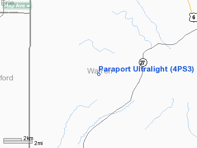
Paraport Ultralight Airport |
Location & QuickFacts
| FAA Information Effective: | 2008-09-25 |
| Airport Identifier: | 4PS3 |
| Airport Status: | Operational |
| Longitude/Latitude: | 079-31-06.9100W/41-47-18.3000N
-79.518586/41.788417 (Estimated) |
| Elevation: | 1400 ft / 426.72 m (Estimated) |
| Land: | 0 acres |
| From nearest city: | 8 nautical miles N of Warren, PA |
| Location: | Warren County, PA |
| Magnetic Variation: | () |
Owner & Manager
| Ownership: | Privately owned |
| Owner: | Karl H. Kodrzycki |
| Address: | R.r. 1 Box 52 Aia
Spring Creek, PA 16436 |
| Phone number: | 814-664-9412 |
| Manager: | Karl H. Kodrzycki |
| Address: | R.r. 1 Box 52 Aia
Spring Creek, PA 16436 |
| Phone number: | 814-833-9902 |
Airport Operations and Facilities
| Airport Use: | Private |
| Wind indicator: | Yes |
| Control Tower: | No |
| Sectional chart: | Detroit |
| Region: | AEA - Eastern |
| Boundary ARTCC: | ZOB - Cleveland |
| Tie-in FSS: | AOO - Altoona |
| FSS Toll Free: | 1-800-WX-BRIEF |
Runway Information
Runway 09U/27U
| Dimension: | 1400 x 400 ft / 426.7 x 121.9 m |
| Surface: | TURF, |
| |
Runway 09U |
Runway 27U |
| Traffic Pattern: | Left | Left |
|
Radio Navigation Aids
| ID |
Type |
Name |
Ch |
Freq |
Var |
Dist |
| ORJ | NDB | Corry | | 258.00 | 09W | 9.5 nm |
| CQD | NDB | Cascade | | 372.00 | 08W | 32.9 nm |
| FKL | VOR | Franklin | | 109.60 | 06W | 25.9 nm |
| JHW | VOR/DME | Jamestown | 094X | 114.70 | 07W | 29.9 nm |
| CIP | VOR/DME | Clarion | 076X | 112.90 | 06W | 38.7 nm |
| BFD | VOR/DME | Bradford | 113X | 116.60 | 07W | 40.3 nm |
| TDT | VORTAC | Tidioute | 123X | 117.60 | 09W | 6.4 nm |
| ERI | VORTAC | Erie | 031X | 109.40 | 06W | 37.3 nm |
| DKK | VORTAC | Dunkirk | 109X | 116.20 | 07W | 43.6 nm |
Images and information placed above are from
http://www.airport-data.com/airport/4PS3/
We thank them for the data!
|
|


