 |
|
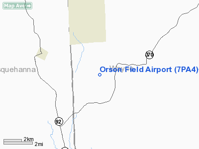
Location & QuickFacts
| FAA Information Effective: | 2008-09-25 |
| Airport Identifier: | 7PA4 |
| Airport Status: | Operational |
| Longitude/Latitude: | 075-26-10.6470W/41-50-32.3020N
-75.436291/41.842306 (Estimated) |
| Elevation: | 2100 ft / 640.08 m (Estimated) |
| Land: | 75 acres |
| From nearest city: | 3 nautical miles N of Orson, PA |
| Location: | Wayne County, PA |
| Magnetic Variation: | 12W (1985) |
Owner & Manager
| Ownership: | Privately owned |
| Owner: | Robert J. Lipinsky |
| Address: | Po Box 164
Lakewood, PA 18439 |
| Phone number: | 717-727-2429 |
| Manager: | Robert J. Lipinsky |
| Address: | Po Box 164
Lakewood, PA 18439 |
| Phone number: | 717-727-2429 |
Airport Operations and Facilities
| Airport Use: | Private |
| Segmented Circle: | No |
| Control Tower: | No |
| Sectional chart: | New York |
| Region: | AEA - Eastern |
| Boundary ARTCC: | ZNY - New York |
| Tie-in FSS: | IPT - Williamsport |
| FSS on Airport: | No |
| FSS Toll Free: | 1-800-WX-BRIEF |
Runway Information
Runway 03/21
| Dimension: | 1700 x 100 ft / 518.2 x 30.5 m |
| Surface: | TURF, |
| |
Runway 03 |
Runway 21 |
| Traffic Pattern: | Left | Right |
|
Radio Navigation Aids
| ID |
Type |
Name |
Ch |
Freq |
Var |
Dist |
| MS | NDB | Monga | | 359.00 | 12W | 26.2 nm |
| CYE | NDB | Crystal Lake | | 410.00 | 11W | 41.9 nm |
| HNK | VOR/DME | Hancock | 115X | 116.80 | 11W | 14.3 nm |
| DNY | VOR/DME | De Lancey | 058X | 112.10 | 11W | 29.4 nm |
| RKA | VOR/DME | Rockdale | 073X | 112.60 | 11W | 38.5 nm |
| HUO | VOR/DME | Huguenot | 108X | 116.10 | 11W | 46.0 nm |
| LHY | VORTAC | Lake Henry | 045X | 110.80 | 10W | 22.1 nm |
| LVZ | VORTAC | Wilkes-barre | 053X | 111.60 | 10W | 36.1 nm |
| CFB | VORTAC | Binghamton | 059X | 112.20 | 10W | 36.6 nm |
Remarks
- TREES & BRUSH IN CLOSE PROXIMITY TO THE RUNWAY ARE REMOVED OR LOWERED TO ENSURE PROPER CLNC OF THE ARPT IMAGINARY SFCS.
Images and information placed above are from
http://www.airport-data.com/airport/7PA4/
We thank them for the data!
| General Info
|
| Country |
United States
|
| State |
PENNSYLVANIA
|
| FAA ID |
7PA4
|
| Latitude |
41-50-32.302N
|
| Longitude |
075-26-10.647W
|
| Elevation |
2100 feet
|
| Near City |
ORSON
|
We don't guarantee the information is fresh and accurate. The data may
be wrong or outdated.
For more up-to-date information please refer to other sources.
|
|


