 |
|
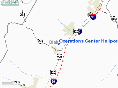
Operations Center Heliport |
Location & QuickFacts
| FAA Information Effective: | 2008-09-25 |
| Airport Identifier: | PS44 |
| Airport Status: | Operational |
| Longitude/Latitude: | 078-19-32.0510W/40-36-41.2370N
-78.325570/40.611455 (Estimated) |
| Elevation: | 1035 ft / 315.47 m (Estimated) |
| Land: | 0 acres |
| From nearest city: | 0 nautical miles ES of Bellwood, PA |
| Location: | Blair County, PA |
| Magnetic Variation: | 09W (1985) |
Owner & Manager
| Ownership: | Privately owned |
| Owner: | Mid-state Bank & Trust Co. |
| Address: | 1130 - 12th Avenue
Altoona, PA 16603 |
| Phone number: | 814-742-6791 |
| Manager: | R. Blaine Locke |
| Address: | 1130 - 12th Avenue
Altoona, PA 16603 |
Airport Operations and Facilities
| Airport Use: | Private |
| Wind indicator: | Yes |
| Segmented Circle: | No |
| Control Tower: | No |
| Landing fee charge: | No |
| Sectional chart: | Detroit |
| Region: | AEA - Eastern |
| Boundary ARTCC: | ZOB - Cleveland |
| Tie-in FSS: | AOO - Altoona |
| FSS on Airport: | No |
| FSS Toll Free: | 1-800-WX-BRIEF |
Runway Information
Helipad H1
| Dimension: | 30 x 30 ft / 9.1 x 9.1 m |
| Surface: | TURF, |
| |
Runway H1 |
Runway |
| Traffic Pattern: | Left | Left |
|
Radio Navigation Aids
| ID |
Type |
Name |
Ch |
Freq |
Var |
Dist |
| RV | NDB | Stroh | | 407.00 | 10W | 27.7 nm |
| INP | NDB | Indiana | | 242.00 | 08W | 33.8 nm |
| SYS | NDB | Stoystown | | 209.00 | 08W | 41.6 nm |
| BHU | NDB | Benje | | 382.00 | 07W | 45.5 nm |
| AOO | VOR | Altoona | | 108.80 | 07W | 17.2 nm |
| REC | VOR/DME | Revloc | 043X | 110.60 | 09W | 19.6 nm |
| TON | VORTAC | Tyrone | 096X | 114.90 | 07W | 7.4 nm |
| PSB | VORTAC | Philipsburg | 102X | 115.50 | 10W | 23.8 nm |
| JST | VORTAC | Johnstown | 077X | 113.00 | 06W | 29.2 nm |
| ETG | VORTAC | Keating | 107X | 116.00 | 10W | 37.2 nm |
| THS | VORTAC | St Thomas | 097X | 115.00 | 07W | 44.2 nm |
Images and information placed above are from
http://www.airport-data.com/airport/PS44/
We thank them for the data!
| General Info
|
| Country |
United States
|
| State |
PENNSYLVANIA
|
| FAA ID |
PS44
|
| Latitude |
40-36-41.237N
|
| Longitude |
078-19-32.051W
|
| Elevation |
1035 feet
|
| Near City |
BELLWOOD
|
We don't guarantee the information is fresh and accurate. The data may
be wrong or outdated.
For more up-to-date information please refer to other sources.
|
|


