 |
|
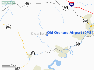
Location & QuickFacts
| FAA Information Effective: | 2008-09-25 |
| Airport Identifier: | 0PS4 |
| Airport Status: | Operational |
| Longitude/Latitude: | 078-33-39.0910W/41-00-30.2100N
-78.560859/41.008392 (Estimated) |
| Elevation: | 1980 ft / 603.50 m (Estimated) |
| Land: | 10 acres |
| From nearest city: | 3 nautical miles NW of Curwensville, PA |
| Location: | Clearfield County, PA |
| Magnetic Variation: | 09W (1980) |
Owner & Manager
| Ownership: | Privately owned |
| Owner: | James H. Gilliland |
| Address: | Rd 1, Box 405
Curwensville, PA 16833 |
| Phone number: | 814-236-3302 |
| Manager: | James H. Gilliland |
| Address: | Rd 1, Box 405
Curwensville, PA 16833 |
| Phone number: | 814-236-3302 |
Airport Operations and Facilities
| Airport Use: | Private |
| Wind indicator: | Yes |
| Segmented Circle: | No |
| Control Tower: | No |
| Landing fee charge: | No |
| Sectional chart: | Detroit |
| Region: | AEA - Eastern |
| Boundary ARTCC: | ZOB - Cleveland |
| Tie-in FSS: | AOO - Altoona |
| FSS Toll Free: | 1-800-WX-BRIEF |
Runway Information
Runway 06/24
| Dimension: | 2400 x 100 ft / 731.5 x 30.5 m |
| Surface: | TURF, |
| |
Runway 06 |
Runway 24 |
| Traffic Pattern: | Left | Right |
| Displaced threshold: | 200.00 ft | 160.00 ft |
| Obstruction: | 30 ft pline, 800.0 ft from runway | 20 ft trees, 400.0 ft from runway |
|
Radio Navigation Aids
| ID |
Type |
Name |
Ch |
Freq |
Var |
Dist |
| INP | NDB | Indiana | | 242.00 | 08W | 32.2 nm |
| RV | NDB | Stroh | | 407.00 | 10W | 45.1 nm |
| BHU | NDB | Benje | | 382.00 | 07W | 50.0 nm |
| AOO | VOR | Altoona | | 108.80 | 07W | 42.7 nm |
| REC | VOR/DME | Revloc | 043X | 110.60 | 09W | 29.0 nm |
| CIP | VOR/DME | Clarion | 076X | 112.90 | 06W | 41.5 nm |
| BFD | VOR/DME | Bradford | 113X | 116.60 | 07W | 46.8 nm |
| TON | VORTAC | Tyrone | 096X | 114.90 | 07W | 19.5 nm |
| ETG | VORTAC | Keating | 107X | 116.00 | 10W | 22.6 nm |
| PSB | VORTAC | Philipsburg | 102X | 115.50 | 10W | 26.4 nm |
| SLT | VORTAC | Slate Run | 086X | 113.90 | 08W | 40.4 nm |
| JST | VORTAC | Johnstown | 077X | 113.00 | 06W | 43.4 nm |
Remarks
Images and information placed above are from
http://www.airport-data.com/airport/0PS4/
We thank them for the data!
| General Info
|
| Country |
United States
|
| State |
PENNSYLVANIA
|
| FAA ID |
0PS4
|
| Latitude |
41-00-30.210N
|
| Longitude |
078-33-39.091W
|
| Elevation |
1980 feet
|
| Near City |
CURWENSVILLE
|
We don't guarantee the information is fresh and accurate. The data may
be wrong or outdated.
For more up-to-date information please refer to other sources.
|
|


