 |
|
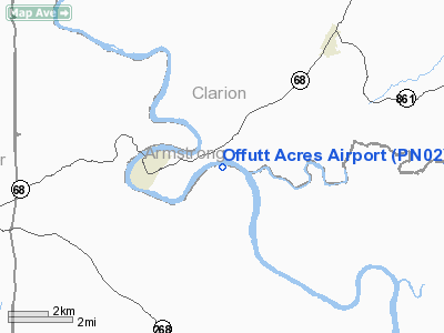
Location & QuickFacts
| FAA Information Effective: | 2008-09-25 |
| Airport Identifier: | PN02 |
| Airport Status: | Operational |
| Longitude/Latitude: | 079-33-59.1650W/40-59-05.2290N
-79.566435/40.984786 (Estimated) |
| Elevation: | 865 ft / 263.65 m (Estimated) |
| Land: | 285 acres |
| From nearest city: | 3 nautical miles W of East Brady, PA |
| Location: | Armstrong County, PA |
| Magnetic Variation: | 08W (1985) |
Owner & Manager
| Ownership: | Privately owned |
| Owner: | Robert E. Offutt |
| Address: | 215 Klein Road
Glenshaw, PA 15116 |
| Phone number: | 412-486-6642 |
| Address: |
|
Airport Operations and Facilities
| Airport Use: | Private |
| Wind indicator: | Yes |
| Segmented Circle: | No |
| Control Tower: | No |
| Landing fee charge: | No |
| Sectional chart: | Detroit |
| Region: | AEA - Eastern |
| Boundary ARTCC: | ZOB - Cleveland |
| Tie-in FSS: | AOO - Altoona |
| FSS on Airport: | No |
| FSS Toll Free: | 1-800-WX-BRIEF |
Airport Services
| Airframe Repair: | NONE |
| Power Plant Repair: | NONE |
Runway Information
Runway E/W
| Dimension: | 1350 x 120 ft / 411.5 x 36.6 m |
| Surface: | TURF, Good Condition |
| |
Runway E |
Runway W |
| Traffic Pattern: | Left | Left |
|
Radio Navigation Aids
| ID |
Type |
Name |
Ch |
Freq |
Var |
Dist |
| INP | NDB | Indiana | | 242.00 | 08W | 31.1 nm |
| UCP | NDB | Castle | | 272.00 | 09W | 38.6 nm |
| BHU | NDB | Benje | | 382.00 | 07W | 39.0 nm |
| MKP | NDB | Mc Keesport | | 287.00 | 07W | 39.1 nm |
| HBD | NDB | Hubbard | | 408.00 | 08W | 44.9 nm |
| FKL | VOR | Franklin | | 109.60 | 06W | 30.3 nm |
| CIP | VOR/DME | Clarion | 076X | 112.90 | 06W | 10.9 nm |
| REC | VOR/DME | Revloc | 043X | 110.60 | 09W | 45.7 nm |
| AGC | VOR/DME | Allegheny | 037X | 110.00 | 09W | 47.6 nm |
| EWC | VORTAC | Ellwood City | 105X | 115.80 | 08W | 30.8 nm |
| MMJ | VORTAC | Montour | 057X | 112.00 | 08W | 41.3 nm |
| TDT | VORTAC | Tidioute | 123X | 117.60 | 09W | 44.3 nm |
Remarks
Images and information placed above are from
http://www.airport-data.com/airport/PN02/
We thank them for the data!
| General Info
|
| Country |
United States
|
| State |
PENNSYLVANIA
|
| FAA ID |
PN02
|
| Latitude |
40-59-05.229N
|
| Longitude |
079-33-59.165W
|
| Elevation |
865 feet
|
| Near City |
EAST BRADY
|
We don't guarantee the information is fresh and accurate. The data may
be wrong or outdated.
For more up-to-date information please refer to other sources.
|
|


