 |
|
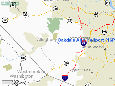
Location & QuickFacts
| FAA Information Effective: | 2008-09-25 |
| Airport Identifier: | 16PN |
| Airport Status: | Operational |
| Longitude/Latitude: | 080-09-29.2050W/40-23-18.2480N
-80.158113/40.388402 (Estimated) |
| Elevation: | 1265 ft / 385.57 m (Estimated) |
| Land: | 0 acres |
| From nearest city: | 0 nautical miles N of Oakdale, PA |
| Location: | Allegheny County, PA |
| Magnetic Variation: | 07W (1985) |
Owner & Manager
| Ownership: | Army owned |
| Owner: | Army |
| Address: | Cmdr, Hq-c.e. Kelly Supt Fac
Oakdale, PA 15071-5001 |
| Phone number: | 412-777-1173 |
| Address: |
|
Airport Operations and Facilities
| Airport Use: | Private |
| Wind indicator: | Yes |
| Segmented Circle: | No |
| Control Tower: | No |
| Sectional chart: | Detroit |
| Region: | AEA - Eastern |
| Boundary ARTCC: | ZOB - Cleveland |
| Tie-in FSS: | AOO - Altoona |
| FSS Toll Free: | 1-800-WX-BRIEF |
Runway Information
Helipad H1
| Dimension: | 100 x 100 ft / 30.5 x 30.5 m |
| Surface: | ASPH, |
| |
Runway H1 |
Runway |
| Traffic Pattern: | Left | Left |
|
Radio Navigation Aids
| ID |
Type |
Name |
Ch |
Freq |
Var |
Dist |
| PNU | NDB | Washington County | | 255.00 | 08W | 14.7 nm |
| MKP | NDB | Mc Keesport | | 287.00 | 07W | 17.4 nm |
| VV | NDB | Camor | | 299.00 | 08W | 35.8 nm |
| UCP | NDB | Castle | | 272.00 | 09W | 39.9 nm |
| CFX | NDB | Cadiz | | 239.00 | 07W | 40.2 nm |
| BHU | NDB | Benje | | 382.00 | 07W | 40.6 nm |
| TSO | NDB | Tolson | | 395.00 | 07W | 43.3 nm |
| HBD | NDB | Hubbard | | 408.00 | 08W | 49.0 nm |
| AGC | VOR/DME | Allegheny | 037X | 110.00 | 09W | 8.5 nm |
| HLG | VOR/DME | Wheeling | 059X | 112.20 | 07W | 20.3 nm |
| AIR | VOR/DME | Bellaire | 118X | 117.10 | 07W | 37.6 nm |
| MMJ | VORTAC | Montour | 057X | 112.00 | 08W | 6.2 nm |
| EWC | VORTAC | Ellwood City | 105X | 115.80 | 08W | 26.4 nm |
| IHD | VORTAC | Indian Head | 019X | 108.20 | 06W | 44.4 nm |
Remarks
- SECURITY FENCE-L 49 FT N OF HELIPAD; 131 FT RADIO TWR-L 82 FT NW.
- APCH/DEP FM SE TO W TO AVOID OVERFLIGHT OF MIL FAC.
Images and information placed above are from
http://www.airport-data.com/airport/16PN/
We thank them for the data!
| General Info
|
| Country |
United States
|
| State |
PENNSYLVANIA
|
| FAA ID |
16PN
|
| Latitude |
40-23-18.248N
|
| Longitude |
080-09-29.205W
|
| Elevation |
1265 feet
|
| Near City |
OAKDALE
|
We don't guarantee the information is fresh and accurate. The data may
be wrong or outdated.
For more up-to-date information please refer to other sources.
|
|


