 |
|
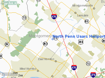
North Penn Usarc Heliport |
Location & QuickFacts
| FAA Information Effective: | 2008-09-25 |
| Airport Identifier: | PS34 |
| Airport Status: | Operational |
| Longitude/Latitude: | 075-20-28.6420W/40-11-30.3820N
-75.341289/40.191773 (Estimated) |
| Elevation: | 450 ft / 137.16 m (Estimated) |
| Land: | 2 acres |
| From nearest city: | 5 nautical miles SW of Worcester, PA |
| Location: | Montgomery County, PA |
| Magnetic Variation: | 11W (1985) |
Owner & Manager
| Ownership: | Army owned |
| Owner: | 330th Engr Br (c)(c) |
| Address: | North Penn Memorial Usarc
Worcester, PA 19490 |
| Phone number: | 215-584-1111
AUTOVAN 991-1661. |
| Manager: | Ltcjames J. Carroll, Ctr Cmdr |
| Address: | Potshop & Berks Road
Worcester, PA 19490-9998 |
| Phone number: | 215-584-1836 |
Airport Operations and Facilities
| Airport Use: | Private |
| Segmented Circle: | No |
| Control Tower: | No |
| Landing fee charge: | No |
| Sectional chart: | New York |
| Region: | AEA - Eastern |
| Boundary ARTCC: | ZNY - New York |
| Tie-in FSS: | IPT - Williamsport |
| FSS on Airport: | No |
| FSS Toll Free: | 1-800-WX-BRIEF |
Runway Information
Helipad H1
| Dimension: | 100 x 100 ft / 30.5 x 30.5 m |
| Surface: | ASPH, |
| |
Runway H1 |
Runway |
| Traffic Pattern: | Left | Left |
|
Radio Navigation Aids
| ID |
Type |
Name |
Ch |
Freq |
Var |
Dist |
| ING | NDB | Ambler | | 275.00 | 11W | 4.7 nm |
| NXX | NDB | Willow Grove | | 388.00 | 12W | 9.0 nm |
| DYL | NDB | Doylestown | | 237.00 | 10W | 13.3 nm |
| UKT | NDB | Quakertown | | 208.00 | 12W | 14.2 nm |
| LQX | NDB | Carbon | | 339.00 | 12W | 41.9 nm |
| NEL | NDB | Lakehurst | | 396.00 | 13W | 47.1 nm |
| RNB | NDB | Rainbow | | 363.00 | 11W | 47.5 nm |
| NXX | TACAN | Willow Grove | 061X | | 10W | 9.0 nm |
| NEL | TACAN | Lakehurst | 055X | | 11W | 46.4 nm |
| NEL | UHF/NDB | Lakehurst | | 274.80 | 13W | 47.1 nm |
| PNE | VOR | North Philadelphia | | 112.00 | 10W | 16.6 nm |
| CKZ | VOR/DME | Pennridge | 025Y | 108.85 | 12W | 12.2 nm |
| ARD | VOR/DME | Yardley | 019X | 108.20 | 10W | 20.2 nm |
| ETX | VOR/DME | East Texas | 039X | 110.20 | 09W | 28.2 nm |
| SBJ | VOR/DME | Solberg | 076X | 112.90 | 10W | 36.1 nm |
| BWZ | VOR/DME | Broadway | 089X | 114.20 | 11W | 43.5 nm |
| PTW | VORTAC | Pottstown | 112X | 116.50 | 09W | 10.2 nm |
| MXE | VORTAC | Modena | 079X | 113.20 | 09W | 22.4 nm |
| FJC | VORTAC | Allentown | 122X | 117.50 | 10W | 32.6 nm |
| DQO | VORTAC | Dupont | 087X | 114.00 | 10W | 33.2 nm |
| OOD | VORTAC | Woodstown | 075X | 112.80 | 10W | 33.5 nm |
| GXU | VORTAC | Mc Guire | 043X | 110.60 | 11W | 36.0 nm |
| RBV | VORTAC | Robbinsville | 085X | 113.80 | 10W | 38.9 nm |
| VCN | VORTAC | Cedar Lake | 099X | 115.20 | 10W | 42.9 nm |
| LRP | VORTAC | Lancaster | 120X | 117.30 | 09W | 43.9 nm |
| CYN | VORTAC | Coyle | 081X | 113.40 | 10W | 47.5 nm |
| PHL | VOT | Philadelphia Intl | | 109.80 | | 19.8 nm |
Remarks
- UNIT (330TH ENGR BR) MUST BE NOTIFIED PRIOR TO LANDING.
Images and information placed above are from
http://www.airport-data.com/airport/PS34/
We thank them for the data!
| General Info
|
| Country |
United States
|
| State |
PENNSYLVANIA
|
| FAA ID |
PS34
|
| Latitude |
40-11-30.382N
|
| Longitude |
075-20-28.642W
|
| Elevation |
450 feet
|
| Near City |
WORCESTER
|
We don't guarantee the information is fresh and accurate. The data may
be wrong or outdated.
For more up-to-date information please refer to other sources.
|
|


