 |
|
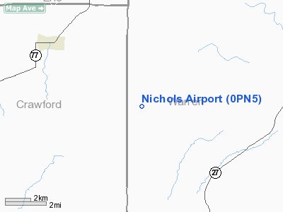
Location & QuickFacts
| FAA Information Effective: | 2008-09-25 |
| Airport Identifier: | 0PN5 |
| Airport Status: | Operational |
| Longitude/Latitude: | 079-35-54.1830W/41-46-45.2100N
-79.598384/41.779225 (Estimated) |
| Elevation: | 1761 ft / 536.75 m (Surveyed) |
| Land: | 0 acres |
| From nearest city: | 5 nautical miles SE of Spartansburg, PA |
| Location: | Warren County, PA |
| Magnetic Variation: | 09W (1985) |
Owner & Manager
| Ownership: | Privately owned |
| Owner: | Keith S. Nichols |
| Address: | Rd 2
Spartansburg, PA 16434 |
| Phone number: | 814-436-7481 |
| Address: |
|
Airport Operations and Facilities
| Airport Use: | Private |
| Wind indicator: | Yes |
| Segmented Circle: | No |
| Control Tower: | No |
| Landing fee charge: | No |
| Sectional chart: | Detroit |
| Region: | AEA - Eastern |
| Boundary ARTCC: | ZOB - Cleveland |
| Tie-in FSS: | AOO - Altoona |
| FSS on Airport: | No |
| FSS Toll Free: | 1-800-WX-BRIEF |
Airport Services
| Airframe Repair: | NONE |
| Power Plant Repair: | NONE |
Runway Information
Runway E/W
| Dimension: | 2400 x 100 ft / 731.5 x 30.5 m |
| Surface: | TURF, |
| |
Runway E |
Runway W |
| Traffic Pattern: | Left | Left |
| Obstruction: | | 4 ft fence, 50.0 ft from runway |
|
Radio Navigation Aids
| ID |
Type |
Name |
Ch |
Freq |
Var |
Dist |
| ORJ | NDB | Corry | | 258.00 | 09W | 8.3 nm |
| CQD | NDB | Cascade | | 372.00 | 08W | 30.5 nm |
| FKL | VOR | Franklin | | 109.60 | 06W | 23.5 nm |
| JHW | VOR/DME | Jamestown | 094X | 114.70 | 07W | 32.6 nm |
| CIP | VOR/DME | Clarion | 076X | 112.90 | 06W | 38.6 nm |
| BFD | VOR/DME | Bradford | 113X | 116.60 | 07W | 43.9 nm |
| TDT | VORTAC | Tidioute | 123X | 117.60 | 09W | 9.0 nm |
| ERI | VORTAC | Erie | 031X | 109.40 | 06W | 34.2 nm |
| DKK | VORTAC | Dunkirk | 109X | 116.20 | 07W | 45.1 nm |
Remarks
Images and information placed above are from
http://www.airport-data.com/airport/0PN5/
We thank them for the data!
| General Info
|
| Country |
United States
|
| State |
PENNSYLVANIA
|
| FAA ID |
0PN5
|
| Latitude |
41-46-45.210N
|
| Longitude |
079-35-54.183W
|
| Elevation |
1761 feet
|
| Near City |
SPARTANSBURG
|
We don't guarantee the information is fresh and accurate. The data may
be wrong or outdated.
For more up-to-date information please refer to other sources.
|
|


