|
|
| New Garden Flying Field |
| Not Just an Airport, A Destination |
| IATA: none – ICAO: none – FAA LID: N57 |
| Summary |
| Airport type |
Public |
| Operator |
New Garden Twp. |
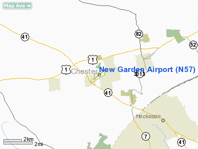
| Location |
Toughkenamon, PA |
| Elevation AMSL |
436 ft / 133 m |
| Coordinates |
39°49′50″N 075°46′11″W / 39.83056°N 75.76972°W / 39.83056; -75.76972 |
| Website |
[1] |
| Runways |
| Direction |
Length |
Surface |
| ft |
m |
| 6/24 |
3,695 |
1,126 |
Asphalt |
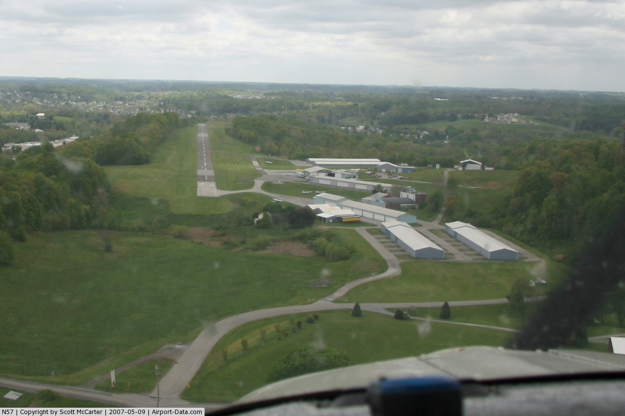
New Garden Flying Field (FAA LID: N57), is a public airport located in Toughkenamon, Chester County, Pennsylvania (about 20 miles (32 km) southwest of Philadelphia). This airport is operated by New Garden Twp. and the airport manager is Jonathan Martin.
The airport serves a large general aviation community, and offers maintenance facilities, aviation fuel (100LL), flight instruction, aircraft rental and hangar/tie-down space. The Colonial Flying Corps Aviation Museum is located on the field. The airport also hosts the Brandywine Soaring Association and Chapter 240 of the Experimental Aircraft Association (EAA). Facilities
New Garden Airport covers an area of 134 acres (54 ha) and contains one runway:
- Runway 6/24: 3,695 x 50 ft (1,126 x 15 m), Surface: Asphalt
Flight School
New Garden Flight Connection is the fligt school based on the field. They utilize a Cessna 172 and Cessna 150 for primary instruction.
Airshow
The Airport host an airshow every June. In 2010 the airshow has been expanded to encompass both saturday and sunday. There will be statics displays varying from Piper Cubs to a WWII B-17, The Memphis Belle. This year's show will also include a car show. Official Site Festival of Flight
The above content comes from Wikipedia and is published under free licenses – click here to read more.
 |
(Click on the photo to enlarge) |
Location & QuickFacts
| FAA Information Effective: | 2008-09-25 |
| Airport Identifier: | N57 |
| Airport Status: | Operational |
| Longitude/Latitude: | 075-46-11.0810W/39-49-49.8950N
-75.769745/39.830526 (Estimated) |
| Elevation: | 436 ft / 132.89 m (Estimated) |
| Land: | 134 acres |
| From nearest city: | 1 nautical miles W of Toughkenamon, PA |
| Location: | Chester County, PA |
| Magnetic Variation: | 09W (1965) |
Owner & Manager
| Ownership: | Publicly owned |
| Owner: | New Garden Township |
| Address: | Township Manager, 299 Starr Rd.
Landenburg, PA 19350 |
| Phone number: | 610-268-8988 |
| Manager: | Everitt Dupont |
| Address: | Box 481
Toughkenamon, PA 19374 |
| Phone number: | 610-268-8988 |
Airport Operations and Facilities
| Airport Use: | Open to public |
| Wind indicator: | Yes |
| Segmented Circle: | No |
| Control Tower: | No |
| Lighting Schedule: | DUSK-DAWN |
| Beacon Color: | Clear-Green (lighted land airport) |
| Landing fee charge: | Yes
NO LANDING FEE IF FUEL IS PURCHASED. |
| Sectional chart: | Washington |
| Region: | AEA - Eastern |
| Boundary ARTCC: | ZNY - New York |
| Tie-in FSS: | IPT - Williamsport |
| FSS on Airport: | No |
| FSS Toll Free: | 1-800-WX-BRIEF |
| NOTAMs Facility: | IPT (NOTAM-d service avaliable) |
| Federal Agreements: | NMY |
Airport Communications
| CTAF: | 123.050 |
| Unicom: | 123.050 |
Airport Services
| Fuel available: | 100LL |
| Airframe Repair: | MAJOR |
| Power Plant Repair: | MAJOR |
| Bottled Oxygen: | NONE |
| Bulk Oxygen: | NONE |
Runway Information
Runway 06/24
| Dimension: | 3695 x 50 ft / 1126.2 x 15.2 m
WIDE LNDG GEAR AC EXIT RY AT EAST END. TURN AROUND AVAILABLE ON WEST END. |
| Surface: | ASPH, Fair Condition
TURF SURFACE ON RY ENDS FOR GLIDER RECOVERY ONLY. |
| Edge Lights: | Non-standard lighting system
RY 06/24 NSTD LIRL DUE TO PLACEMENT - NOT CENTERED ON RY SFC. RY CLOSEST TO LIGHTS ON NW SIDE. |
| |
Runway 06 |
Runway 24 |
| Longitude: | 075-46-28.0630W | 075-45-54.1530W |
| Latitude: | 39-49-37.1040N | 39-50-02.5900N |
| Elevation: | 435.00 ft | 432.00 ft |
| Alignment: | 46 | 127 |
| Traffic Pattern: | Left | Left |
| Markings: | Basic, Fair Condition | Basic, Fair Condition |
| Obstruction: | 20 ft trees, 276.0 ft from runway, 100 ft right of centerline, 3:1 slope to clear
TREES SOUTH OF RY FULL LENGTH. RY 06 HAS +8 FT BRUSH 174 FT FM RY END 116 FT R. | 14 ft bldg, 236.0 ft from runway, 212 ft right of centerline, 2:1 slope to clear |
|
Radio Navigation Aids
| ID |
Type |
Name |
Ch |
Freq |
Var |
Dist |
| APG | NDB | Aberdeen | | 349.00 | 11W | 23.6 nm |
| ING | NDB | Ambler | | 275.00 | 11W | 28.5 nm |
| NXX | NDB | Willow Grove | | 388.00 | 12W | 35.9 nm |
| RNB | NDB | Rainbow | | 363.00 | 11W | 38.4 nm |
| UKT | NDB | Quakertown | | 208.00 | 12W | 41.8 nm |
| DYL | NDB | Doylestown | | 237.00 | 10W | 42.5 nm |
| MTN | NDB | Martin | | 342.00 | 11W | 42.6 nm |
| NXX | TACAN | Willow Grove | 061X | | 10W | 36.1 nm |
| MTN | TACAN | Martin | 068X | | 11W | 42.3 nm |
| DOV | TACAN | Dover | 037X | | 09W | 44.2 nm |
| PNE | VOR | North Philadelphia | | 112.00 | 10W | 38.2 nm |
| PPM | VOR/DME | Phillips | 021X | 108.40 | 09W | 28.7 nm |
| CKZ | VOR/DME | Pennridge | 025Y | 108.85 | 12W | 40.3 nm |
| ETX | VOR/DME | East Texas | 039X | 110.20 | 09W | 45.3 nm |
| ARD | VOR/DME | Yardley | 019X | 108.20 | 10W | 47.1 nm |
| MXE | VORTAC | Modena | 079X | 113.20 | 09W | 7.0 nm |
| DQO | VORTAC | Dupont | 087X | 114.00 | 10W | 11.8 nm |
| OOD | VORTAC | Woodstown | 075X | 112.80 | 10W | 24.5 nm |
| PTW | VORTAC | Pottstown | 112X | 116.50 | 09W | 25.4 nm |
| LRP | VORTAC | Lancaster | 120X | 117.30 | 09W | 29.7 nm |
| ENO | VORTAC | Smyrna | 051X | 111.40 | 09W | 37.9 nm |
| VCN | VORTAC | Cedar Lake | 099X | 115.20 | 10W | 41.1 nm |
| PHL | VOT | Philadelphia Intl | | 109.80 | | 24.3 nm |
Remarks
- RWY 06 NOISE ABATEMENT CLIMB TO 1200' MSL BEFORE TURNING CROSSWIND.
- FOR ASST AFTER HRS CNT 610-444-0186
- VFR USE ONLY
Images and information placed above are from
http://www.airport-data.com/airport/N57/
We thank them for the data!
| General Info
|
| Country |
United States
|
| State |
PENNSYLVANIA
|
| FAA ID |
N57
|
| Latitude |
39-49-49.895N
|
| Longitude |
075-46-11.081W
|
| Elevation |
436 feet
|
| Near City |
TOUGHKENAMON
|
We don't guarantee the information is fresh and accurate. The data may
be wrong or outdated.
For more up-to-date information please refer to other sources.
|
|