 |
|
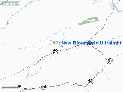
New Bloomfield Ultralight Airport |
Location & QuickFacts
| FAA Information Effective: | 2008-09-25 |
| Airport Identifier: | 0PN4 |
| Airport Status: | Operational |
| Longitude/Latitude: | 077-14-28.9400W/40-24-46.3000N
-77.241372/40.412861 (Estimated) |
| Elevation: | 960 ft / 292.61 m (Estimated) |
| Land: | 28 acres |
| From nearest city: | 2 nautical miles W of New Bloomfield, PA |
| Location: | Perry County, PA |
| Magnetic Variation: | 11W (1995) |
Owner & Manager
| Ownership: | Privately owned |
| Owner: | Kirby W. Kitner |
| Address: | , 7214 Spring Rd
New Bloomfield, PA 17068 |
| Phone number: | 717-582-4872 |
| Manager: | Kirby W. Kitner |
| Address: | 7214 Spring Rd
New Bloomfield, PA 17068 |
| Phone number: | 717-582-4872 |
Airport Operations and Facilities
| Airport Use: | Private |
| Wind indicator: | Yes |
| Segmented Circle: | No |
| Control Tower: | No |
| Sectional chart: | Detroit |
| Region: | AEA - Eastern |
| Boundary ARTCC: | ZNY - New York |
| Tie-in FSS: | IPT - Williamsport |
| FSS Toll Free: | 1-800-WX-BRIEF |
Runway Information
Runway 07/25
| Dimension: | 500 x 100 ft / 152.4 x 30.5 m |
| Surface: | TURF, Good Condition |
| |
Runway 07 |
Runway 25 |
| Traffic Pattern: | Left | Left |
|
Radio Navigation Aids
| ID |
Type |
Name |
Ch |
Freq |
Var |
Dist |
| RV | NDB | Stroh | | 407.00 | 10W | 24.9 nm |
| BZJ | NDB | Bellgrove | | 328.00 | 10W | 31.5 nm |
| EUD | NDB | York | | 254.00 | 11W | 34.0 nm |
| AOO | VOR | Altoona | | 108.80 | 07W | 48.9 nm |
| HAR | VORTAC | Harrisburg | 072X | 112.50 | 10W | 10.3 nm |
| SEG | VORTAC | Selinsgrove | 041X | 110.40 | 08W | 28.0 nm |
| RAV | VORTAC | Ravine | 093X | 114.60 | 11W | 30.5 nm |
| THS | VORTAC | St Thomas | 097X | 115.00 | 07W | 43.5 nm |
| MIP | VORTAC | Milton | 029X | 109.20 | 09W | 45.1 nm |
| PSB | VORTAC | Philipsburg | 102X | 115.50 | 10W | 45.7 nm |
| LRP | VORTAC | Lancaster | 120X | 117.30 | 09W | 47.0 nm |
| MDT | VOT | Harrisburg International | | 110.00 | | 25.4 nm |
Remarks
- PRVDD VFR ONLY, 20:1 APCH/DEP PATH, OPERATE TO MINIMIZE NOISE.
Images and information placed above are from
http://www.airport-data.com/airport/0PN4/
We thank them for the data!
| General Info
|
| Country |
United States
|
| State |
PENNSYLVANIA
|
| FAA ID |
0PN4
|
| Latitude |
40-24-46.300N
|
| Longitude |
077-14-28.940W
|
| Elevation |
960 feet
|
| Near City |
NEW BLOOMFIELD
|
We don't guarantee the information is fresh and accurate. The data may
be wrong or outdated.
For more up-to-date information please refer to other sources.
|
|


