 |
|
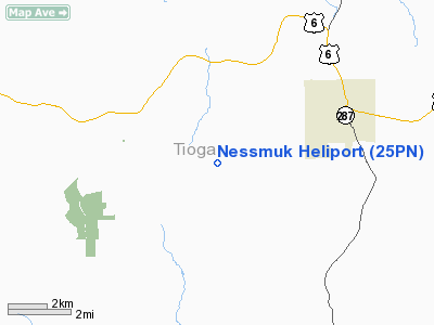
Location & QuickFacts
| FAA Information Effective: | 2008-09-25 |
| Airport Identifier: | 25PN |
| Airport Status: | Operational |
| Longitude/Latitude: | 077-22-39.4900W/41-43-25.6200N
-77.377636/41.723783 (Estimated) |
| Elevation: | 3801 ft / 1158.54 m (Estimated) |
| Land: | 0 acres |
| From nearest city: | 1 nautical miles N of Wellsboro, PA |
| Location: | Tioga County, PA |
| Magnetic Variation: | () |
Owner & Manager
| Ownership: | Privately owned |
| Owner: | Soldiers & Sailors Meml Hospital |
| Address: | 32-36 Central Avenue
Wellsboro, PA 16901 |
| Phone number: | 570-723-7764 |
| Manager: | Soldiers & Sailors Meml Hospital |
| Address: | 32-36 Central Avenue
Wellsboro, PA 16901 |
| Phone number: | 570-723-7764 |
Airport Operations and Facilities
| Airport Use: | Private
MEDICAL. |
| Wind indicator: | Yes |
| Control Tower: | No |
| Lighting Schedule: | DUSK-DAWN |
| Sectional chart: | Detroit |
| Region: | AEA - Eastern |
| Boundary ARTCC: | ZNY - New York |
| Tie-in FSS: | IPT - Williamsport |
| FSS Toll Free: | 1-800-WX-BRIEF |
Runway Information
Helipad H1
| Dimension: | 70 x 70 ft / 21.3 x 21.3 m |
| Surface: | CONC, |
| |
Runway H1 |
Runway |
| Traffic Pattern: | Left | Left |
|
Radio Navigation Aids
| ID |
Type |
Name |
Ch |
Freq |
Var |
Dist |
| EL | NDB | Halos | | 269.00 | 09W | 33.4 nm |
| PIX | NDB | Picture Rocks | | 344.00 | 09W | 40.3 nm |
| ALP | NDB | Alpine | | 245.00 | 12W | 41.3 nm |
| SFK | VOR/DME | Stonyfork | 023X | 108.60 | 08W | 2.6 nm |
| ULW | VOR/DME | Elmira | 033Y | 109.65 | 12W | 27.3 nm |
| FQM | VOR/DME | Williamsport | 091X | 114.40 | 09W | 35.7 nm |
| SLT | VORTAC | Slate Run | 086X | 113.90 | 08W | 29.5 nm |
| ELZ | VORTAC | Wellsville | 051X | 111.40 | 09W | 35.5 nm |
| ETG | VORTAC | Keating | 107X | 116.00 | 10W | 46.1 nm |
Remarks
- PRVDD VFR/PVT USE;TKOF/LDG ARE MKD; WIND INDICATOR MANTAINED; AND CTC NY-FPO.
Images and information placed above are from
http://www.airport-data.com/airport/25PN/
We thank them for the data!
|
|


