|
|
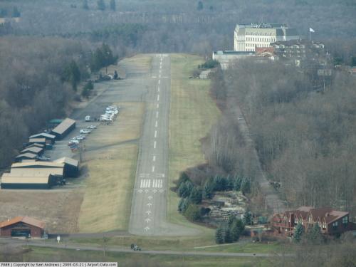 |
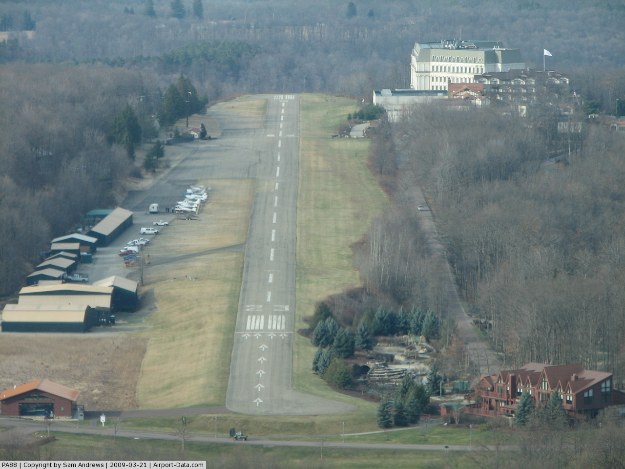
(Click on the photo to enlarge) |
Location & QuickFacts
| FAA Information Effective: | 2008-09-25 |
| Airport Identifier: | PA88 |
| Airport Status: | Operational |
| Longitude/Latitude: | 079-32-56.1480W/39-48-20.2730N
-79.548930/39.805631 (Estimated) |
| Elevation: | 2010 ft / 612.65 m (Estimated) |
| Land: | 0 acres |
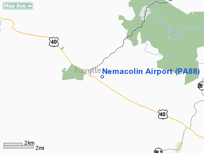
| From nearest city: | 1 nautical miles E of Farmington, PA |
| Location: | Fayette County, PA |
| Magnetic Variation: | 08W (1985) |
Owner & Manager
| Ownership: | Privately owned |
| Owner: | Nemacolin Woodlands Inc |
| Address: | 1001 Lafayette Drive
Farmington, PA 15437 |
| Phone number: | 724-329-8555 |
| Manager: | Scott Ault |
| Address: | 1001 Lafayette Drive
Farmington, PA 15437 |
| Phone number: | 724-329-6638 |
Airport Operations and Facilities
| Airport Use: | Private |
| Wind indicator: | Yes |
| Segmented Circle: | No |
| Control Tower: | No |
| Lighting Schedule: | PHONE REQ
FOR ROTG BCN, PHONE 724-329-8555. |
| Beacon Color: | Clear-Green (lighted land airport) |
| Landing fee charge: | No |
| Sectional chart: | Cincinnati |
| Region: | AEA - Eastern |
| Boundary ARTCC: | ZOB - Cleveland |
| Tie-in FSS: | AOO - Altoona |
| FSS on Airport: | No |
| FSS Toll Free: | 1-800-WX-BRIEF |
Airport Communications
Airport Services
| Airframe Repair: | NONE |
| Power Plant Repair: | NONE |
Runway Information
Runway 05/23
| Dimension: | 3980 x 50 ft / 1213.1 x 15.2 m |
| Surface: | ASPH, |
| Edge Lights: | Medium |
| |
Runway 05 |
Runway 23 |
| Traffic Pattern: | Left | Left |
| Displaced threshold: | 0.00 ft | 900.00 ft |
|
Radio Navigation Aids
| ID |
Type |
Name |
Ch |
Freq |
Var |
Dist |
| VV | NDB | Camor | | 299.00 | 08W | 10.2 nm |
| SYS | NDB | Stoystown | | 209.00 | 08W | 33.7 nm |
| MKP | NDB | Mc Keesport | | 287.00 | 07W | 34.7 nm |
| PNU | NDB | Washington County | | 255.00 | 08W | 34.8 nm |
| BHU | NDB | Benje | | 382.00 | 07W | 36.5 nm |
| CBE | NDB | Cumberland | | 317.00 | 07W | 38.2 nm |
| GRV | VOR/DME | Grantsville | 070X | 112.30 | 06W | 25.2 nm |
| AGC | VOR/DME | Allegheny | 037X | 110.00 | 09W | 36.3 nm |
| ESL | VOR/DME | Kessel | 045X | 110.80 | 06W | 43.5 nm |
| CKB | VOR/DME | Clarksburg | 073X | 112.60 | 04W | 47.0 nm |
| IHD | VORTAC | Indian Head | 019X | 108.20 | 06W | 13.4 nm |
| MGW | VORTAC | Morgantown | 053X | 111.60 | 05W | 20.8 nm |
| JST | VORTAC | Johnstown | 077X | 113.00 | 06W | 45.0 nm |
Remarks
- USE IN VFR CONDITIONS ONLY.
Images and information placed above are from
http://www.airport-data.com/airport/PA88/
We thank them for the data!
| General Info
|
| Country |
United States
|
| State |
PENNSYLVANIA
|
| FAA ID |
PA88
|
| Latitude |
39-48-20.273N
|
| Longitude |
079-32-56.148W
|
| Elevation |
2010 feet
|
| Near City |
FARMINGTON
|
We don't guarantee the information is fresh and accurate. The data may
be wrong or outdated.
For more up-to-date information please refer to other sources.
|
|