 |
|
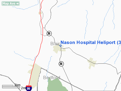
Location & QuickFacts
| FAA Information Effective: | 2008-09-25 |
| Airport Identifier: | 3PA7 |
| Airport Status: | Operational |
| Longitude/Latitude: | 078-23-29.0490W/40-20-20.2700N
-78.391402/40.338964 (Estimated) |
| Elevation: | 1336 ft / 407.21 m (Estimated) |
| Land: | 1 acres |
| From nearest city: | 1 nautical miles NE of Roaring Spring, PA |
| Location: | Blair County, PA |
| Magnetic Variation: | 09W (1990) |
Owner & Manager
| Ownership: | Privately owned |
| Owner: | Nason Hospital |
| Address: | 105 Nason Dr
Roaring Spring, PA 16673 |
| Phone number: | 814-224-2141 |
| Manager: | Pat Kenney |
| Address: | 105 Nason Dr
Roaring Spring, PA 16673 |
| Phone number: | 814-224-2141 |
Airport Operations and Facilities
| Airport Use: | Private
MEDICAL USE. |
| Wind indicator: | Yes |
| Segmented Circle: | No |
| Control Tower: | No |
| Lighting Schedule: | PHONE REQ
FOR PERIMETER LGTS CALL 814-224-2141. |
| Sectional chart: | Detroit |
| Region: | AEA - Eastern |
| Boundary ARTCC: | ZOB - Cleveland |
| Tie-in FSS: | AOO - Altoona |
| FSS on Airport: | No |
| FSS Toll Free: | 1-800-WX-BRIEF |
Runway Information
Helipad H1
| Dimension: | 80 x 80 ft / 24.4 x 24.4 m
CIRCULAR PAD. |
| Surface: | CONC, |
| |
Runway H1 |
Runway |
| Traffic Pattern: | Left | Left |
|
Radio Navigation Aids
| ID |
Type |
Name |
Ch |
Freq |
Var |
Dist |
| SYS | NDB | Stoystown | | 209.00 | 08W | 28.5 nm |
| RV | NDB | Stroh | | 407.00 | 10W | 35.0 nm |
| INP | NDB | Indiana | | 242.00 | 08W | 35.5 nm |
| BHU | NDB | Benje | | 382.00 | 07W | 40.4 nm |
| CBE | NDB | Cumberland | | 317.00 | 07W | 44.6 nm |
| AOO | VOR | Altoona | | 108.80 | 07W | 4.1 nm |
| HGR | VOR | Hagerstown | | 109.80 | 07W | 45.8 nm |
| REC | VOR/DME | Revloc | 043X | 110.60 | 09W | 20.5 nm |
| JST | VORTAC | Johnstown | 077X | 113.00 | 06W | 20.3 nm |
| TON | VORTAC | Tyrone | 096X | 114.90 | 07W | 24.0 nm |
| THS | VORTAC | St Thomas | 097X | 115.00 | 07W | 31.7 nm |
| PSB | VORTAC | Philipsburg | 102X | 115.50 | 10W | 39.2 nm |
| IHD | VORTAC | Indian Head | 019X | 108.20 | 06W | 49.5 nm |
Remarks
- OPNS LIMITED TO VFR CONDS; LARGEST CLASS OF ACFT RCMDD IS HELICOPTER NTE 12500 LBS; PROPOSED INGRESS/EGRESS ROUTES SHOULD BE ADHERED TO.
Images and information placed above are from
http://www.airport-data.com/airport/3PA7/
We thank them for the data!
| General Info
|
| Country |
United States
|
| State |
PENNSYLVANIA
|
| FAA ID |
3PA7
|
| Latitude |
40-20-20.270N
|
| Longitude |
078-23-29.049W
|
| Elevation |
1336 feet
|
| Near City |
ROARING SPRING
|
We don't guarantee the information is fresh and accurate. The data may
be wrong or outdated.
For more up-to-date information please refer to other sources.
|
|


