 |
|
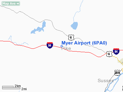
Location & QuickFacts
| FAA Information Effective: | 2008-09-25 |
| Airport Identifier: | 6PA0 |
| Airport Status: | Operational |
| Longitude/Latitude: | 074-55-58.6080W/41-21-00.3310N
-74.932947/41.350092 (Estimated) |
| Elevation: | 1345 ft / 409.96 m (Estimated) |
| Land: | 0 acres |
| From nearest city: | 7 nautical miles NW of Milford, PA |
| Location: | Pike County, PA |
| Magnetic Variation: | 12W (1985) |
Owner & Manager
| Ownership: | Privately owned |
| Owner: | Walter H. Myer |
| Address: | 8899 Rd 2
Milford, PA 18337 |
| Phone number: | 717-296-6268 |
| Address: |
|
Airport Operations and Facilities
| Airport Use: | Private |
| Wind indicator: | Yes |
| Segmented Circle: | No |
| Control Tower: | No |
| Landing fee charge: | No |
| Sectional chart: | New York |
| Region: | AEA - Eastern |
| Boundary ARTCC: | ZNY - New York |
| Tie-in FSS: | IPT - Williamsport |
| FSS on Airport: | No |
| FSS Toll Free: | 1-800-WX-BRIEF |
Airport Services
| Airframe Repair: | NONE |
| Power Plant Repair: | NONE |
Runway Information
Runway N/S
| Dimension: | 2500 x 200 ft / 762.0 x 61.0 m |
| Surface: | TURF, |
| |
Runway N |
Runway S |
| Traffic Pattern: | Left | Left |
|
Radio Navigation Aids
| ID |
Type |
Name |
Ch |
Freq |
Var |
Dist |
| SKU | FAN MARKER | Stanwyck | | | 12W | 41.4 nm |
| MS | NDB | Monga | | 359.00 | 12W | 25.2 nm |
| SW | NDB | Neely | | 335.00 | 14W | 32.8 nm |
| SKU | NDB | Stanwyck | | 261.00 | 12W | 41.4 nm |
| CYE | NDB | Crystal Lake | | 410.00 | 11W | 41.5 nm |
| PNJ | NDB | Paterson | | 347.00 | 12W | 42.9 nm |
| CAT | NDB | Chatham | | 254.00 | 11W | 43.1 nm |
| PO | NDB | Meier | | 403.00 | 12W | 45.7 nm |
| LQX | NDB | Carbon | | 339.00 | 12W | 49.5 nm |
| HUO | VOR/DME | Huguenot | 108X | 116.10 | 11W | 15.8 nm |
| STW | VOR/DME | Stillwater | 033X | 109.60 | 11W | 21.5 nm |
| BWZ | VOR/DME | Broadway | 089X | 114.20 | 11W | 33.5 nm |
| HNK | VOR/DME | Hancock | 115X | 116.80 | 11W | 46.2 nm |
| SBJ | VOR/DME | Solberg | 076X | 112.90 | 10W | 46.9 nm |
| TEB | VOR/DME | Teterboro | 021X | 108.40 | 11W | 49.6 nm |
| DNY | VOR/DME | De Lancey | 058X | 112.10 | 11W | 49.8 nm |
| SAX | VORTAC | Sparta | 104X | 115.70 | 11W | 24.6 nm |
| LHY | VORTAC | Lake Henry | 045X | 110.80 | 10W | 25.9 nm |
| LVZ | VORTAC | Wilkes-barre | 053X | 111.60 | 10W | 34.5 nm |
| FJC | VORTAC | Allentown | 122X | 117.50 | 10W | 44.3 nm |
Remarks
Images and information placed above are from
http://www.airport-data.com/airport/6PA0/
We thank them for the data!
| General Info
|
| Country |
United States
|
| State |
PENNSYLVANIA
|
| FAA ID |
6PA0
|
| Latitude |
41-21-00.331N
|
| Longitude |
074-55-58.608W
|
| Elevation |
1345 feet
|
| Near City |
MILFORD
|
We don't guarantee the information is fresh and accurate. The data may
be wrong or outdated.
For more up-to-date information please refer to other sources.
|
|


