|
|
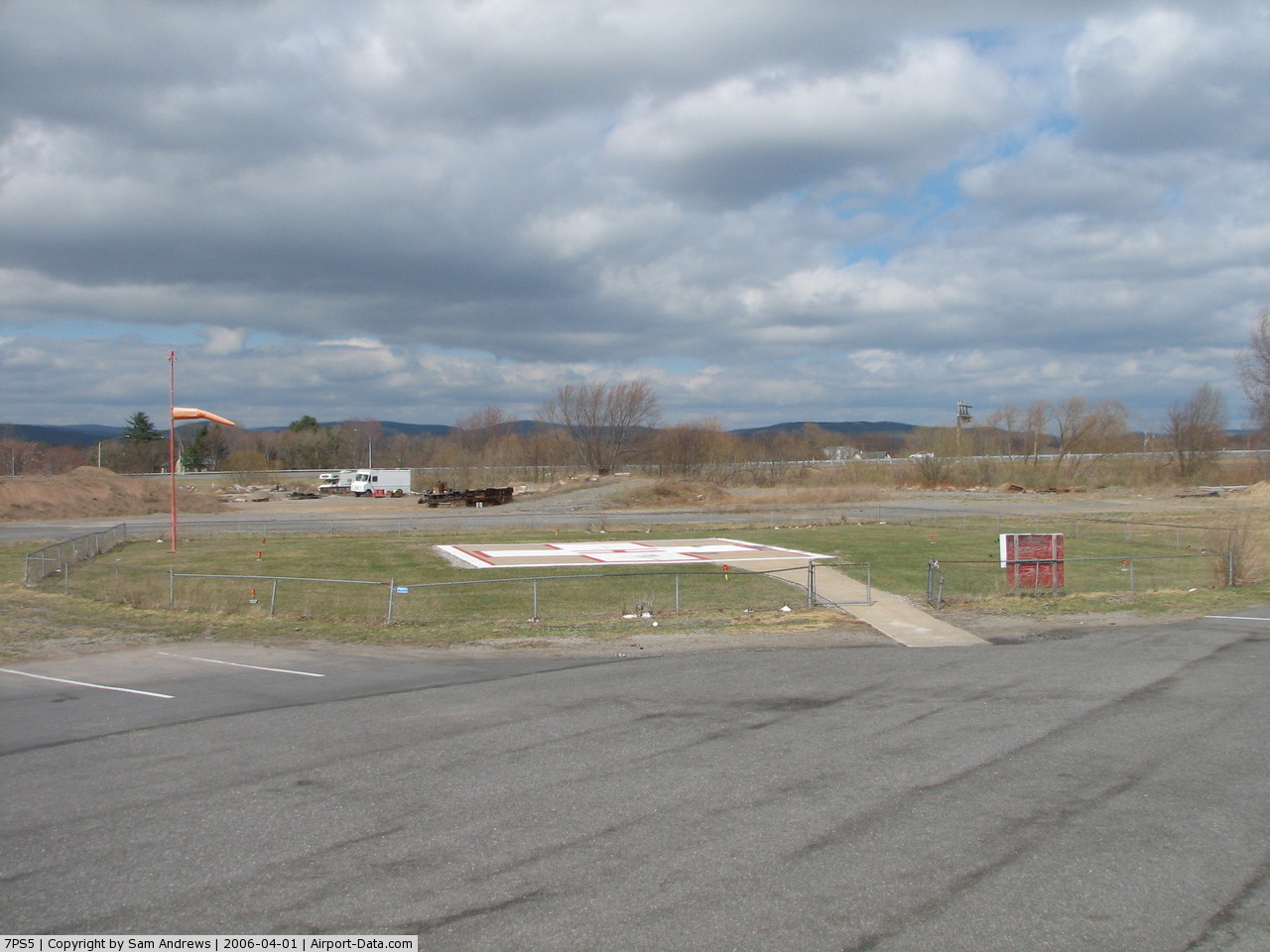
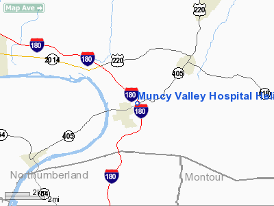
Muncy Valley Hospital Heliport |
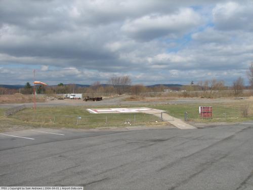 |
(Click on the photo to enlarge) |
Location & QuickFacts
| FAA Information Effective: | 2008-09-25 |
| Airport Identifier: | 7PS5 |
| Airport Status: | Operational |
| Longitude/Latitude: | 076-46-23.8520W/41-12-38.2940N
-76.773292/41.210637 (Estimated) |
| Elevation: | 500 ft / 152.40 m (Estimated) |
| Land: | 0 acres |
| From nearest city: | 0 nautical miles E of Muncy, PA |
| Location: | Lycoming County, PA |
| Magnetic Variation: | 11W (1985) |
Owner & Manager
| Ownership: | Privately owned |
| Owner: | Muncy Valley Hospital |
| Address: | 215 East Water St
Muncy, PA 17756 |
| Phone number: | 717-546-8282 |
| Manager: | Zeb Stevens |
| Address: | 215 East Water St
Muncy, PA 17756 |
| Phone number: | 717-546-8282 |
Airport Operations and Facilities
| Airport Use: | Private
MEDICAL USE |
| Wind indicator: | Yes |
| Segmented Circle: | No |
| Control Tower: | No |
| Sectional chart: | New York |
| Region: | AEA - Eastern |
| Boundary ARTCC: | ZNY - New York |
| Tie-in FSS: | IPT - Williamsport |
| FSS Toll Free: | 1-800-WX-BRIEF |
Runway Information
Helipad H1
| Dimension: | 37 x 37 ft / 11.3 x 11.3 m |
| Surface: | CONC, |
| |
Runway H1 |
Runway |
| Traffic Pattern: | Left | Left |
|
Radio Navigation Aids
| ID |
Type |
Name |
Ch |
Freq |
Var |
Dist |
| PIX | NDB | Picture Rocks | | 344.00 | 09W | 4.9 nm |
| HXM | NDB | Humbolt | | 366.00 | 10W | 37.6 nm |
| CYE | NDB | Crystal Lake | | 410.00 | 11W | 42.6 nm |
| BZJ | NDB | Bellgrove | | 328.00 | 10W | 47.6 nm |
| HZL | VOR | Hazleton | | 109.40 | 09W | 32.6 nm |
| FQM | VOR/DME | Williamsport | 091X | 114.40 | 09W | 7.7 nm |
| SFK | VOR/DME | Stonyfork | 023X | 108.60 | 08W | 41.2 nm |
| MIP | VORTAC | Milton | 029X | 109.20 | 09W | 12.3 nm |
| SEG | VORTAC | Selinsgrove | 041X | 110.40 | 08W | 25.7 nm |
| RAV | VORTAC | Ravine | 093X | 114.60 | 11W | 40.3 nm |
| LVZ | VORTAC | Wilkes-barre | 053X | 111.60 | 10W | 49.1 nm |
Images and information placed above are from
http://www.airport-data.com/airport/7PS5/
We thank them for the data!
| General Info
|
| Country |
United States
|
| State |
PENNSYLVANIA
|
| FAA ID |
7PS5
|
| Latitude |
41-12-38.294N
|
| Longitude |
076-46-23.852W
|
| Elevation |
500 feet
|
| Near City |
MUNCY
|
We don't guarantee the information is fresh and accurate. The data may
be wrong or outdated.
For more up-to-date information please refer to other sources.
|
|