 |
|
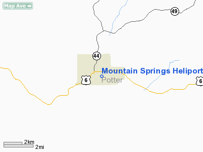
Mountain Springs Heliport |
Location & QuickFacts
| FAA Information Effective: | 2008-09-25 |
| Airport Identifier: | 94PA |
| Airport Status: | Operational |
| Longitude/Latitude: | 078-00-39.0150W/41-46-12.2360N
-78.010838/41.770066 (Estimated) |
| Elevation: | 1810 ft / 551.69 m (Estimated) |
| Land: | 0 acres |
| From nearest city: | 1 nautical miles SE of Coudersport, PA |
| Location: | Potter County, PA |
| Magnetic Variation: | 10W (1985) |
Owner & Manager
| Ownership: | Privately owned |
| Owner: | Clifford B. Carts |
| Address: |
Coudersport, PA 16915 |
| Phone number: | 814-274-8834 |
| Manager: | Clifford B. Carts |
| Address: |
Coudersport, PA 16915 |
| Phone number: | 814-274-8834 |
Airport Operations and Facilities
| Airport Use: | Private |
| Wind indicator: | Yes |
| Segmented Circle: | No |
| Control Tower: | No |
| Landing fee charge: | No |
| Sectional chart: | Detroit |
| Region: | AEA - Eastern |
| Boundary ARTCC: | ZOB - Cleveland |
| Tie-in FSS: | AOO - Altoona |
| FSS on Airport: | No |
| FSS Toll Free: | 1-800-WX-BRIEF |
Airport Services
| Airframe Repair: | NONE |
| Power Plant Repair: | NONE |
Runway Information
Helipad H1
| Dimension: | 200 x 200 ft / 61.0 x 61.0 m |
| Surface: | ASPH-TURF, |
| |
Runway H1 |
Runway |
| Traffic Pattern: | Right | Left |
|
Radio Navigation Aids
| ID |
Type |
Name |
Ch |
Freq |
Var |
Dist |
| EL | NDB | Halos | | 269.00 | 09W | 20.9 nm |
| LYS | NDB | Olean | | 360.00 | 09W | 34.1 nm |
| SFK | VOR/DME | Stonyfork | 023X | 108.60 | 08W | 26.9 nm |
| BFD | VOR/DME | Bradford | 113X | 116.60 | 07W | 27.3 nm |
| ULW | VOR/DME | Elmira | 033Y | 109.65 | 12W | 48.2 nm |
| SLT | VORTAC | Slate Run | 086X | 113.90 | 08W | 15.6 nm |
| ELZ | VORTAC | Wellsville | 051X | 111.40 | 09W | 19.2 nm |
| ETG | VORTAC | Keating | 107X | 116.00 | 10W | 33.9 nm |
Remarks
Images and information placed above are from
http://www.airport-data.com/airport/94PA/
We thank them for the data!
| General Info
|
| Country |
United States
|
| State |
PENNSYLVANIA
|
| FAA ID |
94PA
|
| Latitude |
41-46-12.236N
|
| Longitude |
078-00-39.015W
|
| Elevation |
1810 feet
|
| Near City |
COUDERSPORT
|
We don't guarantee the information is fresh and accurate. The data may
be wrong or outdated.
For more up-to-date information please refer to other sources.
|
|


