 |
|
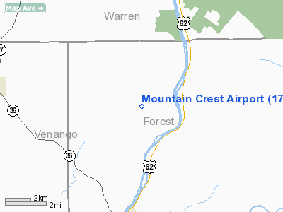
Location & QuickFacts
| FAA Information Effective: | 2008-09-25 |
| Airport Identifier: | 17PS |
| Airport Status: | Operational |
| Longitude/Latitude: | 079-26-30.0000W/41-34-45.0000N
-79.441667/41.579167 (Estimated) |
| Elevation: | 1641 ft / 500.18 m (Estimated) |
| Land: | 0 acres |
| From nearest city: | 3 nautical miles W of Tidioute, PA |
| Location: | Forest County, PA |
| Magnetic Variation: | () |
Owner & Manager
| Ownership: | Privately owned |
| Owner: | Larry Condon |
| Address: | 137 Clib Manor Rd
Latrobe, PA 15650 |
| Phone number: | 724-537-0229 |
| Manager: | Larry Condon |
| Address: | 137 Clib Manor Rd
Latrobe, PA 15650 |
| Phone number: | 724-537-0229 |
Airport Operations and Facilities
| Airport Use: | Private |
| Wind indicator: | Yes |
| Control Tower: | No |
| Sectional chart: | Detroit |
| Region: | AEA - Eastern |
| Boundary ARTCC: | ZNY - New York |
| Tie-in FSS: | AOO - Altoona |
| FSS Toll Free: | 1-800-WX-BRIEF |
Runway Information
Runway 01/19
| Dimension: | 2170 x 100 ft / 661.4 x 30.5 m |
| Surface: | TURF, |
| |
Runway 01 |
Runway 19 |
| Traffic Pattern: | Left | Left |
| Obstruction: | 40 ft trees, 700.0 ft from runway | 40 ft trees, 100.0 ft from runway |
|
Radio Navigation Aids
| ID |
Type |
Name |
Ch |
Freq |
Var |
Dist |
| ORJ | NDB | Corry | | 258.00 | 09W | 22.1 nm |
| CQD | NDB | Cascade | | 372.00 | 08W | 44.0 nm |
| FKL | VOR | Franklin | | 109.60 | 06W | 20.5 nm |
| CIP | VOR/DME | Clarion | 076X | 112.90 | 06W | 26.0 nm |
| BFD | VOR/DME | Bradford | 113X | 116.60 | 07W | 39.0 nm |
| JHW | VOR/DME | Jamestown | 094X | 114.70 | 07W | 39.3 nm |
| TDT | VORTAC | Tidioute | 123X | 117.60 | 09W | 8.1 nm |
| ERI | VORTAC | Erie | 031X | 109.40 | 06W | 46.3 nm |
Remarks
- PRVDD VFR/PVT USE AND THERE IS A CLEAR 20:1 APCH/DEP PATH EACH RY END.
Images and information placed above are from
http://www.airport-data.com/airport/17PS/
We thank them for the data!
|
|


