 |
|
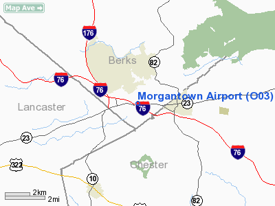
Location & QuickFacts
| FAA Information Effective: | 2008-09-25 |
| Airport Identifier: | O03 |
| Airport Status: | Operational |
| Longitude/Latitude: | 075-52-13.7610W/40-09-25.3490N
-75.870489/40.157041 (Estimated) |
| Elevation: | 600 ft / 182.88 m (Estimated) |
| Land: | 7 acres |
| From nearest city: | 1 nautical miles E of Morgantown, PA |
| Location: | Berks County, PA |
| Magnetic Variation: | 11W (1985) |
Owner & Manager
| Ownership: | Privately owned |
| Owner: | Vernon Beiler |
| Address: | 2019 Valley Road
Morgantown, PA 19543 |
| Phone number: | 610-286-9055 |
| Manager: | Vernon Beiler |
| Address: | 2019 Valley Road
Morgantown, PA 19543 |
| Phone number: | 610-286-9055 |
Airport Operations and Facilities
| Airport Use: | Open to public |
| Wind indicator: | Yes |
| Segmented Circle: | No |
| Control Tower: | No |
| Lighting Schedule: | RDO-CTL
ACTVT LIRL RY 10/28 & WINDSOCK LGTS - CTAF. |
| Landing fee charge: | No |
| Sectional chart: | New York |
| Region: | AEA - Eastern |
| Boundary ARTCC: | ZNY - New York |
| Tie-in FSS: | IPT - Williamsport |
| FSS on Airport: | No |
| FSS Toll Free: | 1-800-WX-BRIEF |
| NOTAMs Facility: | IPT (NOTAM-d service avaliable) |
Airport Communications
Airport Services
| Fuel available: | 100LL |
| Airframe Repair: | NONE |
| Power Plant Repair: | NONE |
Runway Information
Runway 10/28
| Dimension: | 2500 x 100 ft / 762.0 x 30.5 m |
| Surface: | TURF, Good Condition |
| Edge Lights: | Low |
| |
Runway 10 |
Runway 28 |
| Traffic Pattern: | Left | Left |
| Displaced threshold: | 435.00 ft | 0.00 ft |
| Obstruction: | 15 ft road, 54.0 ft from runway, 3:1 slope to clear
RY 10 APCH RATIO 32:1 TO DSPLCD THLD. | , 0.0 ft from runway, 20:1 slope to clear |
|
Radio Navigation Aids
| ID |
Type |
Name |
Ch |
Freq |
Var |
Dist |
| ING | NDB | Ambler | | 275.00 | 11W | 27.0 nm |
| UKT | NDB | Quakertown | | 208.00 | 12W | 30.8 nm |
| NXX | NDB | Willow Grove | | 388.00 | 12W | 33.4 nm |
| BZJ | NDB | Bellgrove | | 328.00 | 10W | 35.5 nm |
| DYL | NDB | Doylestown | | 237.00 | 10W | 36.0 nm |
| APG | NDB | Aberdeen | | 349.00 | 11W | 38.9 nm |
| LQX | NDB | Carbon | | 339.00 | 12W | 39.7 nm |
| EUD | NDB | York | | 254.00 | 11W | 48.5 nm |
| NXX | TACAN | Willow Grove | 061X | | 10W | 33.3 nm |
| PNE | VOR | North Philadelphia | | 112.00 | 10W | 39.8 nm |
| ETX | VOR/DME | East Texas | 039X | 110.20 | 09W | 26.9 nm |
| CKZ | VOR/DME | Pennridge | 025Y | 108.85 | 12W | 30.2 nm |
| PPM | VOR/DME | Phillips | 021X | 108.40 | 09W | 43.8 nm |
| ARD | VOR/DME | Yardley | 019X | 108.20 | 10W | 44.6 nm |
| PTW | VORTAC | Pottstown | 112X | 116.50 | 09W | 14.8 nm |
| MXE | VORTAC | Modena | 079X | 113.20 | 09W | 17.1 nm |
| LRP | VORTAC | Lancaster | 120X | 117.30 | 09W | 19.5 nm |
| DQO | VORTAC | Dupont | 087X | 114.00 | 10W | 31.2 nm |
| FJC | VORTAC | Allentown | 122X | 117.50 | 10W | 39.2 nm |
| OOD | VORTAC | Woodstown | 075X | 112.80 | 10W | 40.8 nm |
| RAV | VORTAC | Ravine | 093X | 114.60 | 11W | 41.0 nm |
| PHL | VOT | Philadelphia Intl | | 109.80 | | 33.6 nm |
| MDT | VOT | Harrisburg International | | 110.00 | | 41.1 nm |
Remarks
Images and information placed above are from
http://www.airport-data.com/airport/O03/
We thank them for the data!
| General Info
|
| Country |
United States
|
| State |
PENNSYLVANIA
|
| FAA ID |
O03
|
| Latitude |
40-09-25.349N
|
| Longitude |
075-52-13.761W
|
| Elevation |
600 feet
|
| Near City |
MORGANTOWN
|
We don't guarantee the information is fresh and accurate. The data may
be wrong or outdated.
For more up-to-date information please refer to other sources.
|
|


