 |
|
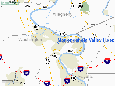
Monongahela Valley Hospital Heliport |
Location & QuickFacts
| FAA Information Effective: | 2008-09-25 |
| Airport Identifier: | 5PA5 |
| Airport Status: | Operational |
| Longitude/Latitude: | 079-54-36.1740W/40-10-56.2560N
-79.910048/40.182293 (Estimated) |
| Elevation: | 1114 ft / 339.55 m (Estimated) |
| Land: | 1 acres |
| From nearest city: | 2 nautical miles SE of Monongahela, PA |
| Location: | Washington County, PA |
| Magnetic Variation: | 09W (2000) |
Owner & Manager
| Ownership: | Privately owned |
| Owner: | Monongahela Valley Hospital |
| Address: | Country Club Rd
Monongahela, PA 15063 |
| Phone number: | 412-258-1000 |
| Manager: | Patrick J. Alberts |
| Address: | Country Club Rd
Monongahela, PA 15063 |
| Phone number: | 412-258-1102 |
Airport Operations and Facilities
| Airport Use: | Private
MEDICAL USE. |
| Wind indicator: | Yes |
| Segmented Circle: | No |
| Control Tower: | No |
| Lighting Schedule: | PHONE REQ
FOR PERIMETER LGTS CALL 412-258-1102. |
| Sectional chart: | Detroit |
| Region: | AEA - Eastern |
| Boundary ARTCC: | ZOB - Cleveland |
| Tie-in FSS: | AOO - Altoona |
| FSS on Airport: | No |
| FSS Toll Free: | 1-800-WX-BRIEF |
Runway Information
Helipad H1
| Dimension: | 65 x 62 ft / 19.8 x 18.9 m |
| Surface: | ASPH, Fair Condition |
| |
Runway H1 |
Runway |
| Traffic Pattern: | Left | Left |
|
Radio Navigation Aids
| ID |
Type |
Name |
Ch |
Freq |
Var |
Dist |
| PNU | NDB | Washington County | | 255.00 | 08W | 11.8 nm |
| MKP | NDB | Mc Keesport | | 287.00 | 07W | 12.0 nm |
| VV | NDB | Camor | | 299.00 | 08W | 19.5 nm |
| BHU | NDB | Benje | | 382.00 | 07W | 31.5 nm |
| SYS | NDB | Stoystown | | 209.00 | 08W | 46.0 nm |
| INP | NDB | Indiana | | 242.00 | 08W | 47.1 nm |
| AGC | VOR/DME | Allegheny | 037X | 110.00 | 09W | 8.3 nm |
| HLG | VOR/DME | Wheeling | 059X | 112.20 | 07W | 30.6 nm |
| AIR | VOR/DME | Bellaire | 118X | 117.10 | 07W | 42.9 nm |
| MMJ | VORTAC | Montour | 057X | 112.00 | 08W | 22.5 nm |
| IHD | VORTAC | Indian Head | 019X | 108.20 | 06W | 28.3 nm |
| MGW | VORTAC | Morgantown | 053X | 111.60 | 05W | 37.7 nm |
| EWC | VORTAC | Ellwood City | 105X | 115.80 | 08W | 41.0 nm |
Remarks
- PRVDD USED FOR VFR PRIVATE OPERATION USE; LARGEST ACFT RECOMMENDED FOR USE IS BO-117; NOISE MUST BE TAKEN INTO CONSIDERATION; INGRESS CONDUCTED 270 DEGS OR 360 DEGS & EGRESS TO 90 DEGS OR 180 DEGS.
Images and information placed above are from
http://www.airport-data.com/airport/5PA5/
We thank them for the data!
| General Info
|
| Country |
United States
|
| State |
PENNSYLVANIA
|
| FAA ID |
5PA5
|
| Latitude |
40-10-56.256N
|
| Longitude |
079-54-36.174W
|
| Elevation |
1114 feet
|
| Near City |
MONONGAHELA
|
We don't guarantee the information is fresh and accurate. The data may
be wrong or outdated.
For more up-to-date information please refer to other sources.
|
|


