 |
|
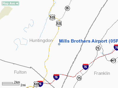
Location & QuickFacts
| FAA Information Effective: | 2008-09-25 |
| Airport Identifier: | 05PS |
| Airport Status: | Operational |
| Longitude/Latitude: | 077-51-43.0000W/40-08-34.0000N
-77.861944/40.142778 (Estimated) |
| Elevation: | 1210 ft / 368.81 m (Estimated) |
| Land: | 27 acres |
| From nearest city: | 4 nautical miles NE of Burnt Cabins, PA |
| Location: | Huntingdon County, PA |
| Magnetic Variation: | () |
Owner & Manager
| Ownership: | Privately owned |
| Owner: | Kevin L. Mills |
| Address: | Hcr 75 Box 216
Burnt Cabins, PA 17215 |
| Phone number: | 814-259-3436 |
| Manager: | Kevin L. Mills |
| Address: | Hcr 75 Box 216
Burnt Cabins, PA 17215 |
| Phone number: | 814-447-3644 |
Airport Operations and Facilities
| Airport Use: | Private |
| Wind indicator: | Yes |
| Segmented Circle: | No |
| Control Tower: | No |
| Sectional chart: | Detroit |
| Region: | AEA - Eastern |
| Boundary ARTCC: | ZNY - New York |
| Tie-in FSS: | AOO - Altoona |
| FSS Toll Free: | 1-800-WX-BRIEF |
Runway Information
Runway 06/24
| Dimension: | 2319 x 100 ft / 706.8 x 30.5 m |
| Surface: | TURF, |
| |
Runway 06 |
Runway 24 |
| Longitude: | 077-51-55.7400W | 077-51-36.1200W |
| Latitude: | 40-08-28.4400N | 40-08-45.7200N |
| Traffic Pattern: | Left | Left |
| Markings: | Nonstandard, | , |
| Displaced threshold: | 320.00 ft | 895.00 ft |
| Obstruction: | 15 ft trees, 25.0 ft from runway | 50 ft trees, 850.0 ft from runway |
|
Radio Navigation Aids
| ID |
Type |
Name |
Ch |
Freq |
Var |
Dist |
| RV | NDB | Stroh | | 407.00 | 10W | 29.1 nm |
| EUD | NDB | York | | 254.00 | 11W | 47.2 nm |
| SYS | NDB | Stoystown | | 209.00 | 08W | 48.6 nm |
| AOO | VOR | Altoona | | 108.80 | 07W | 23.1 nm |
| HGR | VOR | Hagerstown | | 109.80 | 07W | 26.8 nm |
| FDK | VOR | Frederick | | 109.00 | 08W | 49.3 nm |
| REC | VOR/DME | Revloc | 043X | 110.60 | 09W | 47.3 nm |
| THS | VORTAC | St Thomas | 097X | 115.00 | 07W | 13.2 nm |
| HAR | VORTAC | Harrisburg | 072X | 112.50 | 10W | 37.6 nm |
| TON | VORTAC | Tyrone | 096X | 114.90 | 07W | 41.6 nm |
| MRB | VORTAC | Martinsburg | 058X | 112.10 | 07W | 45.5 nm |
| JST | VORTAC | Johnstown | 077X | 113.00 | 06W | 45.8 nm |
| PSB | VORTAC | Philipsburg | 102X | 115.50 | 10W | 46.9 nm |
Images and information placed above are from
http://www.airport-data.com/airport/05PS/
We thank them for the data!
|
|


