 |
|
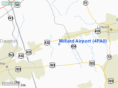
Location & QuickFacts
| FAA Information Effective: | 2008-09-25 |
| Airport Identifier: | 4PA0 |
| Airport Status: | Operational |
| Longitude/Latitude: | 076-32-11.0000W/40-19-01.9000N
-76.536389/40.317194 (Estimated) |
| Elevation: | 485 ft / 147.83 m (Surveyed) |
| Land: | 80 acres |
| From nearest city: | 1 nautical miles SW of Annville, PA |
| Location: | Lebanon County, PA |
| Magnetic Variation: | 08W (1965) |
Owner & Manager
| Ownership: | Privately owned |
| Owner: | Mfs Inc. |
| Address: | Po Box 340
Annville, PA 17003 |
| Phone number: | 717-867-3968 |
| Manager: | L.a. Campbell |
| Address: | Po Box 340
Annville, PA 17003 |
| Phone number: | 717-867-3968 |
Airport Operations and Facilities
| Airport Use: | Private |
| Wind indicator: | Yes |
| Segmented Circle: | No |
| Control Tower: | No |
| Lighting Schedule: | RDO-CTL
ACTVT ROTG BCN & MIRL RY 11/29 - 123.0. |
| Beacon Color: | Clear-Green (lighted land airport) |
| Landing fee charge: | No |
| Sectional chart: | New York |
| Region: | AEA - Eastern |
| Boundary ARTCC: | ZNY - New York |
| Tie-in FSS: | IPT - Williamsport |
| FSS on Airport: | No |
| FSS Toll Free: | 1-800-WX-BRIEF
FILE IFR & PICKUP CLEARANCE TOLL FREE NR 800-932-0712. |
Airport Communications
Airport Services
| Bottled Oxygen: | NONE |
| Bulk Oxygen: | NONE |
Runway Information
Runway 11/29
| Dimension: | 2870 x 50 ft / 874.8 x 15.2 m |
| Surface: | ASPH, Poor Condition
RY 11/29 MODERATE TO SEVERE CRACKING/UNEVEN SFC ON PORTIONS OF RY. |
| Edge Lights: | Medium |
| |
Runway 11 |
Runway 29 |
| Traffic Pattern: | Left | Left |
| Markings: | Non-precision instrument, Fair Condition | Non-precision instrument, Fair Condition |
| Obstruction: | 76 ft tree, 1331.0 ft from runway, 223 ft right of centerline, 14:1 slope to clear
RY 11 BRUSH AT THLD. | 17 ft tree, 622.0 ft from runway, 132 ft left of centerline, 24:1 slope to clear |
|
Radio Navigation Aids
| ID |
Type |
Name |
Ch |
Freq |
Var |
Dist |
| BZJ | NDB | Bellgrove | | 328.00 | 10W | 7.2 nm |
| EUD | NDB | York | | 254.00 | 11W | 28.6 nm |
| LQX | NDB | Carbon | | 339.00 | 12W | 46.3 nm |
| HXM | NDB | Humbolt | | 366.00 | 10W | 47.3 nm |
| HZL | VOR | Hazleton | | 109.40 | 09W | 43.8 nm |
| ETX | VOR/DME | East Texas | 039X | 110.20 | 09W | 42.1 nm |
| RAV | VORTAC | Ravine | 093X | 114.60 | 11W | 14.5 nm |
| LRP | VORTAC | Lancaster | 120X | 117.30 | 09W | 16.3 nm |
| HAR | VORTAC | Harrisburg | 072X | 112.50 | 10W | 24.5 nm |
| SEG | VORTAC | Selinsgrove | 041X | 110.40 | 08W | 32.6 nm |
| MIP | VORTAC | Milton | 029X | 109.20 | 09W | 42.9 nm |
| PTW | VORTAC | Pottstown | 112X | 116.50 | 09W | 45.1 nm |
| MXE | VORTAC | Modena | 079X | 113.20 | 09W | 46.5 nm |
| MDT | VOT | Harrisburg International | | 110.00 | | 12.7 nm |
Remarks
Images and information placed above are from
http://www.airport-data.com/airport/4PA0/
We thank them for the data!
| General Info
|
| Country |
United States
|
| State |
PENNSYLVANIA
|
| FAA ID |
4PA0
|
| Latitude |
40-19-28.318N
|
| Longitude |
076-50-11.899W
|
| Elevation |
400 feet
|
| Near City |
LINGLESTOWN
|
We don't guarantee the information is fresh and accurate. The data may
be wrong or outdated.
For more up-to-date information please refer to other sources.
|
|


