 |
|
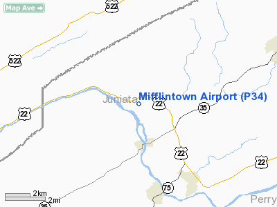
Location & QuickFacts
| FAA Information Effective: | 2008-09-25 |
| Airport Identifier: | P34 |
| Airport Status: | Operational |
| Longitude/Latitude: | 077-24-20.4000W/40-35-56.2000N
-77.405667/40.598944 (Estimated) |
| Elevation: | 545 ft / 166.12 m (Estimated) |
| Land: | 24 acres |
| From nearest city: | 2 nautical miles N of Mifflintown, PA |
| Location: | Juniata County, PA |
| Magnetic Variation: | 11W (2005) |
Owner & Manager
| Ownership: | Privately owned |
| Owner: | Bruce Lisle |
| Address: | Po Box 211
Mifflintown, PA 17059 |
| Phone number: | 717-436-2725 |
| Manager: | Bruce Lisle |
| Address: | Po Box 211
Mifflintown, PA 17059 |
| Phone number: | 717-436-2725 |
Airport Operations and Facilities
| Airport Use: | Open to public |
| Wind indicator: | Yes |
| Segmented Circle: | No |
| Control Tower: | No |
| Lighting Schedule: | RDO-CTL
ACTVT ROTG BCN; LIRL RY 08/26 AND WIND INDICATOR LGTS - CTAF. |
| Beacon Color: | Clear-Green (lighted land airport) |
| Landing fee charge: | No |
| Sectional chart: | Detroit |
| Region: | AEA - Eastern |
| Boundary ARTCC: | ZNY - New York |
| Tie-in FSS: | IPT - Williamsport |
| FSS on Airport: | No |
| FSS Toll Free: | 1-800-WX-BRIEF |
| NOTAMs Facility: | IPT (NOTAM-d service avaliable) |
Airport Communications
| CTAF: | 122.800 |
| Unicom: | 122.800 |
Airport Services
| Fuel available: | 100LLMOGAS |
| Airframe Repair: | NONE |
| Power Plant Repair: | NONE |
Runway Information
Runway 08/26
| Dimension: | 2627 x 50 ft / 800.7 x 15.2 m |
| Surface: | ASPH, Fair Condition |
| Edge Lights: | Low |
| |
Runway 08 |
Runway 26 |
| Longitude: | 077-24-36.0000W | 077-24-04.8000W |
| Latitude: | 40-35-51.0000N | 40-36-01.4000N |
| Elevation: | 544.00 ft | 540.00 ft |
| Traffic Pattern: | Left | Left |
| Markings: | Basic, Fair Condition | Basic, Fair Condition |
| Displaced threshold: | 232.00 ft | 0.00 ft |
|
Radio Navigation Aids
| ID |
Type |
Name |
Ch |
Freq |
Var |
Dist |
| RV | NDB | Stroh | | 407.00 | 10W | 14.3 nm |
| BZJ | NDB | Bellgrove | | 328.00 | 10W | 40.2 nm |
| EUD | NDB | York | | 254.00 | 11W | 47.5 nm |
| AOO | VOR | Altoona | | 108.80 | 07W | 44.2 nm |
| HAR | VORTAC | Harrisburg | 072X | 112.50 | 10W | 23.5 nm |
| SEG | VORTAC | Selinsgrove | 041X | 110.40 | 08W | 26.4 nm |
| PSB | VORTAC | Philipsburg | 102X | 115.50 | 10W | 32.8 nm |
| RAV | VORTAC | Ravine | 093X | 114.60 | 11W | 36.9 nm |
| MIP | VORTAC | Milton | 029X | 109.20 | 09W | 42.3 nm |
| TON | VORTAC | Tyrone | 096X | 114.90 | 07W | 43.0 nm |
| THS | VORTAC | St Thomas | 097X | 115.00 | 07W | 47.2 nm |
| ETG | VORTAC | Keating | 107X | 116.00 | 10W | 49.9 nm |
| MDT | VOT | Harrisburg International | | 110.00 | | 38.0 nm |
Images and information placed above are from
http://www.airport-data.com/airport/P34/
We thank them for the data!
| General Info
|
| Country |
United States
|
| State |
PENNSYLVANIA
|
| FAA ID |
P34
|
| Latitude |
40-36-04.274N
|
| Longitude |
077-24-17.964W
|
| Elevation |
545 feet
|
| Near City |
MIFFLINTOWN
|
We don't guarantee the information is fresh and accurate. The data may
be wrong or outdated.
For more up-to-date information please refer to other sources.
|
|


