 |
|
| Mifflin County Airport |
| IATA: RED – ICAO: KRVL – FAA LID: RVL |
| Summary |
| Airport type |
Public |
| Owner |
Mifflin County Airport Authority |
| Serves |
Lewistown |
| Location |
Reedsville, Pennsylvania |
| Elevation AMSL |
819 ft / 250 m |
| Coordinates |
40°40′39″N 077°37′37″W / 40.6775°N 77.62694°W / 40.6775; -77.62694 |
| Website |
MifflinCountyAirport.com |
| Runways |
| Direction |
Length |
Surface |
| ft |
m |
| 6/24 |
5,001 |
1,524 |
Asphalt |
| Statistics (2009) |
| Aircraft operations |
19,400 |
| Based aircraft |
33 |
| Source: Federal Aviation Administration |
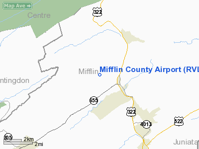
Mifflin County Airport (IATA: RED, ICAO: KRVL, FAA LID: RVL) is a public-use airport in Mifflin County, Pennsylvania, United States. It is located in Reedsville, 5 miles (8 km) northwest of Lewistown. The airport lies in the Kishacoquillas Valley, south of Stone Mountain and north of Jacks Mountain in the Ridge-and-valley Appalachians. It is owned by the Mifflin County Airport Authority. As per the FAA's National Plan of Integrated Airport Systems for 2009-2013, it is categorized as a general aviation airport.
Although many U.S. airports use the same three-letter location identifier for the FAA and IATA, this airport is assigned RVL by the FAA and RED by the IATA. Facilities and aircraft
Mifflin County Airport covers an area of 125 acres (51 ha) at an elevation of 819 feet (250 m) above mean sea level. It has one runway designated 6/24 with an asphalt surface measuring 5,001 by 75 feet (1,524 x 23 m).
For the 12-month period ending February 20, 2009, the airport had 19,400 aircraft operations, an average of 53 per day: 97% general aviation and 3% air taxi. At that time there were 33 aircraft based at this airport: 85% single-engine, 6% multi-engine, 3% jet and 6% glider.
There is an AWOS-3 on the field.
Soaring contests
Mifflin County Airport is a popular site for gliding competitions and has hosted 10 national championships and four regional championships since 1990.
The above content comes from Wikipedia and is published under free licenses – click here to read more.
Location & QuickFacts
| FAA Information Effective: | 2008-09-25 |
| Airport Identifier: | RVL |
| Airport Status: | Operational |
| Longitude/Latitude: | 077-37-36.6000W/40-40-38.6000N
-77.626833/40.677389 (Estimated) |
| Elevation: | 819 ft / 249.63 m (Surveyed) |
| Land: | 125 acres |
| From nearest city: | 5 nautical miles NW of Reedsville, PA |
| Location: | Mifflin County, PA |
| Magnetic Variation: | 10W (1995) |
Owner & Manager
| Ownership: | Publicly owned |
| Owner: | Mifflin County Arpt Auth. |
| Address: | Po Box 461
Reedsville, PA 17084 |
| Phone number: | 717-667-6829 |
| Manager: | Quill Kanagy |
| Address: | P O Box 461
Reedsville, PA 17084 |
| Phone number: | 717-667-6829 |
Airport Operations and Facilities
| Airport Use: | Open to public |
| Wind indicator: | Yes |
| Segmented Circle: | Yes |
| Control Tower: | No |
| Lighting Schedule: | DUSK-DAWN
ACTVT MIRL RY 06/24; PLASI & REIL RY 06 & 24 - CTAF. |
| Beacon Color: | Clear-Green (lighted land airport) |
| Landing fee charge: | No |
| Sectional chart: | Detroit |
| Region: | AEA - Eastern |
| Boundary ARTCC: | ZNY - New York |
| Tie-in FSS: | IPT - Williamsport |
| FSS on Airport: | No |
| FSS Toll Free: | 1-800-WX-BRIEF |
| NOTAMs Facility: | IPT (NOTAM-d service avaliable) |
| Federal Agreements: | NGY |
Airport Communications
| CTAF: | 122.700 |
| Unicom: | 122.700 |
Airport Services
| Fuel available: | 100LLA |
| Airframe Repair: | NONE |
| Power Plant Repair: | NONE |
| Bottled Oxygen: | NONE |
| Bulk Oxygen: | NONE |
Runway Information
Runway 06/24
| Dimension: | 5001 x 75 ft / 1524.3 x 22.9 m |
| Surface: | ASPH, Good Condition |
| Weight Limit: | Single wheel: 60000 lbs. |
| Edge Lights: | Medium |
| |
Runway 06 |
Runway 24 |
| Longitude: | 077-38-01.0339W | 077-37-12.2275W |
| Latitude: | 40-40-22.2762N | 40-40-54.8563N |
| Elevation: | 816.00 ft | 810.00 ft |
| Alignment: | 49 | 127 |
| ILS Type: | LOCALIZER
| |
| Traffic Pattern: | Left | Left |
| Markings: | Non-precision instrument, Fair Condition | Non-precision instrument, Fair Condition |
| Crossing Height: | 36.00 ft | 37.00 ft |
| VASI: | pulsating/steady burning on left side | pulsating/steady burning on left side |
| Visual Glide Angle: | 3.00° | 3.00° |
| Runway End Identifier: | Yes | Yes |
| Obstruction: | 47 ft trees, 1198.0 ft from runway, 389 ft right of centerline, 21:1 slope to clear | 15 ft trees, 761.0 ft from runway, 277 ft right of centerline, 38:1 slope to clear |
|
Radio Navigation Aids
| ID |
Type |
Name |
Ch |
Freq |
Var |
Dist |
| RV | NDB | Stroh | | 407.00 | 10W | 5.6 nm |
| AOO | VOR | Altoona | | 108.80 | 07W | 37.5 nm |
| PSB | VORTAC | Philipsburg | 102X | 115.50 | 10W | 22.0 nm |
| TON | VORTAC | Tyrone | 096X | 114.90 | 07W | 32.3 nm |
| HAR | VORTAC | Harrisburg | 072X | 112.50 | 10W | 34.0 nm |
| SEG | VORTAC | Selinsgrove | 041X | 110.40 | 08W | 34.5 nm |
| ETG | VORTAC | Keating | 107X | 116.00 | 10W | 39.9 nm |
| THS | VORTAC | St Thomas | 097X | 115.00 | 07W | 47.1 nm |
| RAV | VORTAC | Ravine | 093X | 114.60 | 11W | 47.5 nm |
| MIP | VORTAC | Milton | 029X | 109.20 | 09W | 48.4 nm |
| MDT | VOT | Harrisburg International | | 110.00 | | 48.9 nm |
Remarks
- HELICOPTERS LAND ON APRON.
- GLIDER ACTIVITY DURING SUMMER MONTHS.
- PHONE NUMBERS POSTED ON THE OFFICE DOOR FOR AFTER HOURS CALLS.
Images and information placed above are from
http://www.airport-data.com/airport/RVL/
We thank them for the data!
| General Info
|
| Country |
United States
|
| State |
PENNSYLVANIA
|
| FAA ID |
RVL
|
| Latitude |
40-40-38.547N
|
| Longitude |
077-37-36.582W
|
| Elevation |
819 feet
|
| Near City |
REEDSVILLE
|
We don't guarantee the information is fresh and accurate. The data may
be wrong or outdated.
For more up-to-date information please refer to other sources.
|
|


