 |
|
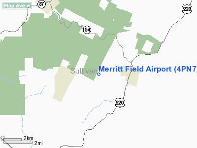
Location & QuickFacts
| FAA Information Effective: | 2008-09-25 |
| Airport Identifier: | 4PN7 |
| Airport Status: | Operational |
| Longitude/Latitude: | 076-32-03.8100W/41-25-05.2800N
-76.534392/41.418133 (Estimated) |
| Elevation: | 2000 ft / 609.60 m (Estimated) |
| Land: | 130 acres |
| From nearest city: | 3 nautical miles E of Eagles Mere, PA |
| Location: | Sullivan County, PA |
| Magnetic Variation: | 12W (2000) |
Owner & Manager
| Ownership: | Privately owned |
| Owner: | Merritt Capital Corporation |
| Address: | 215 Hermitage Drive
Radnor, PA 19087 |
| Phone number: | 610-688-7923 |
| Manager: | George Jenkins |
| Address: | 215 Hermitage Drive
Radnor, PA 19087 |
| Phone number: | 610-688-7923 |
Airport Operations and Facilities
| Airport Use: | Private |
| Wind indicator: | Yes |
| Segmented Circle: | No |
| Control Tower: | No |
| Sectional chart: | New York |
| Region: | AEA - Eastern |
| Boundary ARTCC: | ZNY - New York |
| Tie-in FSS: | IPT - Williamsport |
| FSS Toll Free: | 1-800-WX-BRIEF |
Runway Information
Runway 05/23
| Dimension: | 1600 x 100 ft / 487.7 x 30.5 m |
| Surface: | TURF, |
| |
Runway 05 |
Runway 23 |
| Traffic Pattern: | Left | Left |
|
Radio Navigation Aids
| ID |
Type |
Name |
Ch |
Freq |
Var |
Dist |
| PIX | NDB | Picture Rocks | | 344.00 | 09W | 11.6 nm |
| CYE | NDB | Crystal Lake | | 410.00 | 11W | 34.1 nm |
| HXM | NDB | Humbolt | | 366.00 | 10W | 35.5 nm |
| HZL | VOR | Hazleton | | 109.40 | 09W | 32.4 nm |
| FQM | VOR/DME | Williamsport | 091X | 114.40 | 09W | 11.9 nm |
| SFK | VOR/DME | Stonyfork | 023X | 108.60 | 08W | 43.2 nm |
| ULW | VOR/DME | Elmira | 033Y | 109.65 | 12W | 46.2 nm |
| MIP | VORTAC | Milton | 029X | 109.20 | 09W | 24.5 nm |
| LVZ | VORTAC | Wilkes-barre | 053X | 111.60 | 10W | 39.1 nm |
| SEG | VORTAC | Selinsgrove | 041X | 110.40 | 08W | 40.9 nm |
| LHY | VORTAC | Lake Henry | 045X | 110.80 | 10W | 47.5 nm |
| CFB | VORTAC | Binghamton | 059X | 112.20 | 10W | 47.9 nm |
Remarks
- PRVDD DAYLGT, VFR; A CLEAR 20:1 APCH PATH; AND ACCESS ROAD ON PROPERTY SHOULD BE SIGNED TO WARN APPROACHING VEHICLES OF POSSIBILITY OF APPROACHING ACFT.
Images and information placed above are from
http://www.airport-data.com/airport/4PN7/
We thank them for the data!
| General Info
|
| Country |
United States
|
| State |
PENNSYLVANIA
|
| FAA ID |
4PN7
|
| Latitude |
41-25-05.280N
|
| Longitude |
076-32-03.810W
|
| Elevation |
2000 feet
|
| Near City |
EAGLES MERE
|
We don't guarantee the information is fresh and accurate. The data may
be wrong or outdated.
For more up-to-date information please refer to other sources.
|
|


