 |
|
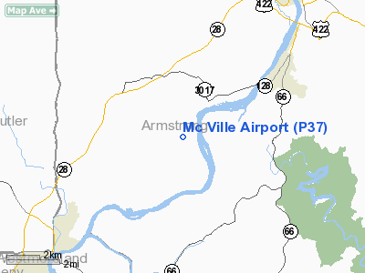
Location & QuickFacts
| FAA Information Effective: | 2008-09-25 |
| Airport Identifier: | P37 |
| Airport Status: | Closed Indefinitely |
| Longitude/Latitude: | 079-35-59.1680W/40-44-00.2320N
-79.599769/40.733398 (Estimated) |
| Elevation: | 1090 ft / 332.23 m (Estimated) |
| Land: | 100 acres |
| From nearest city: | 6 nautical miles NE of Freeport, PA |
| Location: | Armstrong County, PA |
| Magnetic Variation: | 08W (1985) |
Owner & Manager
| Ownership: | Privately owned |
| Owner: | Theodore & Thomas Kijowski |
| Address: | 444 Ford City Rd
Freeport, PA 16229 |
| Phone number: | 724-295-1140 |
| Manager: | Louis Kijowski |
| Address: | 444 Ford City Rd
Freeport, PA 16229 |
| Phone number: | 724-295-9926 |
Airport Operations and Facilities
| Airport Use: | Open to public |
| Wind indicator: | Yes |
| Segmented Circle: | No |
| Control Tower: | No |
| Lighting Schedule: | RDO-CTL
ACTVT LIRL RWY 03/21 AND ROTATING BCN - 123.0. |
| Beacon Color: | Clear-Green (lighted land airport) |
| Landing fee charge: | No |
| Sectional chart: | Detroit |
| Region: | AEA - Eastern |
| Boundary ARTCC: | ZOB - Cleveland |
| Tie-in FSS: | AOO - Altoona |
| FSS on Airport: | No |
| FSS Toll Free: | 1-800-WX-BRIEF |
| NOTAMs Facility: | AOO (NOTAM-d service avaliable) |
Airport Communications
| CTAF: | 123.000 |
| Unicom: | 123.000 |
Airport Services
| Fuel available: | 100LL |
| Airframe Repair: | MAJOR |
| Power Plant Repair: | MAJOR |
Runway Information
Runway 03/21
| Dimension: | 2425 x 160 ft / 739.1 x 48.8 m |
| Surface: | TURF, Fair Condition |
| Edge Lights: | Non-standard lighting system
NSTD LIRL DUE TO SPACING. |
| |
Runway 03 |
Runway 21 |
| Traffic Pattern: | Left | Left |
| Obstruction: | 10 ft road, 30.0 ft from runway, 2:1 slope to clear | 6 ft brush, 41.0 ft from runway, 110 ft left of centerline, 6:1 slope to clear |
|
Runway 18/36
| Dimension: | 2900 x 132 ft / 883.9 x 40.2 m |
| Surface: | TURF, Good Condition |
| |
Runway 18 |
Runway 36 |
| Traffic Pattern: | Left | Left |
| Displaced threshold: | 1050.00 ft
DSPLCD THR MKD WITH RED BARRELS. | 0.00 ft |
| Obstruction: | 35 ft pole, 60.0 ft from runway, 97 ft left of centerline, 1:1 slope to clear
RWY 18 APPR SLOPE 30:1 TO DSPD THRLD. | 5 ft trees, 15.0 ft from runway, 64 ft left of centerline, 2:1 slope to clear |
|
Radio Navigation Aids
| ID |
Type |
Name |
Ch |
Freq |
Var |
Dist |
| MKP | NDB | Mc Keesport | | 287.00 | 07W | 24.2 nm |
| INP | NDB | Indiana | | 242.00 | 08W | 25.1 nm |
| BHU | NDB | Benje | | 382.00 | 07W | 26.2 nm |
| UCP | NDB | Castle | | 272.00 | 09W | 41.0 nm |
| PNU | NDB | Washington County | | 255.00 | 08W | 43.8 nm |
| HBD | NDB | Hubbard | | 408.00 | 08W | 49.2 nm |
| SYS | NDB | Stoystown | | 209.00 | 08W | 49.9 nm |
| FKL | VOR | Franklin | | 109.60 | 06W | 44.0 nm |
| CIP | VOR/DME | Clarion | 076X | 112.90 | 06W | 25.6 nm |
| AGC | VOR/DME | Allegheny | 037X | 110.00 | 09W | 34.0 nm |
| REC | VOR/DME | Revloc | 043X | 110.60 | 09W | 40.5 nm |
| EWC | VORTAC | Ellwood City | 105X | 115.80 | 08W | 28.4 nm |
| MMJ | VORTAC | Montour | 057X | 112.00 | 08W | 30.9 nm |
| JST | VORTAC | Johnstown | 077X | 113.00 | 06W | 43.0 nm |
| IHD | VORTAC | Indian Head | 019X | 108.20 | 06W | 47.0 nm |
Remarks
- TREES PENETRATE 7-1 SFCS ON BOTH SIDES OF APCH TO RYS 03/21 & 36.
- DEER & WOODCHUCK ON & INVOF ARPT.
- RY 18/36 CLSD INDEFLY.
- STEEP DROP-OFF AT AER RY 03.
- (ARPT STATUS) ARPT CLSD INDEFLY.
- VFR OPERNS ONLY.
Images and information placed above are from
http://www.airport-data.com/airport/P37/
We thank them for the data!
| General Info
|
| Country |
United States
|
| State |
PENNSYLVANIA
|
| FAA ID |
P37
|
| Latitude |
40-44-00.232N
|
| Longitude |
079-35-59.168W
|
| Elevation |
1090 feet
|
| Near City |
FREEPORT
|
We don't guarantee the information is fresh and accurate. The data may
be wrong or outdated.
For more up-to-date information please refer to other sources.
|
|


