 |
|
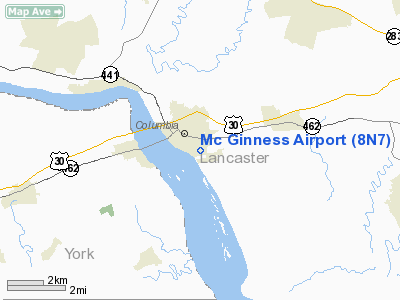
Location & QuickFacts
| FAA Information Effective: | 2008-09-25 |
| Airport Identifier: | 8N7 |
| Airport Status: | Operational |
| Longitude/Latitude: | 076-29-13.8730W/40-01-30.3510N
-76.487187/40.025098 (Estimated) |
| Elevation: | 334 ft / 101.80 m (Estimated) |
| Land: | 102 acres |
| From nearest city: | 1 nautical miles SE of Columbia, PA |
| Location: | Lancaster County, PA |
| Magnetic Variation: | 10W (1985) |
Owner & Manager
| Ownership: | Privately owned |
| Owner: | George Mc Ginness |
| Address: | 1020 Manor St
Columbia, PA 17512 |
| Phone number: | 717-684-6157 |
| Manager: | George Mc Ginness |
| Address: | 1020 Manor St
Columbia, PA 17512 |
| Phone number: | 717-684-6157 |
Airport Operations and Facilities
| Airport Use: | Open to public |
| Wind indicator: | Yes |
| Segmented Circle: | No |
| Control Tower: | No |
| Landing fee charge: | No |
| Sectional chart: | New York |
| Region: | AEA - Eastern |
| Boundary ARTCC: | ZNY - New York |
| Tie-in FSS: | IPT - Williamsport |
| FSS on Airport: | No |
| FSS Toll Free: | 1-800-WX-BRIEF
FILE IFR & PICKUP CLEARANCE TOLL FREE CALL 800-932-0712. |
| NOTAMs Facility: | IPT (NOTAM-d service avaliable) |
Airport Communications
Airport Services
| Bottled Oxygen: | NONE |
| Bulk Oxygen: | NONE |
Runway Information
Runway 08/26
| Dimension: | 1800 x 100 ft / 548.6 x 30.5 m |
| Surface: | TURF, Good Condition |
| |
Runway 08 |
Runway 26 |
| Traffic Pattern: | Left | Left |
| Obstruction: | 23 ft trees, 158.0 ft from runway, 128 ft left of centerline, 6:1 slope to clear
TREELINE 24 FT BEHIND RY 08 THLD 100 FT FM CTRLN TRAVERSING BOTH SIDES OF RY. | 19 ft brush, 48.0 ft from runway, 2:1 slope to clear
TREES 100 FT FM CTRLN TRAVERSING BOTH SIDE OF RY. |
|
Runway 11/29
| Dimension: | 1850 x 120 ft / 563.9 x 36.6 m |
| Surface: | TURF, Good Condition |
| |
Runway 11 |
Runway 29 |
| Traffic Pattern: | Left | Left |
| Obstruction: | 104 ft trees, 102.0 ft from runway, 100 ft left of centerline | 118 ft trees, 988.0 ft from runway, 409 ft left of centerline, 8:1 slope to clear |
|
Radio Navigation Aids
| ID |
Type |
Name |
Ch |
Freq |
Var |
Dist |
| EUD | NDB | York | | 254.00 | 11W | 19.1 nm |
| BZJ | NDB | Bellgrove | | 328.00 | 10W | 24.9 nm |
| APG | NDB | Aberdeen | | 349.00 | 11W | 34.3 nm |
| MTN | NDB | Martin | | 342.00 | 11W | 43.9 nm |
| IUB | NDB | Institute | | 404.00 | 08W | 44.8 nm |
| FND | NDB | Ellicott | | 371.00 | 11W | 46.3 nm |
| MTN | TACAN | Martin | 068X | | 11W | 41.9 nm |
| PPM | VOR/DME | Phillips | 021X | 108.40 | 09W | 36.6 nm |
| ETX | VOR/DME | East Texas | 039X | 110.20 | 09W | 49.7 nm |
| LRP | VORTAC | Lancaster | 120X | 117.30 | 09W | 10.7 nm |
| HAR | VORTAC | Harrisburg | 072X | 112.50 | 10W | 31.5 nm |
| RAV | VORTAC | Ravine | 093X | 114.60 | 11W | 32.2 nm |
| MXE | VORTAC | Modena | 079X | 113.20 | 09W | 38.2 nm |
| EMI | VORTAC | Westminster | 126X | 117.90 | 08W | 39.1 nm |
| PTW | VORTAC | Pottstown | 112X | 116.50 | 09W | 44.2 nm |
| DQO | VORTAC | Dupont | 087X | 114.00 | 10W | 45.7 nm |
| SEG | VORTAC | Selinsgrove | 041X | 110.40 | 08W | 49.5 nm |
| MDT | VOT | Harrisburg International | | 110.00 | | 16.4 nm |
Remarks
Images and information placed above are from
http://www.airport-data.com/airport/8N7/
We thank them for the data!
| General Info
|
| Country |
United States
|
| State |
PENNSYLVANIA
|
| FAA ID |
8N7
|
| Latitude |
40-01-30.351N
|
| Longitude |
076-29-13.873W
|
| Elevation |
334 feet
|
| Near City |
COLUMBIA
|
We don't guarantee the information is fresh and accurate. The data may
be wrong or outdated.
For more up-to-date information please refer to other sources.
|
|


