 |
|
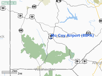
Location & QuickFacts
| FAA Information Effective: | 2008-09-25 |
| Airport Identifier: | 88PA |
| Airport Status: | Operational |
| Longitude/Latitude: | 080-24-47.2330W/40-32-21.2400N
-80.413120/40.539233 (Estimated) |
| Elevation: | 1200 ft / 365.76 m (Estimated) |
| Land: | 0 acres |
| From nearest city: | 6 nautical miles NW of Clinton, PA |
| Location: | Beaver County, PA |
| Magnetic Variation: | 07W (1985) |
Owner & Manager
| Ownership: | Privately owned |
| Owner: | W. Claude Mc Coy |
| Address: | Rr 1, Box 200a
Clinton, PA 15026 |
| Phone number: | 412-899-2640 |
| Address: |
|
Airport Operations and Facilities
| Airport Use: | Private |
| Wind indicator: | Yes |
| Segmented Circle: | No |
| Control Tower: | No |
| Landing fee charge: | No |
| Sectional chart: | Detroit |
| Region: | AEA - Eastern |
| Boundary ARTCC: | ZOB - Cleveland |
| Tie-in FSS: | AOO - Altoona |
| FSS on Airport: | No |
| FSS Toll Free: | 1-800-WX-BRIEF |
Airport Services
| Airframe Repair: | NONE |
| Power Plant Repair: | NONE |
Runway Information
Runway 14/32
| Dimension: | 1300 x 100 ft / 396.2 x 30.5 m |
| Surface: | TURF, |
| |
Runway 14 |
Runway 32 |
| Traffic Pattern: | Left | Left |
|
Radio Navigation Aids
| ID |
Type |
Name |
Ch |
Freq |
Var |
Dist |
| PNU | NDB | Washington County | | 255.00 | 08W | 26.4 nm |
| UCP | NDB | Castle | | 272.00 | 09W | 29.1 nm |
| TSO | NDB | Tolson | | 395.00 | 07W | 30.4 nm |
| MKP | NDB | Mc Keesport | | 287.00 | 07W | 31.0 nm |
| CFX | NDB | Cadiz | | 239.00 | 07W | 32.9 nm |
| HBD | NDB | Hubbard | | 408.00 | 08W | 37.3 nm |
| VV | NDB | Camor | | 299.00 | 08W | 50.0 nm |
| HLG | VOR/DME | Wheeling | 059X | 112.20 | 07W | 18.2 nm |
| AGC | VOR/DME | Allegheny | 037X | 110.00 | 09W | 23.1 nm |
| AIR | VOR/DME | Bellaire | 118X | 117.10 | 07W | 36.5 nm |
| BSV | VOR/DME | Briggs | 071X | 112.40 | 04W | 48.0 nm |
| ACO | VOR/DME | Akron | 091X | 114.40 | 04W | 49.5 nm |
| MMJ | VORTAC | Montour | 057X | 112.00 | 08W | 10.5 nm |
| EWC | VORTAC | Ellwood City | 105X | 115.80 | 08W | 19.5 nm |
| YNG | VORTAC | Youngstown | 027X | 109.00 | 05W | 49.1 nm |
Remarks
- TREES ON EAST SIDE OF RWY 32.
- VFR ONLY
Images and information placed above are from
http://www.airport-data.com/airport/88PA/
We thank them for the data!
| General Info
|
| Country |
United States
|
| State |
PENNSYLVANIA
|
| FAA ID |
88PA
|
| Latitude |
40-32-21.240N
|
| Longitude |
080-24-47.233W
|
| Elevation |
1200 feet
|
| Near City |
CLINTON
|
We don't guarantee the information is fresh and accurate. The data may
be wrong or outdated.
For more up-to-date information please refer to other sources.
|
|


