 |
|
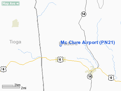
Location & QuickFacts
| FAA Information Effective: | 2008-09-25 |
| Airport Identifier: | PN21 |
| Airport Status: | Operational |
| Longitude/Latitude: | 076-51-23.8510W/41-49-40.2670N
-76.856625/41.827852 (Estimated) |
| Elevation: | 1470 ft / 448.06 m (Estimated) |
| Land: | 0 acres |
| From nearest city: | 4 nautical miles NW of Troy, PA |
| Location: | Bradford County, PA |
| Magnetic Variation: | 11W (1985) |
Owner & Manager
| Ownership: | Privately owned |
| Owner: | Ronald G Mc Clure |
| Address: | Rd 2
Col.cross Rds, PA 16914 |
| Phone number: | 717-297-3860 |
| Address: |
|
Airport Operations and Facilities
| Airport Use: | Private |
| Wind indicator: | Yes |
| Segmented Circle: | No |
| Control Tower: | No |
| Landing fee charge: | No |
| Sectional chart: | New York |
| Region: | AEA - Eastern |
| Boundary ARTCC: | ZNY - New York |
| Tie-in FSS: | IPT - Williamsport |
| FSS on Airport: | No |
| FSS Toll Free: | 1-800-WX-BRIEF |
Airport Services
| Airframe Repair: | NONE |
| Power Plant Repair: | NONE |
Runway Information
Runway 17/35
| Dimension: | 2044 x 100 ft / 623.0 x 30.5 m |
| Surface: | TURF, |
| |
Runway 17 |
Runway 35 |
| Traffic Pattern: | Left | Left |
|
Radio Navigation Aids
| ID |
Type |
Name |
Ch |
Freq |
Var |
Dist |
| ALP | NDB | Alpine | | 245.00 | 12W | 25.0 nm |
| PIX | NDB | Picture Rocks | | 344.00 | 09W | 33.8 nm |
| PYA | NDB | Penn Yan | | 260.00 | 12W | 49.9 nm |
| ULW | VOR/DME | Elmira | 033Y | 109.65 | 12W | 17.7 nm |
| SFK | VOR/DME | Stonyfork | 023X | 108.60 | 08W | 26.5 nm |
| FQM | VOR/DME | Williamsport | 091X | 114.40 | 09W | 29.6 nm |
| ITH | VOR/DME | Ithaca | 055X | 111.80 | 10W | 43.8 nm |
| CFB | VORTAC | Binghamton | 059X | 112.20 | 10W | 37.8 nm |
| MIP | VORTAC | Milton | 029X | 109.20 | 09W | 49.1 nm |
Images and information placed above are from
http://www.airport-data.com/airport/PN21/
We thank them for the data!
| General Info
|
| Country |
United States
|
| State |
PENNSYLVANIA
|
| FAA ID |
PN21
|
| Latitude |
41-49-40.267N
|
| Longitude |
076-51-23.851W
|
| Elevation |
1470 feet
|
| Near City |
TROY
|
We don't guarantee the information is fresh and accurate. The data may
be wrong or outdated.
For more up-to-date information please refer to other sources.
|
|


