 |
|
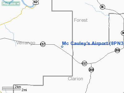
Location & QuickFacts
| FAA Information Effective: | 2008-09-25 |
| Airport Identifier: | 8PN3 |
| Airport Status: | Operational |
| Longitude/Latitude: | 079-30-00.0000W/41-23-00.0000N
-79.500000/41.383333 (Estimated) |
| Elevation: | 1571 ft / 478.84 m (Estimated) |
| Land: | 0 acres |
| From nearest city: | 2 nautical miles NW of Venus, PA |
| Location: | Venango County, PA |
| Magnetic Variation: | () |
Owner & Manager
| Ownership: | Privately owned |
| Owner: | Paul M. Mc Cauley |
| Address: | 138 Airport Dr
Venus, PA 16364 |
| Phone number: | 814-354-2146 |
| Manager: | Paul M. Mc Cauley |
| Address: | 138 Airport Dr
Venus, PA 16364 |
| Phone number: | 814-354-2146 |
Airport Operations and Facilities
| Airport Use: | Private |
| Control Tower: | No |
| Sectional chart: | Detroit |
| Region: | AEA - Eastern |
| Boundary ARTCC: | ZOB - Cleveland |
| Tie-in FSS: | AOO - Altoona |
| FSS Toll Free: | 1-800-WX-BRIEF |
Airport Communications
Runway Information
Runway 01/19
| Dimension: | 1900 x 150 ft / 579.1 x 45.7 m |
| Surface: | TURF, |
| |
Runway 01 |
Runway 19 |
| Traffic Pattern: | Left | Left |
| Displaced threshold: | 0.00 ft | 600.00 ft |
| Obstruction: | 30 ft trees, 600.0 ft from runway | 30 ft trees, 600.0 ft from runway |
|
Radio Navigation Aids
| ID |
Type |
Name |
Ch |
Freq |
Var |
Dist |
| ORJ | NDB | Corry | | 258.00 | 09W | 32.5 nm |
| UCP | NDB | Castle | | 272.00 | 09W | 46.7 nm |
| HBD | NDB | Hubbard | | 408.00 | 08W | 48.6 nm |
| INP | NDB | Indiana | | 242.00 | 08W | 49.3 nm |
| FKL | VOR | Franklin | | 109.60 | 06W | 16.4 nm |
| CIP | VOR/DME | Clarion | 076X | 112.90 | 06W | 14.4 nm |
| BFD | VOR/DME | Bradford | 113X | 116.60 | 07W | 46.4 nm |
| TDT | VORTAC | Tidioute | 123X | 117.60 | 09W | 20.2 nm |
| EWC | VORTAC | Ellwood City | 105X | 115.80 | 08W | 46.5 nm |
Remarks
Images and information placed above are from
http://www.airport-data.com/airport/8PN3/
We thank them for the data!
|
|


