 |
|
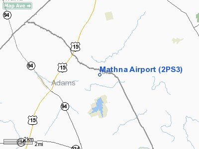
Location & QuickFacts
| FAA Information Effective: | 2008-09-25 |
| Airport Identifier: | 2PS3 |
| Airport Status: | Operational |
| Longitude/Latitude: | 077-02-28.9230W/40-01-00.3400N
-77.041368/40.016761 (Estimated) |
| Elevation: | 490 ft / 149.35 m (Estimated) |
| Land: | 25 acres |
| From nearest city: | 3 nautical miles E of York Springs, PA |
| Location: | Adams County, PA |
| Magnetic Variation: | 10W (1980) |
Owner & Manager
| Ownership: | Privately owned |
| Owner: | Gary G. Mathna |
| Address: | 495 Pondtown Rd
Dillsburg, PA 17019 |
| Phone number: | 717-432-8250 |
| Manager: | Gary G. Mathna |
| Address: | Rd 2
Dillsburg, PA 17019 |
| Phone number: | 717-432-8250 |
Airport Operations and Facilities
| Airport Use: | Private |
| Wind indicator: | Yes |
| Segmented Circle: | No |
| Control Tower: | No |
| Landing fee charge: | No |
| Sectional chart: | Washington |
| Region: | AEA - Eastern |
| Boundary ARTCC: | ZNY - New York |
| Tie-in FSS: | IPT - Williamsport |
| FSS Toll Free: | 1-800-WX-BRIEF |
Runway Information
Runway 06/24
| Dimension: | 1800 x 100 ft / 548.6 x 30.5 m |
| Surface: | TURF, |
| |
Runway 06 |
Runway 24 |
| Traffic Pattern: | Left | Left |
|
Radio Navigation Aids
| ID |
Type |
Name |
Ch |
Freq |
Var |
Dist |
| EUD | NDB | York | | 254.00 | 11W | 9.5 nm |
| BZJ | NDB | Bellgrove | | 328.00 | 10W | 33.7 nm |
| FND | NDB | Ellicott | | 371.00 | 11W | 45.5 nm |
| RV | NDB | Stroh | | 407.00 | 10W | 47.5 nm |
| IUB | NDB | Institute | | 404.00 | 08W | 47.9 nm |
| FDK | VOR | Frederick | | 109.00 | 08W | 39.5 nm |
| HGR | VOR | Hagerstown | | 109.80 | 07W | 42.2 nm |
| HAR | VORTAC | Harrisburg | 072X | 112.50 | 10W | 17.2 nm |
| EMI | VORTAC | Westminster | 126X | 117.90 | 08W | 31.5 nm |
| LRP | VORTAC | Lancaster | 120X | 117.30 | 09W | 35.1 nm |
| RAV | VORTAC | Ravine | 093X | 114.60 | 11W | 38.1 nm |
| THS | VORTAC | St Thomas | 097X | 115.00 | 07W | 42.2 nm |
| SEG | VORTAC | Selinsgrove | 041X | 110.40 | 08W | 47.1 nm |
| MDT | VOT | Harrisburg International | | 110.00 | | 16.8 nm |
Images and information placed above are from
http://www.airport-data.com/airport/2PS3/
We thank them for the data!
| General Info
|
| Country |
United States
|
| State |
PENNSYLVANIA
|
| FAA ID |
2PS3
|
| Latitude |
40-01-00.340N
|
| Longitude |
077-02-28.923W
|
| Elevation |
490 feet
|
| Near City |
YORK SPRINGS
|
We don't guarantee the information is fresh and accurate. The data may
be wrong or outdated.
For more up-to-date information please refer to other sources.
|
|


