 |
|
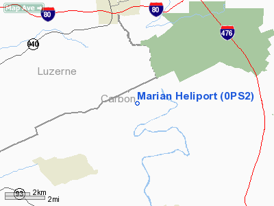
Location & QuickFacts
| FAA Information Effective: | 2008-09-25 |
| Airport Identifier: | 0PS2 |
| Airport Status: | Operational |
| Longitude/Latitude: | 075-45-04.6900W/40-59-22.3000N
-75.751303/40.989528 (Estimated) |
| Elevation: | 1285 ft / 391.67 m (Estimated) |
| Land: | 77 acres |
| From nearest city: | 4 nautical miles NE of Weatherly, PA |
| Location: | Carbon County, PA |
| Magnetic Variation: | 12W (2000) |
Owner & Manager
| Ownership: | Privately owned |
| Owner: | Floyd C. Hoffman |
| Address: | 190 Decker La.
Weatherly, PA 18255 |
| Phone number: | 570-427-8036 |
| Manager: | Floyd C. Hoffman |
| Address: | 190 Decker La.
Weatherly, PA 18255 |
| Phone number: | 570-427-8036 |
Airport Operations and Facilities
| Airport Use: | Private |
| Wind indicator: | Yes |
| Segmented Circle: | No |
| Control Tower: | No |
| Lighting Schedule: | 24 HRS |
| Sectional chart: | New York |
| Region: | AEA - Eastern |
| Boundary ARTCC: | ZNY - New York |
| Tie-in FSS: | IPT - Williamsport |
| FSS Toll Free: | 1-800-WX-BRIEF |
Runway Information
Helipad H1
| Dimension: | 70 x 70 ft / 21.3 x 21.3 m |
| Surface: | CONC, |
| |
Runway H1 |
Runway |
| Traffic Pattern: | Left | Left |
|
Radio Navigation Aids
| ID |
Type |
Name |
Ch |
Freq |
Var |
Dist |
| LQX | NDB | Carbon | | 339.00 | 12W | 10.7 nm |
| HXM | NDB | Humbolt | | 366.00 | 10W | 11.1 nm |
| CYE | NDB | Crystal Lake | | 410.00 | 11W | 13.8 nm |
| UKT | NDB | Quakertown | | 208.00 | 12W | 39.7 nm |
| PIX | NDB | Picture Rocks | | 344.00 | 09W | 46.7 nm |
| DYL | NDB | Doylestown | | 237.00 | 10W | 48.7 nm |
| BZJ | NDB | Bellgrove | | 328.00 | 10W | 49.4 nm |
| HZL | VOR | Hazleton | | 109.40 | 09W | 17.0 nm |
| ETX | VOR/DME | East Texas | 039X | 110.20 | 09W | 24.7 nm |
| STW | VOR/DME | Stillwater | 033X | 109.60 | 11W | 40.0 nm |
| CKZ | VOR/DME | Pennridge | 025Y | 108.85 | 12W | 41.7 nm |
| BWZ | VOR/DME | Broadway | 089X | 114.20 | 11W | 43.8 nm |
| LVZ | VORTAC | Wilkes-barre | 053X | 111.60 | 10W | 17.3 nm |
| FJC | VORTAC | Allentown | 122X | 117.50 | 10W | 20.8 nm |
| LHY | VORTAC | Lake Henry | 045X | 110.80 | 10W | 31.7 nm |
| MIP | VORTAC | Milton | 029X | 109.20 | 09W | 41.5 nm |
| RAV | VORTAC | Ravine | 093X | 114.60 | 11W | 46.7 nm |
| PTW | VORTAC | Pottstown | 112X | 116.50 | 09W | 46.9 nm |
Remarks
- PRVDD CLEAR 8:1 INGRESS/EGRESS, HELIPAD MKD,LGTD WINDSOCK INSTALLED, VFR ONLY, LOW LIGHTING SHOULD BE PRVDD FOR NIGHT OPNS.
Images and information placed above are from
http://www.airport-data.com/airport/0PS2/
We thank them for the data!
| General Info
|
| Country |
United States
|
| State |
PENNSYLVANIA
|
| FAA ID |
0PS2
|
| Latitude |
40-59-22.300N
|
| Longitude |
075-45-04.690W
|
| Elevation |
1285 feet
|
| Near City |
WEATHERLY
|
We don't guarantee the information is fresh and accurate. The data may
be wrong or outdated.
For more up-to-date information please refer to other sources.
|
|


