 |
|
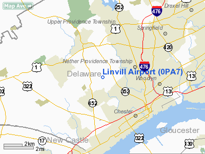
Location & QuickFacts
| FAA Information Effective: | 2008-09-25 |
| Airport Identifier: | 0PA7 |
| Airport Status: | Operational |
| Longitude/Latitude: | 075-24-53.7000W/39-53-05.4020N
-75.414917/39.884834 (Estimated) |
| Elevation: | 180 ft / 54.86 m (Estimated) |
| Land: | 7 acres |
| From nearest city: | 3 nautical miles SW of Media, PA |
| Location: | Delaware County, PA |
| Magnetic Variation: | 12W (1990) |
Owner & Manager
| Ownership: | Privately owned |
| Owner: | Paul Linvill |
| Address: | 137 W. Knowlton Rd
Media, PA 19063 |
| Phone number: | 215-876-7116 |
| Manager: | Jeff Saitto |
| Address: | 130 W. Knowlton Rd
Media, PA 19063 |
| Phone number: | 215-876-7116 |
Airport Operations and Facilities
| Airport Use: | Private |
| Wind indicator: | Yes |
| Segmented Circle: | No |
| Control Tower: | No |
| Landing fee charge: | No |
| Sectional chart: | Washington |
| Region: | AEA - Eastern |
| Boundary ARTCC: | ZDC - Washington |
| Tie-in FSS: | IPT - Williamsport |
| FSS on Airport: | No |
| FSS Toll Free: | 1-800-WX-BRIEF |
Runway Information
Runway 04/22
| Dimension: | 1200 x 100 ft / 365.8 x 30.5 m |
| Surface: | TURF, Good Condition |
| |
Runway 04 |
Runway 22 |
| Traffic Pattern: | Right | Left |
| Displaced threshold: | 0.00 ft | 550.00 ft |
| Obstruction: | | 25 ft pline, 550.0 ft from runway |
|
Radio Navigation Aids
| ID |
Type |
Name |
Ch |
Freq |
Var |
Dist |
| ING | NDB | Ambler | | 275.00 | 11W | 15.7 nm |
| NXX | NDB | Willow Grove | | 388.00 | 12W | 22.1 nm |
| DYL | NDB | Doylestown | | 237.00 | 10W | 30.3 nm |
| RNB | NDB | Rainbow | | 363.00 | 11W | 30.9 nm |
| UKT | NDB | Quakertown | | 208.00 | 12W | 32.9 nm |
| APG | NDB | Aberdeen | | 349.00 | 11W | 38.3 nm |
| NXX | TACAN | Willow Grove | 061X | | 10W | 22.3 nm |
| DOV | TACAN | Dover | 037X | | 09W | 45.3 nm |
| NEL | TACAN | Lakehurst | 055X | | 11W | 49.8 nm |
| PNE | VOR | North Philadelphia | | 112.00 | 10W | 22.1 nm |
| CKZ | VOR/DME | Pennridge | 025Y | 108.85 | 12W | 31.0 nm |
| ARD | VOR/DME | Yardley | 019X | 108.20 | 10W | 32.2 nm |
| PPM | VOR/DME | Phillips | 021X | 108.40 | 09W | 43.1 nm |
| ETX | VOR/DME | East Texas | 039X | 110.20 | 09W | 43.6 nm |
| MXE | VORTAC | Modena | 079X | 113.20 | 09W | 12.0 nm |
| DQO | VORTAC | Dupont | 087X | 114.00 | 10W | 15.3 nm |
| OOD | VORTAC | Woodstown | 075X | 112.80 | 10W | 15.8 nm |
| PTW | VORTAC | Pottstown | 112X | 116.50 | 09W | 21.4 nm |
| VCN | VORTAC | Cedar Lake | 099X | 115.20 | 10W | 29.4 nm |
| GXU | VORTAC | Mc Guire | 043X | 110.60 | 11W | 38.5 nm |
| ENO | VORTAC | Smyrna | 051X | 111.40 | 09W | 39.5 nm |
| LRP | VORTAC | Lancaster | 120X | 117.30 | 09W | 42.8 nm |
| CYN | VORTAC | Coyle | 081X | 113.40 | 10W | 45.6 nm |
| RBV | VORTAC | Robbinsville | 085X | 113.80 | 10W | 46.4 nm |
| ACY | VORTAC | Atlantic City | 023X | 108.60 | 10W | 46.6 nm |
| PHL | VOT | Philadelphia Intl | | 109.80 | | 7.9 nm |
Remarks
- (E111-1) TREES SOUTH OF RY SHOULD BE CUT BACK TO PROVIDE A 7:1 TRANSITION. LANDING AREA SUITABLE FOR SINGLE ENGINE LAND AIRPLANES. DUE TO THE NOISE LEVEL, LOW ALTITUDE OVERFLIGHT OF RESIDENCES AND OTHER NOISE SENSITIVE LAND USES SHOULD BE AVOIDED.
- PRVDD ARPT OPERATES IN VFR; NO IFR OPNS; INSTALL A SAFETY FENCE; PORTABLE BLDG ADJACENT TO RY BE MOVED BACK TO PROVDE A 7:1 TRANSITION.
Images and information placed above are from
http://www.airport-data.com/airport/0PA7/
We thank them for the data!
| General Info
|
| Country |
United States
|
| State |
PENNSYLVANIA
|
| FAA ID |
0PA7
|
| Latitude |
39-53-05.402N
|
| Longitude |
075-24-53.700W
|
| Elevation |
180 feet
|
| Near City |
MEDIA
|
We don't guarantee the information is fresh and accurate. The data may
be wrong or outdated.
For more up-to-date information please refer to other sources.
|
|


