 |
|
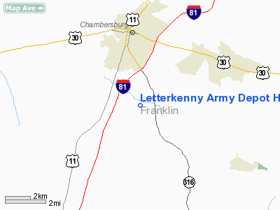
Letterkenny Army Depot Helipad Heliport |
Location & QuickFacts
| FAA Information Effective: | 2008-09-25 |
| Airport Identifier: | 7PN5 |
| Airport Status: | Operational |
| Longitude/Latitude: | 077-38-58.9680W/39-53-00.3300N
-77.649713/39.883425 (Estimated) |
| Elevation: | 774 ft / 235.92 m (Estimated) |
| Land: | 0 acres |
| From nearest city: | 3 nautical miles NW of Chambersburg, PA |
| Location: | Adams County, PA |
| Magnetic Variation: | 09W (1985) |
Owner & Manager
| Ownership: | Army owned |
| Owner: | Unknown |
| Address: | Attn: Amsds-n
Chambersburg, PA 17201-5000 |
| Manager: | Unknown |
| Address: |
|
Airport Operations and Facilities
| Airport Use: | Private |
| Segmented Circle: | No |
| Control Tower: | No |
| Sectional chart: | Washington |
| Region: | AEA - Eastern |
| Boundary ARTCC: | ZNY - New York |
| Tie-in FSS: | IPT - Williamsport |
| FSS Toll Free: | 1-800-WX-BRIEF |
Runway Information
Helipad H1
| Dimension: | 100 x 100 ft / 30.5 x 30.5 m |
| Surface: | ASPH, |
| |
Runway H1 |
Runway |
| Traffic Pattern: | Left | Left |
|
Radio Navigation Aids
| ID |
Type |
Name |
Ch |
Freq |
Var |
Dist |
| EUD | NDB | York | | 254.00 | 11W | 35.7 nm |
| RV | NDB | Stroh | | 407.00 | 10W | 44.1 nm |
| GAI | NDB | Gaithersburg | | 385.00 | 09W | 48.4 nm |
| HGR | VOR | Hagerstown | | 109.80 | 07W | 14.7 nm |
| FDK | VOR | Frederick | | 109.00 | 08W | 31.0 nm |
| AOO | VOR | Altoona | | 108.80 | 07W | 40.1 nm |
| THS | VORTAC | St Thomas | 097X | 115.00 | 07W | 14.2 nm |
| MRB | VORTAC | Martinsburg | 058X | 112.10 | 07W | 31.3 nm |
| HAR | VORTAC | Harrisburg | 072X | 112.50 | 10W | 36.7 nm |
| EMI | VORTAC | Westminster | 126X | 117.90 | 08W | 38.8 nm |
| MDT | VOT | Harrisburg International | | 110.00 | | 44.9 nm |
Remarks
- (E137-1) PPR AUTOVON 242-6882.
- (E137-2) APCH/DEP NW-SW. CTC OPS AT LEAST 15 MIN PRIOR TO LDG.
Images and information placed above are from
http://www.airport-data.com/airport/7PN5/
We thank them for the data!
| General Info
|
| Country |
United States
|
| State |
PENNSYLVANIA
|
| FAA ID |
7PN5
|
| Latitude |
39-53-00.330N
|
| Longitude |
077-38-58.968W
|
| Elevation |
774 feet
|
| Near City |
CHAMBERSBURG
|
We don't guarantee the information is fresh and accurate. The data may
be wrong or outdated.
For more up-to-date information please refer to other sources.
|
|


