|
|
Lehigh Valley Intl Airport |
| Lehigh Valley International Airport |
 |
| IATA: ABE – ICAO: KABE – FAA LID: ABE |
| Summary |
| Airport type |
Public |
| Owner |
Lehigh-Northampton Airport Authority |
| Serves |
Lehigh Valley |
| Location |
Allentown, Pennsylvania |
| Elevation AMSL |
393 ft / 120 m |
| Coordinates |
40°39′07″N 075°26′26″W / 40.65194°N 75.44056°W / 40.65194; -75.44056 |
| Website |
www.lvia.org |
| Runways |
| Direction |
Length |
Surface |
| ft |
m |
| 6/24 |
7,600 |
2,316 |
Asphalt |
| 13/31 |
5,797 |
1,767 |
Asphalt |
| Statistics (2006) |
| Aircraft operations |
122,012 |
| Based aircraft |
117 |
| Sources: airport website and FAA |
Lehigh Valley International Airport (IATA: ABE, ICAO: KABE, FAA LID: ABE), formerly Allentown-Bethlehem-Easton International Airport, is a public airport in Hanover Township, Lehigh County, Pennsylvania.
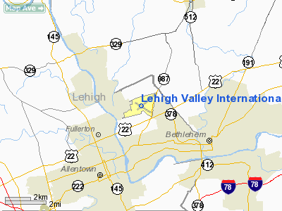
The airport is located three miles (5 km) northeast of Allentown, in the Lehigh Valley region of Pennsylvania, the third most populated metropolitan region in the state (after Philadelphia and Pittsburgh).
It is owned and operated by the Lehigh-Northampton Airport Authority. In 2007, 847,256 people used the airport.
In recent years, Lehigh Valley International Airport has encountered stiff competition from nearby airports such as Philadelphia International Airport (75 miles away) and Newark Liberty International Airport (80 miles away). These airports often offer a greater selection of flights and sometimes lower fares. This was exacerbated by the completion of the Pennsylvania extension of Interstate 78 in 1990, which allowed for a faster drive to Newark; and the opening of Interstate 476 in 1991 that made it easier to connect to Interstate 95 near Philadelphia. History
 | |
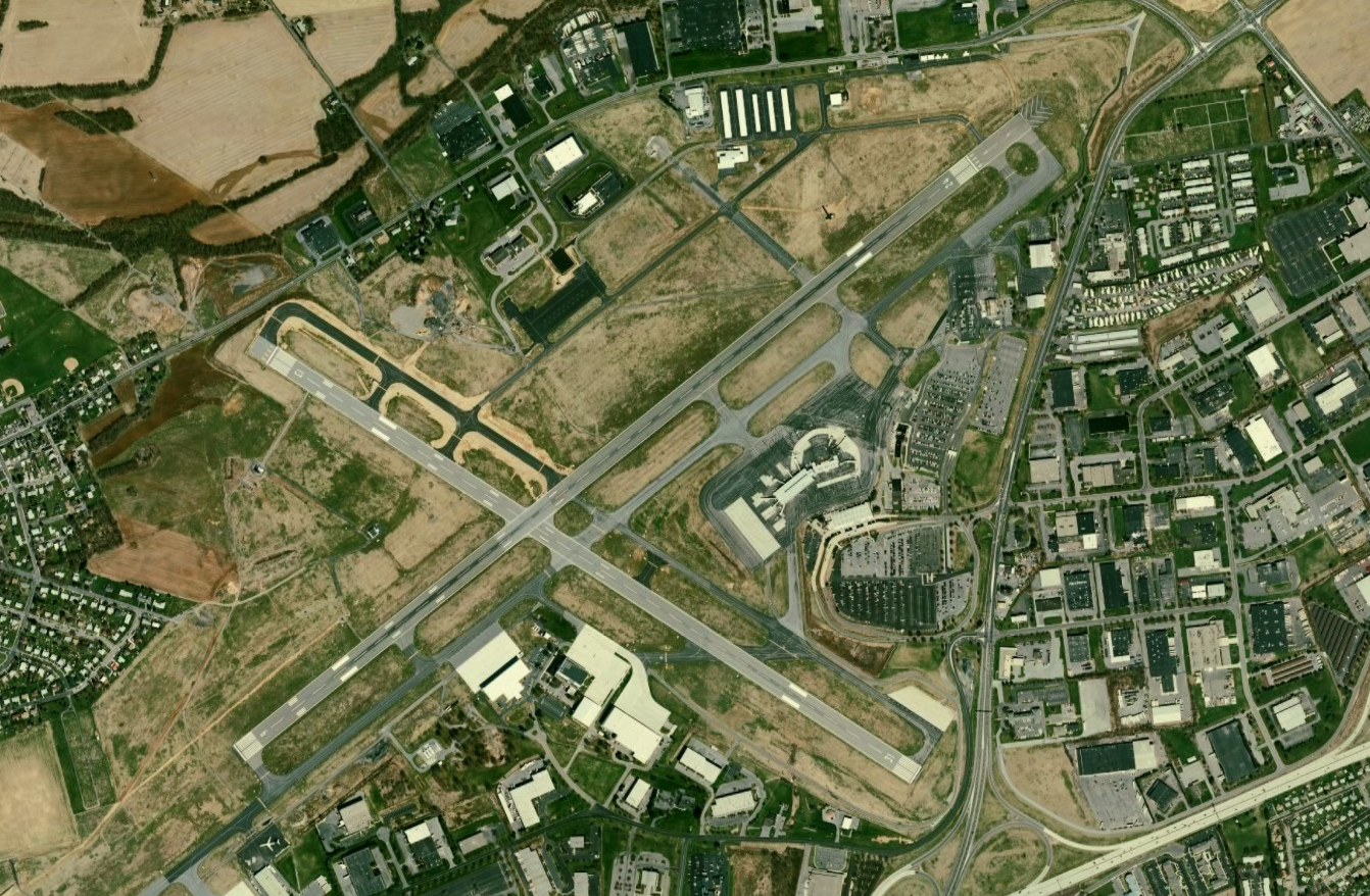
Lehigh Valley International Airport (ABE), 2005. |
Allentown Airport opened in 1929 and is one of the very few in the nation that still serves its community from its original location. Scheduled airline service began on September 16, 1935 by United Airlines with Boeing 247 service. At the time, the airport hangar served as the passenger terminal. The first terminal building at the airport was built in 1938 as a Works Projects Administration (WPA) project.
During World War II the U. S. Navy V-5 flight training program was conducted at the airport in conjunction with ground training held at Muhlenberg College. In addition, Headquarters of Group 312 of the Civil Air Patrol was at Allentown-Bethlehem Airport. One of its activities was to provide a courier service for cargo defense plants. Allentown CAP pilots also patrolled the Atlantic coastline, and was active in recruiting young men for the air cadet program of the Army Air Force.
By January 1944, work on a new runway was completed and a Class A United States Weather Bureau station had been installed. About 1,000 Naval Aviation Cadets had been trained during 1943, and a large increase in the amount of civilian and military air traffic had occurred. In late July, the War Production Board approved the construction of a second story addition to the administration building. The building housed the Lehigh Aircraft Company, the weather bureau station, the Civil Aeronautic communications station, and the office and waiting room of United Air Lines. In August, the V-5 flight training program ended when the Navy decided to move all flight training to naval air bases under Navy pilots.
In the immediate postwar years, in April 1946, the Lehigh Airport Authority was created to own and manage the airport. This made the airport a public enterprise. 1948 saw the beginning of construction for a new passenger terminal, being finished in 1950. Allentown-Bethlehem-Easton (ABE) airport, as it was now called, also expanded passenger service by offering flights with United, Trans World Airlines (TWA), and Colonial airlines. DC-4 and DC-6 service was offered with the addition of 5,000 ft of runway.
Throughout the 1950s, both passenger service as well as air cargo service expanded at ABE. Eastern and Allegheny Airlines began service. In 1960, both Vice President Richard Nixon and Senator John F. Kennedy made campaign stops at ABE. Construction began in late 1972 for the new terminal, which was opened on December 14, 1975.
Today Lehigh Valley International Airport continues to serve the Lehigh Valley.
Facilities and aircraft
Lehigh Valley International Airport covers an area of 2,629 acres (1,064 ha) at an elevation of 393 feet (120 m) above mean sea level. It has two asphalt paved runways: 6/24 measuring 7,600 by 150 feet (2,316 x 46 m) and 13/31 measuring 5,797 by 150 feet (1,767 x 46 m).
For the 12-month period ending December 31, 2006, the airport had 122,012 aircraft operations, an average of 334 per day: 69% general aviation, 15% air taxi (18,365), 14% scheduled commercial and 2% military. At that time there were 117 aircraft based at this airport: 59% single-engine, 11% multi-engine, 24% jet and 6% helicopter.
The airport also is one of several dozen designated landing facilities for the Space Shuttle.
Dining and Shopping
Lehigh Valley International Airport contains a number of restaurants: two Subway restaurants, one on the landside terminal and one on the airside terminal, a restaurant called the L.A. Cafe on the landside terminal, and a snack bar restaurant on the airside terminal. It has 2 Hudson News gift shops, one on the landside and one on the airside terminals, respectively.
Airlines and destinations
| Airlines |
Destinations |
| Air Canada Jazz operated by Air Georgian |
Toronto-Pearson |
| AirTran Airways |
Atlanta [seasonal] Fort Lauderdale, Orlando [seasonal] |
| Allegiant Air |
Myrtle Beach, Orlando, St. Petersburg/Clearwater |
| American Eagle |
Chicago-O'Hare |
| Continental Airlines |
Newark [bus service] |
| Delta Air Lines |
Atlanta |
| Delta Connection operated by Atlantic Southeast Airlines |
Atlanta |
| Delta Connection operated by Comair |
Detroit |
| Delta Connection operated by Mesaba Airlines |
Detroit |
| Delta Connection operated by Pinnacle Airlines |
Detroit |
| Direct Air operated by Falcon Air Express |
Fort Myers/Punta Gorda [seasonal] |
| United Express operated by Colgan Air |
Washington-Dulles |
| United Express operated by Expressjet Airlines |
Chicago-O'Hare |
| United Express operated by Mesa Airlines |
Chicago-O'Hare |
| United Express operated by SkyWest Airlines |
Chicago-O'Hare |
| US Airways |
Charlotte |
| US Airways Express operated by Piedmont Airlines |
Philadelphia |
| US Airways Express operated by PSA Airlines |
Charlotte |
Cargo Operations
- FedEx Express (Indianapolis, Memphis, Newark)
Incidents
On Sunday, November 16, 2008, US Airways Flight 4551, a US Airways Express deHavilland Dash-8 turboprop operated by Piedmont Airlines, took off from Lehigh Valley International Airport at 8:20am heading to Philadelphia International Airport, had to make an emergency landing. The flight crew indicated that the front nose gear had not come down, and the plane had to make a flyover the runway for confirmation. Of 35 passengers and 3 crew, there were no injuries.
On Saturday, June 27, 2009, Allegiant Air Flight 746, a McDonnell Douglas MD-80 aircraft made an emergency landing after flames were observed coming from the aircraft's left engine. The flight was bound for Orlando Sanford International Airport. During takeoff, one of the aircraft's tires had shredded and a piece of that tire was sucked into the engine, causing it to fail and momentarily catch on fire. The airliner landed safely minutes later with no injuries reported.
The above content comes from Wikipedia and is published under free licenses – click here to read more.
 |
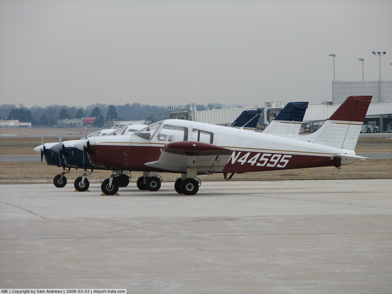
(Click on the photo to enlarge) |
 |
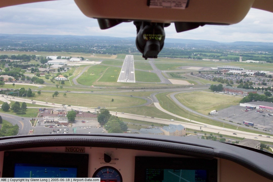
(Click on the photo to enlarge) |
Location & QuickFacts
| FAA Information Effective: | 2008-09-25 |
| Airport Identifier: | ABE |
| Airport Status: | Operational |
| Longitude/Latitude: | 075-26-25.4443W/40-39-08.5056N
-75.440401/40.652363 (Estimated) |
| Elevation: | 393 ft / 119.79 m (Surveyed) |
| Land: | 2629 acres |
| From nearest city: | 3 nautical miles NE of Allentown, PA |
| Location: | Lehigh County, PA |
| Magnetic Variation: | 12W (2005) |
Owner & Manager
| Ownership: | Publicly owned |
| Owner: | Lehigh Northampton A Auth |
| Address: | 3311 Airport Rd
Allentown, PA 18109-3040 |
| Phone number: | 610-266-6000 |
| Manager: | George Doughty |
| Address: | 3311 Airport Rd
Allentown, PA 18109-3040 |
| Phone number: | 610-266-6000 |
Airport Operations and Facilities
| Airport Use: | Open to public |
| Wind indicator: | Yes |
| Segmented Circle: | No |
| Control Tower: | Yes |
| Lighting Schedule: | DUSK-DAWN |
| Beacon Color: | Clear-Green (lighted land airport) |
| Landing fee charge: | Yes |
| Sectional chart: | New York |
| Region: | AEA - Eastern |
| Boundary ARTCC: | ZNY - New York |
| Tie-in FSS: | IPT - Williamsport |
| FSS on Airport: | No |
| FSS Toll Free: | 1-800-WX-BRIEF |
| NOTAMs Facility: | ABE (NOTAM-d service avaliable) |
| Certification type/date: | I C S 05/1973 |
| Federal Agreements: | NGVYH3 |
Airport Communications
Airport Services
| Fuel available: | 100LLA |
| Airframe Repair: | MAJOR |
| Power Plant Repair: | MAJOR |
| Bottled Oxygen: | NONE |
| Bulk Oxygen: | HIGH/LOW |
Runway Information
Runway 06/24
| Dimension: | 7600 x 150 ft / 2316.5 x 45.7 m |
| Surface: | ASPH, Good Condition |
| Surface Treatment: | Saw-cut or plastic Grooved |
| Weight Limit: | Single wheel: 75000 lbs.
Dual wheel: 209000 lbs.
Dual tandem wheel: 370000 lbs. |
| Edge Lights: | High |
| |
Runway 06 |
Runway 24 |
| Longitude: | 075-27-02.2730W | 075-25-45.3500W |
| Latitude: | 40-38-49.1360N | 40-39-36.1300N |
| Elevation: | 393.00 ft | 381.00 ft |
| Alignment: | 51 | 127 |
| ILS Type: | ILS
| ILS/DME
|
| Traffic Pattern: | Left | Left |
| Markings: | Precision instrument, Good Condition | Precision instrument, Good Condition |
| Crossing Height: | 48.00 ft | 60.00 ft |
| Displaced threshold: | 0.00 ft | 500.00 ft |
| VASI: | 4-light PAPI on left side | 4-light PAPI on left side |
| Visual Glide Angle: | 3.00° | 3.00° |
| RVR Equipment: | touchdown, rollout | touchdown, rollout |
| Approach lights: | MALSR | |
| Runway End Identifier: | | Yes |
| Centerline Lights: | Yes | Yes |
| Obstruction: | , 50:1 slope to clear | 20 ft road, 361.0 ft from runway, 479 ft right of centerline, 8:1 slope to clear
APCH RATIO 43:1 TO DSPLCD THLD. |
| Decleard distances: | Take off run available 7600.00 ft
Take off distance available 7600.00 ft
Actual stop distance available 7600.00 ft
Landing distance available 7600.00 ft
| Take off run available 7600.00 ft
Take off distance available 7600.00 ft
Actual stop distance available 7600.00 ft
Landing distance available 7100.00 ft
|
|
Runway 13/31
| Dimension: | 5797 x 150 ft / 1766.9 x 45.7 m |
| Surface: | ASPH, Good Condition |
| Surface Treatment: | Saw-cut or plastic Grooved |
| Weight Limit: | Single wheel: 75000 lbs.
Dual wheel: 161000 lbs.
Dual tandem wheel: 290000 lbs. |
| Edge Lights: | High |
| |
Runway 13 |
Runway 31 |
| Longitude: | 075-26-59.1210W | 075-25-56.0490W |
| Latitude: | 40-39-18.6900N | 40-38-47.4990N |
| Elevation: | 383.00 ft | 380.00 ft |
| Alignment: | 123 | 127 |
| ILS Type: | ILS
| |
| Traffic Pattern: | Left | Left |
| Markings: | Precision instrument, Good Condition | Non-precision instrument, Good Condition |
| Crossing Height: | 0.00 ft | 45.00 ft |
| VASI: | | 4-box on left side |
| Visual Glide Angle: | 0.00° | 3.00° |
| Approach lights: | MALSR | |
| Runway End Identifier: | | Yes |
| Centerline Lights: | No | |
| Obstruction: | , 50:1 slope to clear | 25 ft pole, 280.0 ft from runway, 425 ft right of centerline, 3:1 slope to clear |
| Decleard distances: | Take off run available 5797.00 ft
Take off distance available 5797.00 ft
Actual stop distance available 5797.00 ft
Landing distance available 5797.00 ft
| Take off run available 5797.00 ft
Take off distance available 5797.00 ft
Actual stop distance available 5797.00 ft
Landing distance available 5797.00 ft
|
|
Radio Navigation Aids
| ID |
Type |
Name |
Ch |
Freq |
Var |
Dist |
| UKT | NDB | Quakertown | | 208.00 | 12W | 15.2 nm |
| LQX | NDB | Carbon | | 339.00 | 12W | 17.4 nm |
| DYL | NDB | Doylestown | | 237.00 | 10W | 24.0 nm |
| NXX | NDB | Willow Grove | | 388.00 | 12W | 30.9 nm |
| HXM | NDB | Humbolt | | 366.00 | 10W | 32.4 nm |
| ING | NDB | Ambler | | 275.00 | 11W | 32.4 nm |
| CYE | NDB | Crystal Lake | | 410.00 | 11W | 38.0 nm |
| CAT | NDB | Chatham | | 254.00 | 11W | 46.4 nm |
| NXX | TACAN | Willow Grove | 061X | | 10W | 30.6 nm |
| HZL | VOR | Hazleton | | 109.40 | 09W | 36.7 nm |
| PNE | VOR | North Philadelphia | | 112.00 | 10W | 39.6 nm |
| ETX | VOR/DME | East Texas | 039X | 110.20 | 09W | 11.9 nm |
| CKZ | VOR/DME | Pennridge | 025Y | 108.85 | 12W | 17.2 nm |
| BWZ | VOR/DME | Broadway | 089X | 114.20 | 11W | 29.5 nm |
| SBJ | VOR/DME | Solberg | 076X | 112.90 | 10W | 32.1 nm |
| STW | VOR/DME | Stillwater | 033X | 109.60 | 11W | 33.2 nm |
| ARD | VOR/DME | Yardley | 019X | 108.20 | 10W | 34.2 nm |
| FJC | VORTAC | Allentown | 122X | 117.50 | 10W | 4.5 nm |
| PTW | VORTAC | Pottstown | 112X | 116.50 | 09W | 26.4 nm |
| LVZ | VORTAC | Wilkes-barre | 053X | 111.60 | 10W | 39.0 nm |
| MXE | VORTAC | Modena | 079X | 113.20 | 09W | 45.4 nm |
| SAX | VORTAC | Sparta | 104X | 115.70 | 11W | 48.0 nm |
| LHY | VORTAC | Lake Henry | 045X | 110.80 | 10W | 49.5 nm |
| PHL | VOT | Philadelphia Intl | | 109.80 | | 47.9 nm |
Remarks
- TPA 1400 FT MSL (1006 FT AGL) RECIPROCATING PROPS; 2000 FT MSL (1606 FT AGL) TURBINE POWERED ACFT.
- TWY B SOUTH OF TWY G RESTRD TO ACRFT WITH WINGSPAN 118 FT OR LESS
- TWY E NORTH OF RY 06/24, IN VERY POOR COND WITH SECTIONS OF BROKEN PAVEMENT, RSTD TO MAX ACFT WT 12500 LBS.
- TWY J RESTRD TO ACRFT WITH WINGSPAN 118 FT OR LESS
- (RWY LENGTH SOURCE, RWY 06/24) NGS VALIDATED 17 FEB 2006.
- MIL ACFT PLAN TO PARK & REFUEL ON FBO APRON W OF RY 13/31 & S OF TWY A.
- BIRDS; GROUNDHOGS & DEER ON & INVOF ARPT.
- FLIGHT NOTIFICATION SERVICE (ADCUS) AVBL - 2 HR PPR.
- TWY C RESTRD TO MAXIMUM ACFT WEIGHT 12500 LBS.
- NOISE ABATEMENT PROCEDURES FOR TURBOJET POWERED ACFT IN EFFECT; PREFERENTIAL RY 06/24.
- RY 06 & 24 FLY RY HEADING UNTIL 2000 FT.
- RY 6 13 & 24 DEPS BE ADVISED THAT DEPS ARE OVER A NOISE SENSITIVE AREA.
- RY 31 TURBOJET DEPS TURN RIGHT HEADING 360 DEGS UNTIL 2000 FT MSL.
Images and information placed above are from
http://www.airport-data.com/airport/ABE/
We thank them for the data!
| General Info
|
| Country |
United States
|
| State |
PENNSYLVANIA
|
| FAA ID |
ABE
|
| Latitude |
40-39-08.506N
|
| Longitude |
075-26-25.446W
|
| Elevation |
394 feet
|
| Near City |
ALLENTOWN
|
We don't guarantee the information is fresh and accurate. The data may
be wrong or outdated.
For more up-to-date information please refer to other sources.
|
|