 |
|
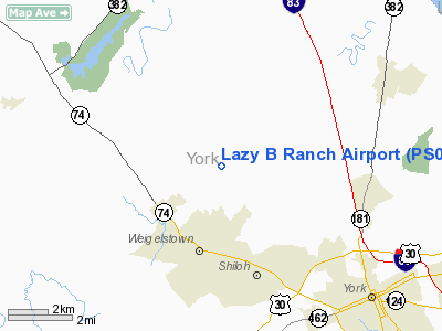
Location & QuickFacts
| FAA Information Effective: | 2008-09-25 |
| Airport Identifier: | PS08 |
| Airport Status: | Operational |
| Longitude/Latitude: | 076-48-59.8900W/40-01-21.3460N
-76.816636/40.022596 (Estimated) |
| Elevation: | 450 ft / 137.16 m (Estimated) |
| Land: | 24 acres |
| From nearest city: | 3 nautical miles E of Dover, PA |
| Location: | York County, PA |
| Magnetic Variation: | 10W (1985) |
Owner & Manager
| Ownership: | Privately owned |
| Owner: | Irvin L. Baughman |
| Address: | 1400 Second Avenue
York, PA 17403 |
| Phone number: | 717-854-7411 |
| Manager: | Irvin L. Baughman |
| Address: | 1400 Second Avenue
York, PA 17403 |
| Phone number: | 717-292-7029 |
Airport Operations and Facilities
| Airport Use: | Private |
| Wind indicator: | Yes |
| Segmented Circle: | No |
| Control Tower: | No |
| Lighting Schedule: | RDO-CTL
FOR LIRL RY 05/23 KEY 122.9 5 TIMES. |
| Landing fee charge: | No |
| Sectional chart: | New York |
| Region: | AEA - Eastern |
| Boundary ARTCC: | ZNY - New York |
| Tie-in FSS: | IPT - Williamsport |
| FSS Toll Free: | 1-800-WX-BRIEF |
Runway Information
Runway 05/23
| Dimension: | 2600 x 100 ft / 792.5 x 30.5 m |
| Surface: | TURF, Good Condition |
| Edge Lights: | Low |
| |
Runway 05 |
Runway 23 |
| Traffic Pattern: | Left | Right |
|
Radio Navigation Aids
| ID |
Type |
Name |
Ch |
Freq |
Var |
Dist |
| EUD | NDB | York | | 254.00 | 11W | 6.8 nm |
| BZJ | NDB | Bellgrove | | 328.00 | 10W | 27.6 nm |
| APG | NDB | Aberdeen | | 349.00 | 11W | 44.0 nm |
| FND | NDB | Ellicott | | 371.00 | 11W | 44.2 nm |
| IUB | NDB | Institute | | 404.00 | 08W | 45.1 nm |
| MTN | NDB | Martin | | 342.00 | 11W | 47.9 nm |
| MTN | TACAN | Martin | 068X | | 11W | 45.6 nm |
| FDK | VOR | Frederick | | 109.00 | 08W | 44.9 nm |
| PPM | VOR/DME | Phillips | 021X | 108.40 | 09W | 44.8 nm |
| HAR | VORTAC | Harrisburg | 072X | 112.50 | 10W | 20.4 nm |
| LRP | VORTAC | Lancaster | 120X | 117.30 | 09W | 24.9 nm |
| EMI | VORTAC | Westminster | 126X | 117.90 | 08W | 32.6 nm |
| RAV | VORTAC | Ravine | 093X | 114.60 | 11W | 33.4 nm |
| SEG | VORTAC | Selinsgrove | 041X | 110.40 | 08W | 46.3 nm |
| MDT | VOT | Harrisburg International | | 110.00 | | 10.8 nm |
Remarks
- PROVIDED A RIGHT TRAFFIC PATTERN IS USED FOR RWY 23.
Images and information placed above are from
http://www.airport-data.com/airport/PS08/
We thank them for the data!
| General Info
|
| Country |
United States
|
| State |
PENNSYLVANIA
|
| FAA ID |
PS08
|
| Latitude |
40-01-21.346N
|
| Longitude |
076-48-59.890W
|
| Elevation |
450 feet
|
| Near City |
DOVER
|
We don't guarantee the information is fresh and accurate. The data may
be wrong or outdated.
For more up-to-date information please refer to other sources.
|
|


