 |
|
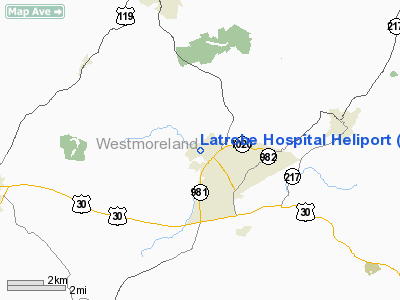
Latrobe Hospital Heliport |
Location & QuickFacts
| FAA Information Effective: | 2008-09-25 |
| Airport Identifier: | PA24 |
| Airport Status: | Operational |
| Longitude/Latitude: | 079-23-37.0000W/40-19-13.0000N
-79.393611/40.320278 (Estimated) |
| Elevation: | 1039 ft / 316.69 m (Surveyed) |
| Land: | 0 acres |
| From nearest city: | 1 nautical miles W of Latrobe, PA |
| Location: | Westmoreland County, PA |
| Magnetic Variation: | 08W (1985) |
Owner & Manager
| Ownership: | Privately owned |
| Owner: | Latrobe Hospital |
| Address: | 121 W Second Ave
Latrobe, PA 15650-1096 |
| Phone number: | 412-537-1000 |
| Manager: | David M. Hanig |
| Address: | 121 W Second Ave
Latrobe, PA 15650-1096 |
| Phone number: | 412-537-1000 |
Airport Operations and Facilities
| Airport Use: | Private
MEDICAL USE ONLY. |
| Wind indicator: | Yes |
| Segmented Circle: | No |
| Control Tower: | No |
| Landing fee charge: | No |
| Sectional chart: | Detroit |
| Region: | AEA - Eastern |
| Boundary ARTCC: | ZOB - Cleveland |
| Tie-in FSS: | AOO - Altoona |
| FSS on Airport: | No |
| FSS Toll Free: | 1-800-WX-BRIEF |
Runway Information
Helipad H1
| Dimension: | 75 x 75 ft / 22.9 x 22.9 m |
| Surface: | ASPH, |
| |
Runway H1 |
Runway |
| Traffic Pattern: | Left | Left |
|
Radio Navigation Aids
| ID |
Type |
Name |
Ch |
Freq |
Var |
Dist |
| BHU | NDB | Benje | | 382.00 | 07W | 6.5 nm |
| MKP | NDB | Mc Keesport | | 287.00 | 07W | 17.9 nm |
| INP | NDB | Indiana | | 242.00 | 08W | 24.0 nm |
| SYS | NDB | Stoystown | | 209.00 | 08W | 26.0 nm |
| VV | NDB | Camor | | 299.00 | 08W | 30.9 nm |
| PNU | NDB | Washington County | | 255.00 | 08W | 36.8 nm |
| AOO | VOR | Altoona | | 108.80 | 07W | 49.9 nm |
| AGC | VOR/DME | Allegheny | 037X | 110.00 | 09W | 29.8 nm |
| REC | VOR/DME | Revloc | 043X | 110.60 | 09W | 32.6 nm |
| GRV | VOR/DME | Grantsville | 070X | 112.30 | 06W | 44.1 nm |
| CIP | VOR/DME | Clarion | 076X | 112.90 | 06W | 49.7 nm |
| IHD | VORTAC | Indian Head | 019X | 108.20 | 06W | 20.9 nm |
| JST | VORTAC | Johnstown | 077X | 113.00 | 06W | 25.6 nm |
| MMJ | VORTAC | Montour | 057X | 112.00 | 08W | 38.0 nm |
| EWC | VORTAC | Ellwood City | 105X | 115.80 | 08W | 48.1 nm |
Remarks
- PRVDD 45/225 DEG INGRESS/EGRESS ROUTES ADHERED TO; LETTER OF AGREEMENT WITH WESTMORELAND COUNTY ACTC; TREE TO SW LOWERED/REMOVED.
Images and information placed above are from
http://www.airport-data.com/airport/PA24/
We thank them for the data!
| General Info
|
| Country |
United States
|
| State |
PENNSYLVANIA
|
| FAA ID |
PA24
|
| Latitude |
40-19-10.250N
|
| Longitude |
079-23-43.133W
|
| Elevation |
1040 feet
|
| Near City |
LATROBE
|
We don't guarantee the information is fresh and accurate. The data may
be wrong or outdated.
For more up-to-date information please refer to other sources.
|
|


