|
|
| Lancaster Airport |
| IATA: LNS – ICAO: KLNS |
| Summary |
| Airport type |
Public |
| Owner |
Lancaster Airport Authority |
| Location |
Lancaster, Pennsylvania |
| Elevation AMSL |
403 ft / 122.8 m |
| Coordinates |
40°07′18″N 76°17′46″W / 40.12167°N 76.29611°W / 40.12167; -76.29611 |
| Runways |
| Direction |
Length |
Surface |
| ft |
m |
| 8/26 |
6,934 |
2,113 |
Asphalt/Grooved |
| 13/31 |
4,102 |
1,250 |
Asphalt |
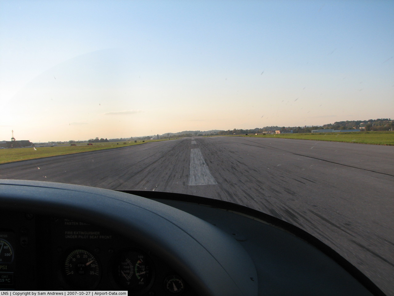
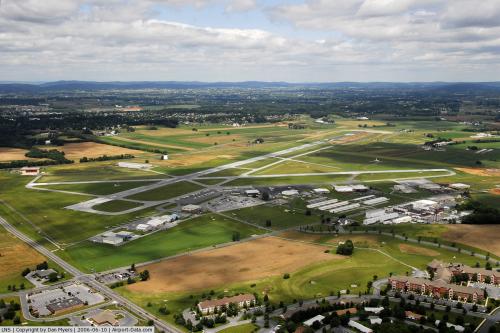
Looking down runway 31. The control tower and the VOR are seen on the right. The main hangers and terminal are seen in the left. A small single engine aircraft is seen on taxiway A (closest to the end of the runway.)
- There is also a Lancaster Airport (Texas), plus several other airports serving cities of Lancaster in other states.
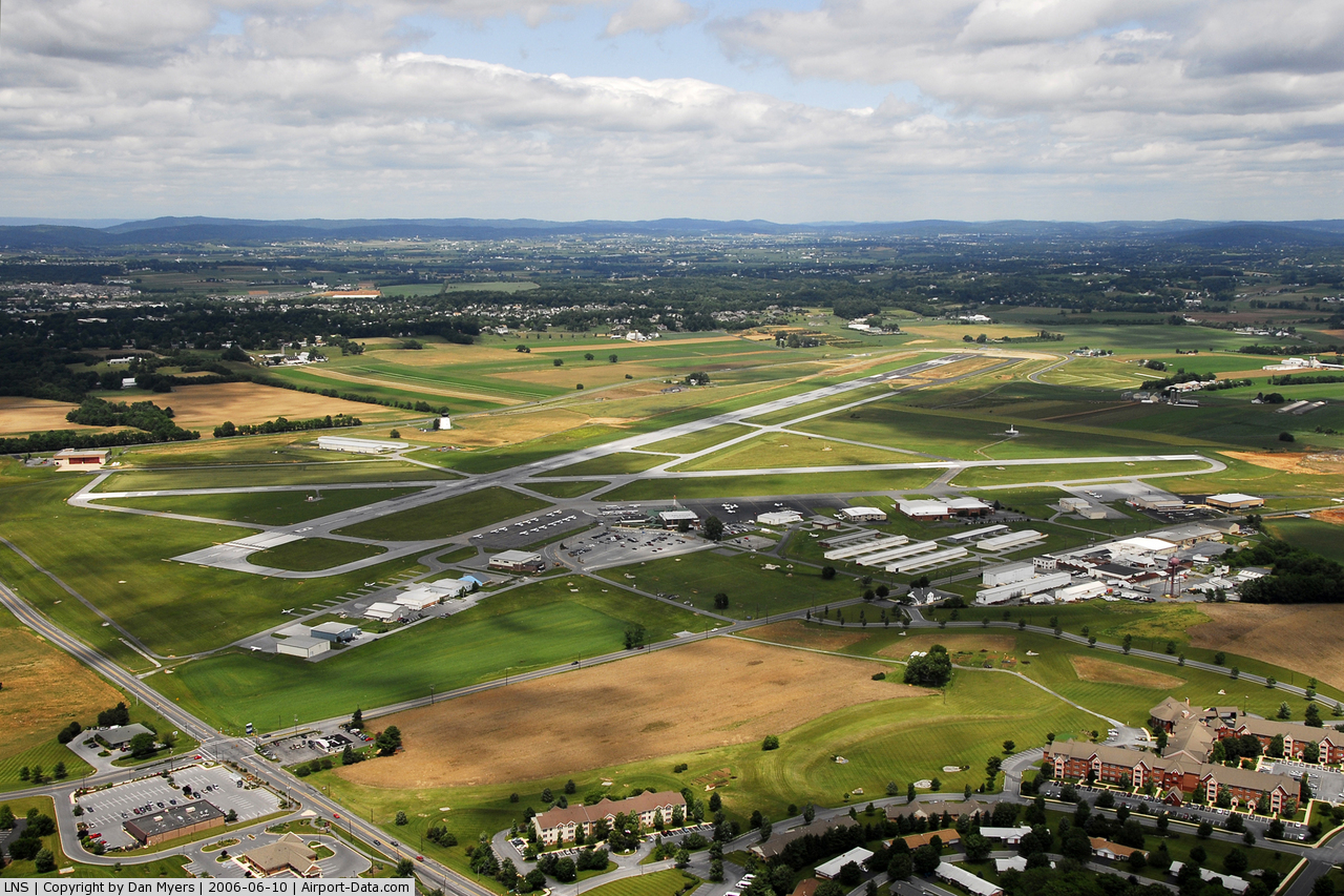
Lancaster Airport (IATA: LNS, ICAO: KLNS) is a public airport located four miles (6 km) north of the central business district (CBD) of Lancaster, a city in Lancaster County, Pennsylvania, USA. The airport covers 850 acres (344 ha) and has two runways. It is mostly used for general aviation but is also served by one commercial airline and one charter airline. Service is subsidized by the Essential Air Service program. Airlines and destinations
| Airlines |
Destinations |
| Cape Air |
Baltimore |
| Southwest |
Orlando (Charter by Boscov's Travel) |
Businesses
In addition to hosting a large number of general aviation aircraft, Lancaster Airport is also host to a variety of different businesses. There are flight schools, planes for charter, aircraft rides, helicopter rides, hot air balloon rides, aircraft maintenance shops, a restaurant, and a gift shop. It provides many services to the pilots who call Lancaster their home airport and also to those in the surrounding community.
Flight Schools
- Aero-Tech Services, Inc.
- Henry Weber Aircraft Dist.
- Dutch Country Helicopters
- Lancaster Helicopters
Charters
- Aero-Tech Services, Inc.
- AirNet, Inc.
- Dutch Country Helicopters, Ltd.
- Henry Weber Aircraft Dist.
- Tower Aviation, Inc.
- Venture Jets, Inc.
Aircraft Maintenance
- Airways, Inc.
- Henry Weber Aircraft Dist.
- Lancaster Avionics, Inc.
- Sensenich Propeller Service.
- Tower Aviation
Miscellaneous Operations
- Fiorentino's Bar & Grill - A restaurant with a runway and ramp view.
- Airways, Inc. - A pilot and gift shop for pilots and enthusiasts alike.
- Rental Cars - Hertz and Avis
The above content comes from Wikipedia and is published under free licenses – click here to read more.
 |
(Click on the photo to enlarge) |
 |
(Click on the photo to enlarge) |
 |
(Click on the photo to enlarge) |
 |
(Click on the photo to enlarge) |
Location & QuickFacts
| FAA Information Effective: | 2008-09-25 |
| Airport Identifier: | LNS |
| Airport Status: | Operational |
| Longitude/Latitude: | 076-17-45.9520W/40-07-18.1750N
-76.296098/40.121715 (Estimated) |
| Elevation: | 403 ft / 122.83 m (Surveyed) |
| Land: | 850 acres |
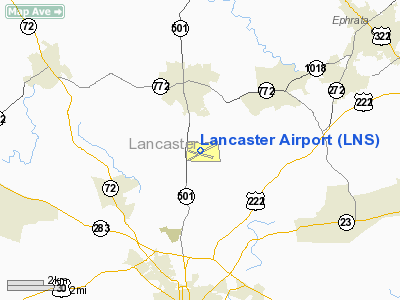
| From nearest city: | 4 nautical miles N of Lancaster, PA |
| Location: | Lancaster County, PA |
| Magnetic Variation: | 09W (1965) |
Owner & Manager
| Ownership: | Publicly owned |
| Owner: | Lancaster Arpt Authority |
| Address: | 500 Airport Rd Suite G
Lititz, PA 17543-9340 |
| Phone number: | 717-569-1221 |
| Manager: | David F Eberly |
| Address: | 500 Airport Rd Suite G
Lititz, PA 17543-9340 |
| Phone number: | 717-569-1221 |
Airport Operations and Facilities
| Airport Use: | Open to public |
| Wind indicator: | Yes |
| Segmented Circle: | No |
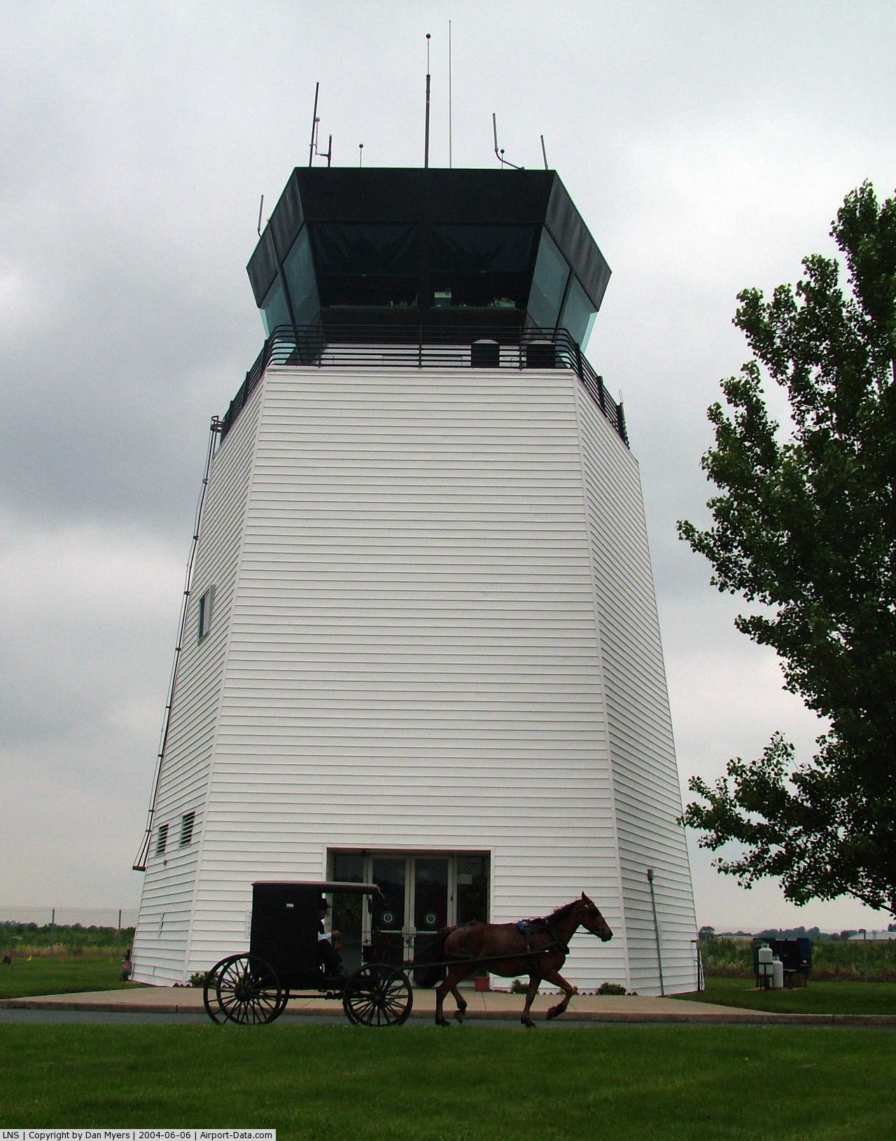
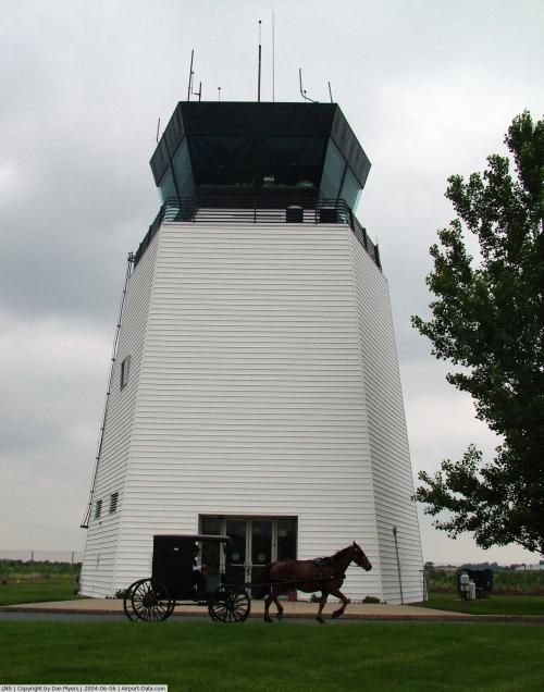
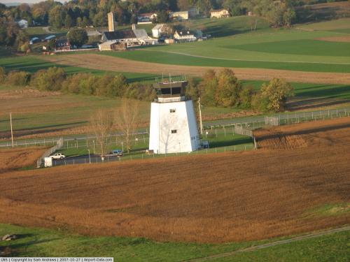
| Control Tower: | Yes |
| Lighting Schedule: | DUSK-DAWN
WHEN ATCT CLSD ACTVT HIRL RY 08/26; MALSR RY 08; MIRL 13/31; REIL RY 31 & TWY LGTS - CTAF. |
| Beacon Color: | Clear-Green (lighted land airport) |
| Landing fee charge: | No |
| Sectional chart: | New York |
| Region: | AEA - Eastern |
| Traffic Pattern Alt: | 1000 ft |
| Boundary ARTCC: | ZNY - New York |
| Tie-in FSS: | IPT - Williamsport |
| FSS on Airport: | No |
| FSS Toll Free: | 1-800-WX-BRIEF |
| NOTAMs Facility: | LNS (NOTAM-d service avaliable) |
| Certification type/date: | II A S 06/198
PPR 24 HRS FOR ACR OPNS WITH MORE THAN 30 PSGR SEATS; CALL AMGR (717) 569-1221. |
| Federal Agreements: | NGHY |
Airport Communications
| CTAF: | 120.900 |
| Unicom: | 122.950 |
Airport Services
| Fuel available: | 100LLA |
| Airframe Repair: | MAJOR |
| Power Plant Repair: | MAJOR |
| Bottled Oxygen: | LOW |
Runway Information
Runway 08/26
| Dimension: | 6934 x 150 ft / 2113.5 x 45.7 m |
| Surface: | ASPH, Good Condition |
| Surface Treatment: | Saw-cut or plastic Grooved |
| Weight Limit: | Single wheel: 65000 lbs.
Dual wheel: 92000 lbs.
Dual tandem wheel: 146000 lbs. |
| Edge Lights: | High |
| |
Runway 08 |
Runway 26 |
| Longitude: | 076-18-14.5900W | 076-16-51.8500W |
| Latitude: | 40-07-11.7400N | 40-07-37.4300N |
| Elevation: | 396.00 ft | 375.00 ft |
| Alignment: | 68 | 127 |
| ILS Type: | ILS
| |
| Traffic Pattern: | Left | Left |
| Markings: | Precision instrument, Poor Condition
THLD MARKINGS FADED. | Non-precision instrument, Good Condition |
| Crossing Height: | 0.00 ft | 47.00 ft |
| Displaced threshold: | 200.00 ft | 55.00 ft |
| VASI: | | 4-light PAPI on left side |
| Visual Glide Angle: | 0.00° | 3.00° |
| Approach lights: | MALSR | |
| Obstruction: | 7 ft road, 273.0 ft from runway, 55 ft right of centerline, 9:1 slope to clear
RWY 08 / RWY 08 APCH RATIO 50:1 TO DSPLCD THR. | , 50:1 slope to clear
50:1 TO DISPLACED THRESHOLD |
| Decleard distances: | Take off run available 6934.00 ft
Take off distance available 6934.00 ft
Actual stop distance available 6475.00 ft
Landing distance available 6275.00 ft
| Take off run available 6934.00 ft
Take off distance available 6934.00 ft
Actual stop distance available 6234.00 ft
Landing distance available 5775.00 ft
|
|
Runway 13/31
| Dimension: | 4102 x 100 ft / 1250.3 x 30.5 m |
| Surface: | ASPH, Good Condition |
| Weight Limit: | Single wheel: 65000 lbs.
Dual wheel: 92000 lbs.
Dual tandem wheel: 146000 lbs. |
| Edge Lights: | Medium |
| |
Runway 13 |
Runway 31 |
| Longitude: | 076-18-13.6820W | 076-17-27.6040W |
| Latitude: | 40-07-23.3740N | 40-07-03.5900N |
| Elevation: | 394.00 ft | 400.00 ft |
| Alignment: | 119 | 127 |
| Traffic Pattern: | Left | Left |
| Markings: | Basic, Fair Condition | Non-precision instrument, Fair Condition |
| Crossing Height: | 0.00 ft | 37.00 ft |
| VASI: | | 4-box on left side |
| Visual Glide Angle: | 0.00° | 3.00° |
| Runway End Identifier: | | Yes |
| Obstruction: | 54 ft tree, 1538.0 ft from runway, 292 ft right of centerline, 24:1 slope to clear | , 50:1 slope to clear |
| Decleard distances: | Take off run available 4102.00 ft
Take off distance available 4102.00 ft
Actual stop distance available 4102.00 ft
Landing distance available 4102.00 ft
| Take off run available 4102.00 ft
Take off distance available 4102.00 ft
Actual stop distance available 4102.00 ft
Landing distance available 4102.00 ft
|
|
Radio Navigation Aids
| ID |
Type |
Name |
Ch |
Freq |
Var |
Dist |
| BZJ | NDB | Bellgrove | | 328.00 | 10W | 22.3 nm |
| EUD | NDB | York | | 254.00 | 11W | 29.4 nm |
| APG | NDB | Aberdeen | | 349.00 | 11W | 36.3 nm |
| ING | NDB | Ambler | | 275.00 | 11W | 46.5 nm |
| LQX | NDB | Carbon | | 339.00 | 12W | 48.2 nm |
| UKT | NDB | Quakertown | | 208.00 | 12W | 49.3 nm |
| MTN | NDB | Martin | | 342.00 | 11W | 49.6 nm |
| MTN | TACAN | Martin | 068X | | 11W | 47.8 nm |
| ETX | VOR/DME | East Texas | 039X | 110.20 | 09W | 39.3 nm |
| PPM | VOR/DME | Phillips | 021X | 108.40 | 09W | 39.8 nm |
| CKZ | VOR/DME | Pennridge | 025Y | 108.85 | 12W | 49.0 nm |
| LRP | VORTAC | Lancaster | 120X | 117.30 | 09W | 0.2 nm |
| RAV | VORTAC | Ravine | 093X | 114.60 | 11W | 29.4 nm |
| MXE | VORTAC | Modena | 079X | 113.20 | 09W | 31.3 nm |
| PTW | VORTAC | Pottstown | 112X | 116.50 | 09W | 34.3 nm |
| HAR | VORTAC | Harrisburg | 072X | 112.50 | 10W | 37.1 nm |
| DQO | VORTAC | Dupont | 087X | 114.00 | 10W | 41.5 nm |
| SEG | VORTAC | Selinsgrove | 041X | 110.40 | 08W | 48.4 nm |
| EMI | VORTAC | Westminster | 126X | 117.90 | 08W | 49.1 nm |
| MDT | VOT | Harrisburg International | | 110.00 | | 21.9 nm |
Remarks
- RY LGTS AND MALSR UNMONITORED WHEN TWR CLSD.
- PREDATES ACT.
Images and information placed above are from
http://www.airport-data.com/airport/LNS/
We thank them for the data!
| General Info
|
| Country |
United States
|
| State |
PENNSYLVANIA
|
| FAA ID |
LNS
|
| Latitude |
40-07-18.175N
|
| Longitude |
076-17-45.952W
|
| Elevation |
403 feet
|
| Near City |
LANCASTER
|
We don't guarantee the information is fresh and accurate. The data may
be wrong or outdated.
For more up-to-date information please refer to other sources.
|
|