 |
|
| Lakehill Airport |
| IATA: none – ICAO: none – FAA LID: P09 |
| Summary |
| Airport type |
Public |
| Owner |
Private |
| Serves |
Mars, Pennsylvania |
| Location |
Adams Township, Pennsylvania |
| Elevation AMSL |
1,030 ft / 314 m |
| Coordinates |
40°42′25″N 080°01′49″W / 40.70694°N 80.03028°W / 40.70694; -80.03028 |
| Runways |
| Direction |
Length |
Surface |
| ft |
m |
| 5/23 |
2,850 |
869 |
Turf |
| Statistics (2008) |
| Aircraft operations |
26,280 |
| Based aircraft |
11 |
| Source: Federal Aviation Administration |
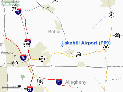
Lakehill Airport (FAA LID: P09), is a privately owned airport in Mars, Pennsylvania, USA. It is the smallest of the three airports located in Butler County. The other two are the Butler County Airport and the Butler Farm Show Airport.
The above content comes from Wikipedia and is published under free licenses – click here to read more.
Location & QuickFacts
| FAA Information Effective: | 2008-09-25 |
| Airport Identifier: | P09 |
| Airport Status: | Operational |
| Longitude/Latitude: | 080-01-49.2130W/40-42-25.2380N
-80.030337/40.707011 (Estimated) |
| Elevation: | 1030 ft / 313.94 m (Estimated) |
| Land: | 27 acres |
| From nearest city: | 1 nautical miles NW of Mars, PA |
| Location: | Butler County, PA |
| Magnetic Variation: | 08W (1985) |
Owner & Manager
| Ownership: | Privately owned |
| Owner: | James Harjer |
| Address: | 123 Harjer La
Mars, PA 16046 |
| Phone number: | 724-625-2996 |
| Manager: | James Harjer |
| Address: | 123 Harjer La
Mars, PA 16046 |
| Phone number: | 724-625-2996 |
Airport Operations and Facilities
| Airport Use: | Open to public |
| Wind indicator: | Yes |
| Segmented Circle: | No |
| Control Tower: | No |
| Landing fee charge: | No |
| Sectional chart: | Detroit |
| Region: | AEA - Eastern |
| Boundary ARTCC: | ZOB - Cleveland |
| Tie-in FSS: | AOO - Altoona |
| FSS on Airport: | No |
| FSS Toll Free: | 1-800-WX-BRIEF |
| NOTAMs Facility: | AOO (NOTAM-d service avaliable) |
Airport Communications
Airport Services
| Airframe Repair: | NONE |
| Power Plant Repair: | NONE |
Runway Information
Runway 05/23
| Dimension: | 2850 x 75 ft / 868.7 x 22.9 m
WIDTH VARIES FM 75 FT TO 100 FT. |
| Surface: | TURF, Fair Condition |
| |
Runway 05 |
Runway 23 |
| Longitude: | 080-01-54.3600W | 080-01-30.6600W |
| Latitude: | 40-42-18.2500N | 40-42-39.8900N |
| Traffic Pattern: | Left | Left |
| Displaced threshold: | 366.00 ft | 0.00 ft |
| Obstruction: | 30 ft trees, 25.0 ft from runway, 105 ft right of centerline
RY 05 HAS 19:1 TO 565 FT DSPLCD THLD. RY 05 HAS +53 FT TREES, DIST 970 FT, 153 FT LEFT, 18:1 BASED ON 565 FT DSPLCD THLD. | 53 ft trees, 245.0 ft from runway, 127 ft left of centerline, 4:1 slope to clear |
|
Radio Navigation Aids
| ID |
Type |
Name |
Ch |
Freq |
Var |
Dist |
| MKP | NDB | Mc Keesport | | 287.00 | 07W | 24.0 nm |
| UCP | NDB | Castle | | 272.00 | 09W | 25.8 nm |
| PNU | NDB | Washington County | | 255.00 | 08W | 34.3 nm |
| HBD | NDB | Hubbard | | 408.00 | 08W | 35.2 nm |
| BHU | NDB | Benje | | 382.00 | 07W | 40.0 nm |
| INP | NDB | Indiana | | 242.00 | 08W | 44.2 nm |
| TSO | NDB | Tolson | | 395.00 | 07W | 48.6 nm |
| FKL | VOR | Franklin | | 109.60 | 06W | 44.7 nm |
| AGC | VOR/DME | Allegheny | 037X | 110.00 | 09W | 25.8 nm |
| HLG | VOR/DME | Wheeling | 059X | 112.20 | 07W | 36.4 nm |
| CIP | VOR/DME | Clarion | 076X | 112.90 | 06W | 37.0 nm |
| EWC | VORTAC | Ellwood City | 105X | 115.80 | 08W | 10.9 nm |
| MMJ | VORTAC | Montour | 057X | 112.00 | 08W | 15.1 nm |
| YNG | VORTAC | Youngstown | 027X | 109.00 | 05W | 47.5 nm |
Remarks
- ARPT CLSD WHEN SNOW ON RY.
- RY 05/23 SOFT DURG WET & THAWING PERIODS.
- GROUND HOGS ON AND INVOF ARPT.
- BUILT BEFORE 1959
Images and information placed above are from
http://www.airport-data.com/airport/P09/
We thank them for the data!
| General Info
|
| Country |
United States
|
| State |
PENNSYLVANIA
|
| FAA ID |
P09
|
| Latitude |
40-42-25.238N
|
| Longitude |
080-01-49.213W
|
| Elevation |
1030 feet
|
| Near City |
MARS
|
We don't guarantee the information is fresh and accurate. The data may
be wrong or outdated.
For more up-to-date information please refer to other sources.
|
|


