 |
|
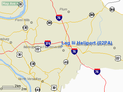
Location & QuickFacts
| FAA Information Effective: | 2008-09-25 |
| Airport Identifier: | 02PA |
| Airport Status: | Operational |
| Longitude/Latitude: | 079-46-12.0000W/40-26-18.0000N
-79.770000/40.438333 (Estimated) |
| Elevation: | 1070 ft / 326.14 m (Estimated) |
| Land: | 4 acres |
| From nearest city: | 0 nautical miles N of Monroeville, PA |
| Location: | Allegheny County, PA |
| Magnetic Variation: | 09W (1995) |
Owner & Manager
| Ownership: | Privately owned |
| Owner: | Louis A Grant Inc |
| Address: | 597 Davidson Rd
Pittsburgh, PA 15239 |
| Phone number: | 412-795-4000 |
| Manager: | Louis A Grant Jr |
| Address: | 597 Davidson Rd
Pittsburgh, PA 15239 |
| Phone number: | 412-795-4000 |
Airport Operations and Facilities
| Airport Use: | Private |
| Wind indicator: | Yes |
| Segmented Circle: | Yes |
| Control Tower: | No |
| Sectional chart: | Detroit |
| Region: | AEA - Eastern |
| Boundary ARTCC: | ZOB - Cleveland |
| Tie-in FSS: | AOO - Altoona |
| FSS on Airport: | No |
| FSS Toll Free: | 1-800-WX-BRIEF |
Runway Information
Helipad H1
| Dimension: | 60 x 50 ft / 18.3 x 15.2 m |
| Surface: | TURF-GRVL, |
| |
Runway H1 |
Runway |
| Traffic Pattern: | Left | Left |
|
Radio Navigation Aids
| ID |
Type |
Name |
Ch |
Freq |
Var |
Dist |
| MKP | NDB | Mc Keesport | | 287.00 | 07W | 5.0 nm |
| BHU | NDB | Benje | | 382.00 | 07W | 23.1 nm |
| PNU | NDB | Washington County | | 255.00 | 08W | 25.2 nm |
| VV | NDB | Camor | | 299.00 | 08W | 33.4 nm |
| INP | NDB | Indiana | | 242.00 | 08W | 34.2 nm |
| SYS | NDB | Stoystown | | 209.00 | 08W | 44.5 nm |
| UCP | NDB | Castle | | 272.00 | 09W | 45.8 nm |
| AGC | VOR/DME | Allegheny | 037X | 110.00 | 09W | 15.7 nm |
| HLG | VOR/DME | Wheeling | 059X | 112.20 | 07W | 38.1 nm |
| CIP | VOR/DME | Clarion | 076X | 112.90 | 06W | 44.9 nm |
| REC | VOR/DME | Revloc | 043X | 110.60 | 09W | 47.2 nm |
| MMJ | VORTAC | Montour | 057X | 112.00 | 08W | 19.6 nm |
| EWC | VORTAC | Ellwood City | 105X | 115.80 | 08W | 30.8 nm |
| IHD | VORTAC | Indian Head | 019X | 108.20 | 06W | 33.7 nm |
| JST | VORTAC | Johnstown | 077X | 113.00 | 06W | 43.5 nm |
Remarks
- PRVDD LARGEST CLASS OF HELICOPTERS SHOULD WEIGH LESS THAN 12500; IFR OPNS ARE NOT CONDUCTED; APPROPRIATE FENCING; MARKINGS; WINDSOCK ARE INSTALLED; & YOU ISURE ALL POTENTIAL NOISE ISSUES.
Images and information placed above are from
http://www.airport-data.com/airport/02PA/
We thank them for the data!
| General Info
|
| Country |
United States
|
| State |
PENNSYLVANIA
|
| FAA ID |
02PA
|
| Latitude |
40-27-47.260N
|
| Longitude |
079-46-08.160W
|
| Elevation |
1070 feet
|
| Near City |
MONROEVILLE
|
We don't guarantee the information is fresh and accurate. The data may
be wrong or outdated.
For more up-to-date information please refer to other sources.
|
|


