 |
|
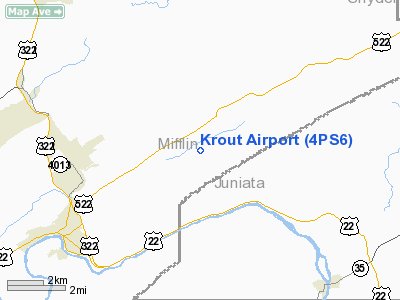
Location & QuickFacts
| FAA Information Effective: | 2008-09-25 |
| Airport Identifier: | 4PS6 |
| Airport Status: | Operational |
| Longitude/Latitude: | 077-29-00.9740W/40-38-12.2610N
-77.483604/40.636739 (Estimated) |
| Elevation: | 600 ft / 182.88 m (Estimated) |
| Land: | 25 acres |
| From nearest city: | 5 nautical miles SW of Lewistown, PA |
| Location: | Mifflin County, PA |
| Magnetic Variation: | 10W (1985) |
Owner & Manager
| Ownership: | Privately owned |
| Owner: | Raymond E. Krout |
| Address: | R-3, Box 224
Lewistown, PA 17044 |
| Phone number: | 717-543-5245 |
| Address: |
|
Airport Operations and Facilities
| Airport Use: | Private |
| Wind indicator: | Yes |
| Segmented Circle: | No |
| Control Tower: | No |
| Sectional chart: | Detroit |
| Region: | AEA - Eastern |
| Boundary ARTCC: | ZNY - New York |
| Tie-in FSS: | IPT - Williamsport |
| FSS Toll Free: | 1-800-WX-BRIEF |
Runway Information
Runway 08/26
| Dimension: | 1800 x 125 ft / 548.6 x 38.1 m |
| Surface: | TURF, |
| |
Runway 08 |
Runway 26 |
| Traffic Pattern: | Left | Left |
|
Radio Navigation Aids
| ID |
Type |
Name |
Ch |
Freq |
Var |
Dist |
| RV | NDB | Stroh | | 407.00 | 10W | 10.8 nm |
| BZJ | NDB | Bellgrove | | 328.00 | 10W | 44.2 nm |
| AOO | VOR | Altoona | | 108.80 | 07W | 41.9 nm |
| HAR | VORTAC | Harrisburg | 072X | 112.50 | 10W | 27.6 nm |
| PSB | VORTAC | Philipsburg | 102X | 115.50 | 10W | 28.6 nm |
| SEG | VORTAC | Selinsgrove | 041X | 110.40 | 08W | 28.8 nm |
| TON | VORTAC | Tyrone | 096X | 114.90 | 07W | 39.1 nm |
| RAV | VORTAC | Ravine | 093X | 114.60 | 11W | 40.7 nm |
| MIP | VORTAC | Milton | 029X | 109.20 | 09W | 43.9 nm |
| ETG | VORTAC | Keating | 107X | 116.00 | 10W | 45.9 nm |
| THS | VORTAC | St Thomas | 097X | 115.00 | 07W | 47.4 nm |
| MDT | VOT | Harrisburg International | | 110.00 | | 42.2 nm |
Images and information placed above are from
http://www.airport-data.com/airport/4PS6/
We thank them for the data!
| General Info
|
| Country |
United States
|
| State |
PENNSYLVANIA
|
| FAA ID |
4PS6
|
| Latitude |
40-38-12.261N
|
| Longitude |
077-29-00.974W
|
| Elevation |
600 feet
|
| Near City |
LEWISTOWN
|
We don't guarantee the information is fresh and accurate. The data may
be wrong or outdated.
For more up-to-date information please refer to other sources.
|
|


