 |
|
Location & QuickFacts
| FAA Information Effective: | 2008-09-25 |
| Airport Identifier: | 89PA |
| Airport Status: | Operational |
| Longitude/Latitude: | 079-37-41.1900W/40-27-58.2400N
-79.628108/40.466178 (Estimated) |
| Elevation: | 1195 ft / 364.24 m (Estimated) |
| Land: | 0 acres |
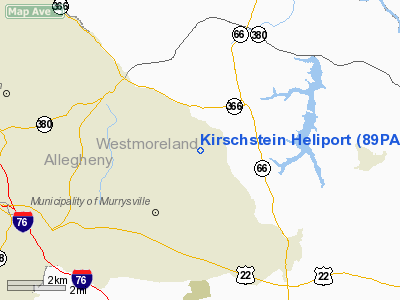
| From nearest city: | 5 nautical miles SW of Murrysville, PA |
| Location: | Westmoreland County, PA |
| Magnetic Variation: | 09W (1995) |
Owner & Manager
| Ownership: | Privately owned |
| Owner: | Alexander Waibel |
| Address: | 619 Windsor Avenue
Pittsburgh, PA 15221 |
| Phone number: | 412-351-5529 |
| Manager: | Alexander Waibel |
| Address: | 619 Windsor Avenue
Pittsburgh, PA 15221 |
| Phone number: | 412-351-5529 |
Airport Operations and Facilities
| Airport Use: | Private |
| Wind indicator: | Yes |
| Segmented Circle: | No |
| Control Tower: | No |
| Sectional chart: | Detroit |
| Region: | AEA - Eastern |
| Boundary ARTCC: | ZOB - Cleveland |
| Tie-in FSS: | AOO - Altoona |
| FSS on Airport: | No |
| FSS Toll Free: | 1-800-WX-BRIEF |
Runway Information
Helipad H1
| Dimension: | 26 x 26 ft / 7.9 x 7.9 m |
| Surface: | CONC, |
| |
Runway H1 |
Runway |
| Traffic Pattern: | Left | Left |
|
Radio Navigation Aids
| ID |
Type |
Name |
Ch |
Freq |
Var |
Dist |
| MKP | NDB | Mc Keesport | | 287.00 | 07W | 9.7 nm |
| BHU | NDB | Benje | | 382.00 | 07W | 17.2 nm |
| INP | NDB | Indiana | | 242.00 | 08W | 27.5 nm |
| PNU | NDB | Washington County | | 255.00 | 08W | 31.2 nm |
| VV | NDB | Camor | | 299.00 | 08W | 35.5 nm |
| SYS | NDB | Stoystown | | 209.00 | 08W | 39.8 nm |
| UCP | NDB | Castle | | 272.00 | 09W | 49.1 nm |
| AGC | VOR/DME | Allegheny | 037X | 110.00 | 09W | 22.0 nm |
| REC | VOR/DME | Revloc | 043X | 110.60 | 09W | 40.6 nm |
| CIP | VOR/DME | Clarion | 076X | 112.90 | 06W | 41.6 nm |
| HLG | VOR/DME | Wheeling | 059X | 112.20 | 07W | 44.8 nm |
| MMJ | VORTAC | Montour | 057X | 112.00 | 08W | 25.9 nm |
| IHD | VORTAC | Indian Head | 019X | 108.20 | 06W | 32.1 nm |
| EWC | VORTAC | Ellwood City | 105X | 115.80 | 08W | 34.3 nm |
| JST | VORTAC | Johnstown | 077X | 113.00 | 06W | 37.4 nm |
Remarks
- PRVDD NO IFR OPNS; CLEAR 8:1 APCHS ON HDGS 195-015 AND 285-105; INSTALLATION OF FENCING & SIGNS; NO HELICOPTERS MORE THAN 12000 LBS MGW.
Images and information placed above are from
http://www.airport-data.com/airport/89PA/
We thank them for the data!
| General Info
|
| Country |
United States
|
| State |
PENNSYLVANIA
|
| FAA ID |
89PA
|
| Latitude |
40-27-58.240N
|
| Longitude |
079-37-41.190W
|
| Elevation |
1195 feet
|
| Near City |
MURRYSVILLE
|
We don't guarantee the information is fresh and accurate. The data may
be wrong or outdated.
For more up-to-date information please refer to other sources.
|
|


