 |
|
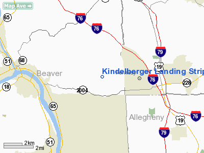
Kindelberger Landing Strip Airport |
Location & QuickFacts
| FAA Information Effective: | 2008-09-25 |
| Airport Identifier: | 24PA |
| Airport Status: | Operational |
| Longitude/Latitude: | 080-10-40.2170W/40-41-30.2390N
-80.177838/40.691733 (Estimated) |
| Elevation: | 1140 ft / 347.47 m (Estimated) |
| Land: | 63 acres |
| From nearest city: | 3 nautical miles E of Freedom, PA |
| Location: | Beaver County, PA |
| Magnetic Variation: | 08W (1985) |
Owner & Manager
| Ownership: | Privately owned |
| Owner: | Emil Kindelberger, Jr. |
| Address: | 1065 Blank Road
Freedom, PA 15042 |
| Phone number: | 724-774-7540 |
| Address: |
|
Airport Operations and Facilities
| Airport Use: | Private |
| Wind indicator: | Yes |
| Segmented Circle: | No |
| Control Tower: | No |
| Landing fee charge: | No |
| Sectional chart: | Detroit |
| Region: | AEA - Eastern |
| Boundary ARTCC: | ZOB - Cleveland |
| Tie-in FSS: | AOO - Altoona |
| FSS on Airport: | No |
| FSS Toll Free: | 1-800-WX-BRIEF |
Airport Services
| Airframe Repair: | NONE |
| Power Plant Repair: | NONE |
Runway Information
Runway 09/27
| Dimension: | 1515 x 110 ft / 461.8 x 33.5 m |
| Surface: | TURF, Poor Condition |
| |
Runway 09 |
Runway 27 |
| Traffic Pattern: | Left | Left |
| Obstruction: | 5 ft fence, 75 ft right of centerline | 40 ft pline, 10.0 ft from runway, 110 ft left of centerline |
|
Radio Navigation Aids
| ID |
Type |
Name |
Ch |
Freq |
Var |
Dist |
| UCP | NDB | Castle | | 272.00 | 09W | 22.7 nm |
| MKP | NDB | Mc Keesport | | 287.00 | 07W | 27.2 nm |
| HBD | NDB | Hubbard | | 408.00 | 08W | 32.0 nm |
| PNU | NDB | Washington County | | 255.00 | 08W | 32.9 nm |
| TSO | NDB | Tolson | | 395.00 | 07W | 41.8 nm |
| BHU | NDB | Benje | | 382.00 | 07W | 45.6 nm |
| CFX | NDB | Cadiz | | 239.00 | 07W | 47.0 nm |
| FKL | VOR | Franklin | | 109.60 | 06W | 47.2 nm |
| AGC | VOR/DME | Allegheny | 037X | 110.00 | 09W | 25.6 nm |
| HLG | VOR/DME | Wheeling | 059X | 112.20 | 07W | 31.5 nm |
| CIP | VOR/DME | Clarion | 076X | 112.90 | 06W | 42.6 nm |
| EWC | VORTAC | Ellwood City | 105X | 115.80 | 08W | 8.2 nm |
| MMJ | VORTAC | Montour | 057X | 112.00 | 08W | 12.3 nm |
| YNG | VORTAC | Youngstown | 027X | 109.00 | 05W | 44.5 nm |
Remarks
Images and information placed above are from
http://www.airport-data.com/airport/24PA/
We thank them for the data!
| General Info
|
| Country |
United States
|
| State |
PENNSYLVANIA
|
| FAA ID |
24PA
|
| Latitude |
40-41-30.239N
|
| Longitude |
080-10-40.217W
|
| Elevation |
1140 feet
|
| Near City |
FREEDOM
|
We don't guarantee the information is fresh and accurate. The data may
be wrong or outdated.
For more up-to-date information please refer to other sources.
|
|


