 |
|
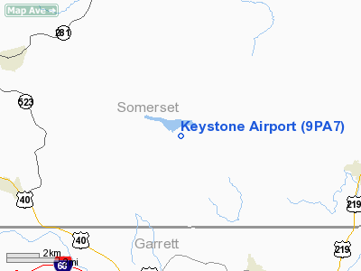
Location & QuickFacts
| FAA Information Effective: | 2008-09-25 |
| Airport Identifier: | 9PA7 |
| Airport Status: | Operational |
| Longitude/Latitude: | 079-12-40.0000W/39-46-22.0000N
-79.211111/39.772778 (Estimated) |
| Elevation: | 2531 ft / 771.45 m (Surveyed) |
| Land: | 0 acres |
| From nearest city: | 5 nautical miles SE of Fort Hill, PA |
| Location: | Somerset County, PA |
| Magnetic Variation: | 08W (1990) |
Owner & Manager
| Ownership: | Privately owned |
| Owner: | Mark Folk |
| Address: | Po Box 278
Springs, PA 15562 |
| Phone number: | 814-662-2711 |
| Manager: | Mark Folk |
| Address: | Po Box 278
Springs, PA 15562 |
| Phone number: | 814-662-2711 |
Airport Operations and Facilities
| Airport Use: | Private |
| Wind indicator: | Yes |
| Segmented Circle: | No |
| Control Tower: | No |
| Sectional chart: | Cincinnati |
| Region: | AEA - Eastern |
| Boundary ARTCC: | ZOB - Cleveland |
| Tie-in FSS: | AOO - Altoona |
| FSS on Airport: | No |
| FSS Toll Free: | 1-800-WX-BRIEF |
Runway Information
Runway 09/27
| Dimension: | 1825 x 35 ft / 556.3 x 10.7 m |
| Surface: | ASPH, |
| |
Runway 09 |
Runway 27 |
| Traffic Pattern: | Left | Left |
| Obstruction: | | 35 ft bldg, 300.0 ft from runway |
|
Radio Navigation Aids
| ID |
Type |
Name |
Ch |
Freq |
Var |
Dist |
| CBE | NDB | Cumberland | | 317.00 | 07W | 22.7 nm |
| SYS | NDB | Stoystown | | 209.00 | 08W | 23.2 nm |
| VV | NDB | Camor | | 299.00 | 08W | 25.5 nm |
| BHU | NDB | Benje | | 382.00 | 07W | 36.3 nm |
| MKP | NDB | Mc Keesport | | 287.00 | 07W | 43.7 nm |
| PNU | NDB | Washington County | | 255.00 | 08W | 49.2 nm |
| GRV | VOR/DME | Grantsville | 070X | 112.30 | 06W | 11.1 nm |
| ESL | VOR/DME | Kessel | 045X | 110.80 | 06W | 34.5 nm |
| AGC | VOR/DME | Allegheny | 037X | 110.00 | 09W | 48.8 nm |
| IHD | VORTAC | Indian Head | 019X | 108.20 | 06W | 13.9 nm |
| MGW | VORTAC | Morgantown | 053X | 111.60 | 05W | 32.7 nm |
| JST | VORTAC | Johnstown | 077X | 113.00 | 06W | 37.0 nm |
Remarks
- SNGL ENG ACFT ONLY; AVOID OVERFLYINGCAMPS; CHURCHES & RESIDENTIAL AREAS NEARBY.
Images and information placed above are from
http://www.airport-data.com/airport/9PA7/
We thank them for the data!
| General Info
|
| Country |
United States
|
| State |
PENNSYLVANIA
|
| FAA ID |
9PA7
|
| Latitude |
39-46-22.000N
|
| Longitude |
079-12-40.000W
|
| Elevation |
2531 feet
|
| Near City |
FORT HILL
|
We don't guarantee the information is fresh and accurate. The data may
be wrong or outdated.
For more up-to-date information please refer to other sources.
|
|


