 |
|
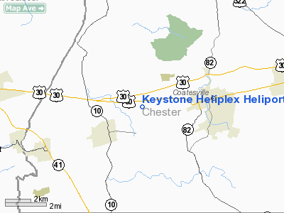
Keystone Heliplex Heliport |
Location & QuickFacts
| FAA Information Effective: | 2008-09-25 |
| Airport Identifier: | PN34 |
| Airport Status: | Operational |
| Longitude/Latitude: | 075-52-56.5000W/39-58-40.9000N
-75.882361/39.978028 (Estimated) |
| Elevation: | 642 ft / 195.68 m (Estimated) |
| Land: | 0 acres |
| From nearest city: | 2 nautical miles W of Coatsville, PA |
| Location: | Chester County, PA |
| Magnetic Variation: | () |
Owner & Manager
| Ownership: | Privately owned |
| Owner: | Keystone Helicopter Corp |
| Address: | 110 E. Stewart Huston Dr
Coatesville, PA 19320 |
| Phone number: | 610-883-4566 |
| Manager: | Chuck Dilabbio |
| Address: | 110 E. Stewart Huston Drive
Coatesville, PA 19320 |
| Phone number: | 610-883-4565 |
Airport Operations and Facilities
| Airport Use: | Private |
| Control Tower: | No |
| Sectional chart: | Washington |
| Region: | AEA - Eastern |
| Boundary ARTCC: | ZNY - New York |
| Responsible ARTCC: | ZNY - New York |
| Tie-in FSS: | IPT - Williamsport |
| FSS Toll Free: | 1-800-WX-BRIEF |
Runway Information
Helipad H1
| Dimension: | 41 x 41 ft / 12.5 x 12.5 m |
| Surface: | CONC, |
| |
Runway H1 |
Runway |
| Traffic Pattern: | Left | Left |
|
Radio Navigation Aids
| ID |
Type |
Name |
Ch |
Freq |
Var |
Dist |
| APG | NDB | Aberdeen | | 349.00 | 11W | 28.6 nm |
| ING | NDB | Ambler | | 275.00 | 11W | 28.9 nm |
| NXX | NDB | Willow Grove | | 388.00 | 12W | 36.2 nm |
| UKT | NDB | Quakertown | | 208.00 | 12W | 38.0 nm |
| DYL | NDB | Doylestown | | 237.00 | 10W | 41.0 nm |
| BZJ | NDB | Bellgrove | | 328.00 | 10W | 41.3 nm |
| EUD | NDB | York | | 254.00 | 11W | 46.0 nm |
| MTN | NDB | Martin | | 342.00 | 11W | 46.8 nm |
| RNB | NDB | Rainbow | | 363.00 | 11W | 48.2 nm |
| NXX | TACAN | Willow Grove | 061X | | 10W | 36.3 nm |
| MTN | TACAN | Martin | 068X | | 11W | 46.0 nm |
| PNE | VOR | North Philadelphia | | 112.00 | 10W | 40.7 nm |
| PPM | VOR/DME | Phillips | 021X | 108.40 | 09W | 33.5 nm |
| CKZ | VOR/DME | Pennridge | 025Y | 108.85 | 12W | 36.9 nm |
| ETX | VOR/DME | East Texas | 039X | 110.20 | 09W | 37.4 nm |
| ARD | VOR/DME | Yardley | 019X | 108.20 | 10W | 47.8 nm |
| MXE | VORTAC | Modena | 079X | 113.20 | 09W | 10.4 nm |
| LRP | VORTAC | Lancaster | 120X | 117.30 | 09W | 20.7 nm |
| PTW | VORTAC | Pottstown | 112X | 116.50 | 09W | 20.9 nm |
| DQO | VORTAC | Dupont | 087X | 114.00 | 10W | 22.1 nm |
| OOD | VORTAC | Woodstown | 075X | 112.80 | 10W | 33.7 nm |
| RAV | VORTAC | Ravine | 093X | 114.60 | 11W | 47.7 nm |
| ENO | VORTAC | Smyrna | 051X | 111.40 | 09W | 48.0 nm |
| FJC | VORTAC | Allentown | 122X | 117.50 | 10W | 49.1 nm |
| VCN | VORTAC | Cedar Lake | 099X | 115.20 | 10W | 49.9 nm |
| PHL | VOT | Philadelphia Intl | | 109.80 | | 30.1 nm |
| MDT | VOT | Harrisburg International | | 110.00 | | 42.6 nm |
Remarks
- 60 FT WATER TWR .32 NM SOUTH OF PAD.
- PVDD CLEAR 8:1 INGRESS/EGRESS; PAD IS MARKED; LIGHTED WINDSOCK; AND TAKE STEPS TO CONTROL VEHICULAR TRAFFIC AND PERSONS INVOF PAD.
Images and information placed above are from
http://www.airport-data.com/airport/PN34/
We thank them for the data!
| General Info
|
| Country |
United States
|
| State |
PENNSYLVANIA
|
| FAA ID |
PN34
|
| Latitude |
41-58-42.246N
|
| Longitude |
077-42-34.970W
|
| Elevation |
2245 feet
|
| Near City |
HARRISON VALLEY
|
We don't guarantee the information is fresh and accurate. The data may
be wrong or outdated.
For more up-to-date information please refer to other sources.
|
|


