 |
|
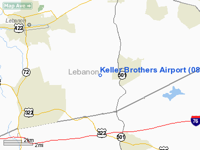
Location & QuickFacts
| FAA Information Effective: | 2008-09-25 |
| Airport Identifier: | 08N |
| Airport Status: | Operational |
| Longitude/Latitude: | 076-19-43.8430W/40-17-30.3320N
-76.328845/40.291759 (Estimated) |
| Elevation: | 550 ft / 167.64 m (Estimated) |
| Land: | 22 acres |
| From nearest city: | 5 nautical miles SE of Lebanon, PA |
| Location: | Lebanon County, PA |
| Magnetic Variation: | 11W (1985) |
Owner & Manager
| Ownership: | Privately owned |
| Owner: | Keller Bros Arpt Inc |
| Address: | 600 Rexmont Rd
Lebanon, PA 17042 |
| Phone number: | 717-949-2424 |
| Manager: | Daniel N Keller |
| Address: | 600 Rexmont Rd
Lebanon, PA 17042 |
| Phone number: | 717-949-2424 |
Airport Operations and Facilities
| Airport Use: | Open to public |
| Wind indicator: | No |
| Segmented Circle: | Yes |
| Control Tower: | No |
| Lighting Schedule: | RDO-CTL
ACTVT ROTG BCN; WIND INDICATOR LIGHT & LIRL RY 07/25 - 121.9. |
| Beacon Color: | Clear-Green (lighted land airport) |
| Landing fee charge: | No |
| Sectional chart: | New York |
| Region: | AEA - Eastern |
| Boundary ARTCC: | ZNY - New York |
| Tie-in FSS: | IPT - Williamsport |
| FSS on Airport: | No |
| FSS Toll Free: | 1-800-WX-BRIEF
FILE IFR & PICKUP CLNC TOLL FREE CALL 800-932-0712. |
| NOTAMs Facility: | IPT (NOTAM-d service avaliable) |
Airport Communications
Airport Services
| Airframe Repair: | NONE |
| Power Plant Repair: | NONE |
| Bottled Oxygen: | NONE |
| Bulk Oxygen: | NONE |
Runway Information
Runway 07/25
| Dimension: | 2635 x 120 ft / 803.1 x 36.6 m |
| Surface: | TURF, Good Condition |
| Edge Lights: | Non-standard lighting system
NSTD LIRL; RY ENDS IDENTIFIED BY 2 STROBE LGTS & NSTD THLD LGT FIXTURES. |
| |
Runway 07 |
Runway 25 |
| Traffic Pattern: | Left | Left |
| Displaced threshold: | 275.00 ft
THRESH DSPLCD: & 25 DSPLCD THLDS NOT LGTD; MARKED WITH 2 YELLOW BARELS EACH SIDE OF RYS AND THREE (3) WHITE LENS RY LGTS ON EACH SIDE OF RYS. | 600.00 ft |
| Obstruction: | 40 ft tree, 385.0 ft from runway, 151 ft left of centerline, 9:1 slope to clear
RY 07 HAS APCH SLOPE 16:1 TO DSPLCD THLD. | 69 ft tree, 698.0 ft from runway, 116 ft right of centerline, 10:1 slope to clear
RY 25 APCH SLOPE 18:1 TO DSPLCD THLD. |
|
Radio Navigation Aids
| ID |
Type |
Name |
Ch |
Freq |
Var |
Dist |
| BZJ | NDB | Bellgrove | | 328.00 | 10W | 13.4 nm |
| EUD | NDB | York | | 254.00 | 11W | 33.7 nm |
| LQX | NDB | Carbon | | 339.00 | 12W | 40.7 nm |
| HXM | NDB | Humbolt | | 366.00 | 10W | 44.5 nm |
| APG | NDB | Aberdeen | | 349.00 | 11W | 46.6 nm |
| UKT | NDB | Quakertown | | 208.00 | 12W | 47.9 nm |
| ING | NDB | Ambler | | 275.00 | 11W | 48.9 nm |
| HZL | VOR | Hazleton | | 109.40 | 09W | 42.1 nm |
| ETX | VOR/DME | East Texas | 039X | 110.20 | 09W | 34.2 nm |
| CKZ | VOR/DME | Pennridge | 025Y | 108.85 | 12W | 48.0 nm |
| LRP | VORTAC | Lancaster | 120X | 117.30 | 09W | 10.5 nm |
| RAV | VORTAC | Ravine | 093X | 114.60 | 11W | 20.0 nm |
| HAR | VORTAC | Harrisburg | 072X | 112.50 | 10W | 34.0 nm |
| PTW | VORTAC | Pottstown | 112X | 116.50 | 09W | 35.5 nm |
| MXE | VORTAC | Modena | 079X | 113.20 | 09W | 37.7 nm |
| SEG | VORTAC | Selinsgrove | 041X | 110.40 | 08W | 39.3 nm |
| MIP | VORTAC | Milton | 029X | 109.20 | 09W | 46.6 nm |
| FJC | VORTAC | Allentown | 122X | 117.50 | 10W | 47.7 nm |
| DQO | VORTAC | Dupont | 087X | 114.00 | 10W | 49.7 nm |
| MDT | VOT | Harrisburg International | | 110.00 | | 20.7 nm |
Remarks
Images and information placed above are from
http://www.airport-data.com/airport/08N/
We thank them for the data!
| General Info
|
| Country |
United States
|
| State |
PENNSYLVANIA
|
| FAA ID |
08N
|
| Latitude |
40-17-30.332N
|
| Longitude |
076-19-43.843W
|
| Elevation |
550 feet
|
| Near City |
LEBANON
|
We don't guarantee the information is fresh and accurate. The data may
be wrong or outdated.
For more up-to-date information please refer to other sources.
|
|


