 |
|
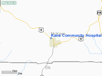
Kane Community Hospital Heliport |
Location & QuickFacts
| FAA Information Effective: | 2008-09-25 |
| Airport Identifier: | PA91 |
| Airport Status: | Operational |
| Longitude/Latitude: | 078-49-05.0000W/41-40-19.0000N
-78.818056/41.671944 (Estimated) |
| Elevation: | 2000 ft / 609.60 m (Estimated) |
| Land: | 5 acres |
| From nearest city: | 0 nautical miles N of Kane, PA |
| Location: | Mc Kean County, PA |
| Magnetic Variation: | 10W (1995) |
Owner & Manager
| Ownership: | Privately owned |
| Owner: | Kane Community Hospital |
| Address: | N. Fraley St; Po Box 778
Kane, PA 16735 |
| Phone number: | 814-837-8585 |
| Manager: | Michael J. Okruch |
| Address: | 7 Hillside Ave
Ludlow, PA 16333 |
| Phone number: | 814-945-6569 |
Airport Operations and Facilities
| Airport Use: | Private
MEDICAL. |
| Wind indicator: | Yes |
| Segmented Circle: | No |
| Control Tower: | No |
| Lighting Schedule: | PHONE REQ
FOR PERIMETER LGTS CALL 814-945-6569. |
| Sectional chart: | Detroit |
| Region: | AEA - Eastern |
| Boundary ARTCC: | ZOB - Cleveland |
| Tie-in FSS: | AOO - Altoona |
| FSS Toll Free: | 1-800-WX-BRIEF |
Runway Information
Helipad H1
| Dimension: | 65 x 60 ft / 19.8 x 18.3 m |
| Surface: | ASPH, Good Condition |
| |
Runway H1 |
Runway |
| Traffic Pattern: | Left | Left |
|
Radio Navigation Aids
| ID |
Type |
Name |
Ch |
Freq |
Var |
Dist |
| ORJ | NDB | Corry | | 258.00 | 09W | 39.9 nm |
| LYS | NDB | Olean | | 360.00 | 09W | 42.6 nm |
| EL | NDB | Halos | | 269.00 | 09W | 48.2 nm |
| FKL | VOR | Franklin | | 109.60 | 06W | 48.8 nm |
| BFD | VOR/DME | Bradford | 113X | 116.60 | 07W | 11.3 nm |
| JHW | VOR/DME | Jamestown | 094X | 114.70 | 07W | 33.9 nm |
| CIP | VOR/DME | Clarion | 076X | 112.90 | 06W | 42.8 nm |
| TDT | VORTAC | Tidioute | 123X | 117.60 | 09W | 27.0 nm |
| SLT | VORTAC | Slate Run | 086X | 113.90 | 08W | 39.3 nm |
| ETG | VORTAC | Keating | 107X | 116.00 | 10W | 41.0 nm |
| ELZ | VORTAC | Wellsville | 051X | 111.40 | 09W | 44.4 nm |
Remarks
- PRVDD IFR OPNS NOT CONDUCTED; CLEAR 8:1 INGRESS/EGRESS, VEHICULAR TFC CONTROLLED BY GROUND PERSONNEL OR SIGNAGE; INGRESS/EGRESS APPROPRIATEY MKD; LGT POLES REMOVED.
Images and information placed above are from
http://www.airport-data.com/airport/PA91/
We thank them for the data!
| General Info
|
| Country |
United States
|
| State |
PENNSYLVANIA
|
| FAA ID |
PA91
|
| Latitude |
41-40-19.000N
|
| Longitude |
078-49-05.000W
|
| Elevation |
2000 feet
|
| Near City |
KANE
|
We don't guarantee the information is fresh and accurate. The data may
be wrong or outdated.
For more up-to-date information please refer to other sources.
|
|


