 |
|
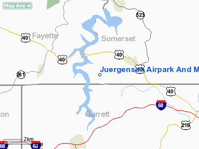
Juergensen Airpark And Maritime Facility Airport |
Location & QuickFacts
| FAA Information Effective: | 2008-09-25 |
| Airport Identifier: | PS27 |
| Airport Status: | Operational |
| Longitude/Latitude: | 079-22-30.0000W/39-43-53.0000N
-79.375000/39.731389 (Estimated) |
| Elevation: | 1890 ft / 576.07 m (Estimated) |
| Land: | 0 acres |
| From nearest city: | 2 nautical miles S of Addison, PA |
| Location: | Somerset County, PA |
| Magnetic Variation: | 08W (1990) |
Owner & Manager
| Ownership: | Privately owned |
| Owner: | Juergensen Marine |
| Address: | 1448 Polk Hill Rd
Addison, PA 15411 |
| Phone number: | 814-395-9509 |
| Manager: | Juergensen Marine |
| Address: | 1448 Polk Hill Rd
Addison, PA 15411 |
| Phone number: | 814-395-9509 |
Airport Operations and Facilities
| Airport Use: | Private |
| Wind indicator: | Yes |
| Segmented Circle: | No |
| Control Tower: | No |
| Sectional chart: | Cincinnati |
| Region: | AEA - Eastern |
| Boundary ARTCC: | ZOB - Cleveland |
| Tie-in FSS: | AOO - Altoona |
| FSS Toll Free: | 1-800-WX-BRIEF |
Airport Communications
Runway Information
Runway 14/32
| Dimension: | 1500 x 100 ft / 457.2 x 30.5 m |
| Surface: | TURF, |
| |
Runway 14 |
Runway 32 |
| Traffic Pattern: | Left | Left |
| Displaced threshold: | 0.00 ft | 300.00 ft |
| Obstruction: | | 50 ft trees, 950.0 ft from runway |
|
Radio Navigation Aids
| ID |
Type |
Name |
Ch |
Freq |
Var |
Dist |
| VV | NDB | Camor | | 299.00 | 08W | 19.3 nm |
| CBE | NDB | Cumberland | | 317.00 | 07W | 29.5 nm |
| SYS | NDB | Stoystown | | 209.00 | 08W | 30.0 nm |
| BHU | NDB | Benje | | 382.00 | 07W | 39.0 nm |
| MKP | NDB | Mc Keesport | | 287.00 | 07W | 41.9 nm |
| PNU | NDB | Washington County | | 255.00 | 08W | 44.0 nm |
| GRV | VOR/DME | Grantsville | 070X | 112.30 | 06W | 16.1 nm |
| ESL | VOR/DME | Kessel | 045X | 110.80 | 06W | 35.3 nm |
| AGC | VOR/DME | Allegheny | 037X | 110.00 | 09W | 45.0 nm |
| IHD | VORTAC | Indian Head | 019X | 108.20 | 06W | 14.6 nm |
| MGW | VORTAC | Morgantown | 053X | 111.60 | 05W | 24.8 nm |
| JST | VORTAC | Johnstown | 077X | 113.00 | 06W | 43.1 nm |
Remarks
- PRVDD LIMITED TO SINGLE LAND TAIL WIND ACFT; PLINE BURIED OR MKD OR PILOTS BRIEFED.
Images and information placed above are from
http://www.airport-data.com/airport/PS27/
We thank them for the data!
| General Info
|
| Country |
United States
|
| State |
PENNSYLVANIA
|
| FAA ID |
PS27
|
| Latitude |
39-43-53.000N
|
| Longitude |
079-22-30.000W
|
| Elevation |
1890 feet
|
| Near City |
ADDISON
|
We don't guarantee the information is fresh and accurate. The data may
be wrong or outdated.
For more up-to-date information please refer to other sources.
|
|


